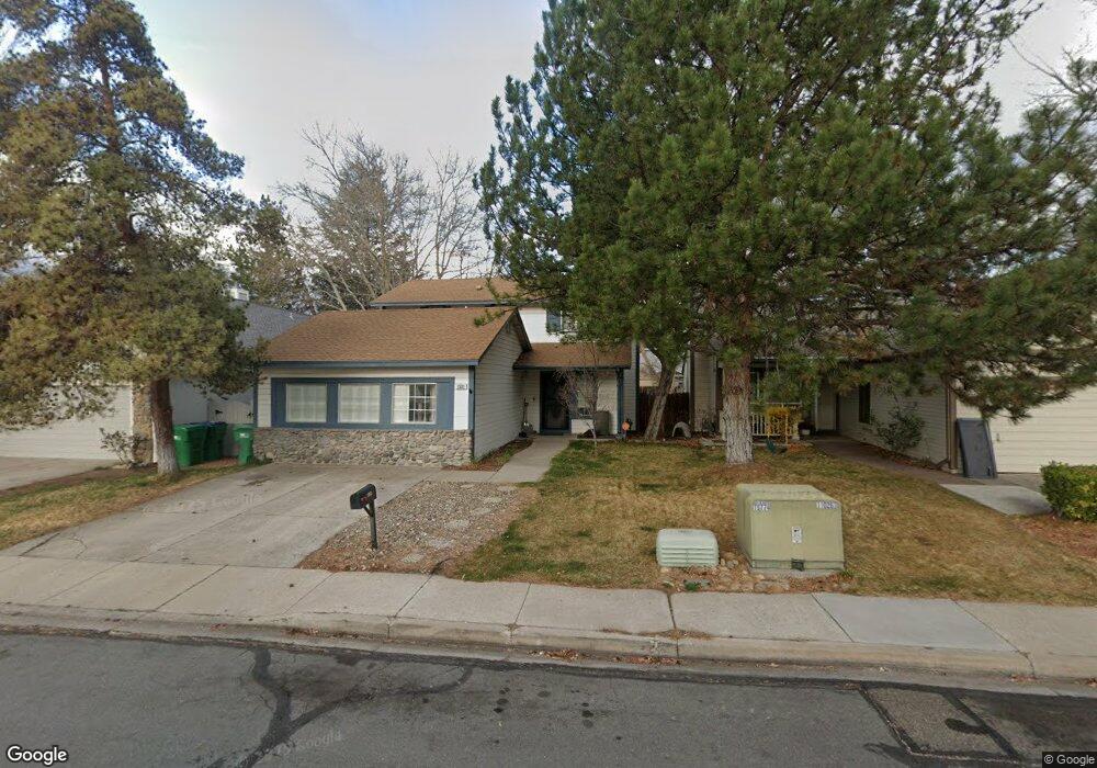
1531 Burnside Ct Sparks, NV 89434
O'Callaghan NeighborhoodEstimated Value: $451,433 - $490,000
3
Beds
4
Baths
2,226
Sq Ft
$211/Sq Ft
Est. Value
About This Home
This home is located at 1531 Burnside Ct, Sparks, NV 89434 and is currently estimated at $468,858, approximately $210 per square foot. 1531 Burnside Ct is a home located in Washoe County with nearby schools including Katherine Dunn Elementary School, George L Dilworth Middle School, and Edward C Reed High School.
Ownership History
Date
Name
Owned For
Owner Type
Purchase Details
Closed on
Mar 23, 2004
Sold by
Keefer Steven D and Keefer Kathy A
Bought by
Eslinger James P
Current Estimated Value
Home Financials for this Owner
Home Financials are based on the most recent Mortgage that was taken out on this home.
Original Mortgage
$183,200
Outstanding Balance
$84,127
Interest Rate
5.64%
Mortgage Type
Unknown
Estimated Equity
$384,731
Create a Home Valuation Report for This Property
The Home Valuation Report is an in-depth analysis detailing your home's value as well as a comparison with similar homes in the area
Home Values in the Area
Average Home Value in this Area
Purchase History
| Date | Buyer | Sale Price | Title Company |
|---|---|---|---|
| Eslinger James P | $229,000 | Western Title Incorporated |
Source: Public Records
Mortgage History
| Date | Status | Borrower | Loan Amount |
|---|---|---|---|
| Open | Eslinger James P | $183,200 |
Source: Public Records
Tax History
| Year | Tax Paid | Tax Assessment Tax Assessment Total Assessment is a certain percentage of the fair market value that is determined by local assessors to be the total taxable value of land and additions on the property. | Land | Improvement |
|---|---|---|---|---|
| 2026 | $1,676 | $71,684 | $34,650 | $37,034 |
| 2025 | $1,676 | $72,896 | $34,580 | $38,316 |
| 2024 | $2,079 | $71,918 | $32,725 | $39,193 |
| 2023 | $1,923 | $69,937 | $32,305 | $37,632 |
| 2022 | $1,780 | $57,668 | $26,005 | $31,663 |
| 2021 | $1,728 | $51,527 | $19,845 | $31,682 |
| 2020 | $1,625 | $52,253 | $19,775 | $32,478 |
| 2019 | $1,579 | $50,739 | $18,935 | $31,804 |
| 2018 | $1,505 | $45,444 | $13,965 | $31,479 |
| 2017 | $1,445 | $44,561 | $12,670 | $31,891 |
| 2016 | $1,409 | $44,278 | $11,410 | $32,868 |
| 2015 | $1,408 | $42,800 | $9,625 | $33,175 |
| 2014 | $1,366 | $40,410 | $8,225 | $32,185 |
| 2013 | -- | $36,442 | $6,090 | $30,352 |
Source: Public Records
Map
Nearby Homes
- 1655 Sabatino Dr
- 1674 Sabatino Dr
- 2227 Valencia Way
- 2140 Burnside Dr
- 1308 Coachman Dr
- 2264 Fernwood Ct
- 1544 Woodhaven Ln
- 1695 Atlantic Way
- 1357 Coupler Ct
- 1236 Flora Glen Dr
- 2407 Sunny Slope Dr Unit 1
- 1218 Junction Dr
- 2507 Sycamore Glen Dr Unit 5
- 2624 Sunny Slope Dr Unit 10
- 2625 Sunny Slope Dr
- 2625 Sunny Slope Dr Unit 2
- 2627 Sunny Slope Dr Unit 5
- 2152 Wabash Cir
- 2688 Laguna Way
- 2659 Sycamore Glen Dr Unit 5
- 1511 Burnside Ct
- 1561 Burnside Ct
- 1481 Burnside Ct
- 1581 Burnside Ct
- 1502 Union St
- 1542 Union St
- 1461 Burnside Ct
- 1472 Union St
- 1582 Union St
- 1441 Burnside Ct
- 1560 Burnside Ct
- 1560 Burnside Ct Unit 1
- 1510 Burnside Ct
- 1530 Burnside Ct
- 1432 Union St
- 1580 Burnside Ct
- 1480 Burnside Ct
- 1421 Burnside Ct
- 1460 Burnside Ct
- 1601 Burnside Dr
Your Personal Tour Guide
Ask me questions while you tour the home.