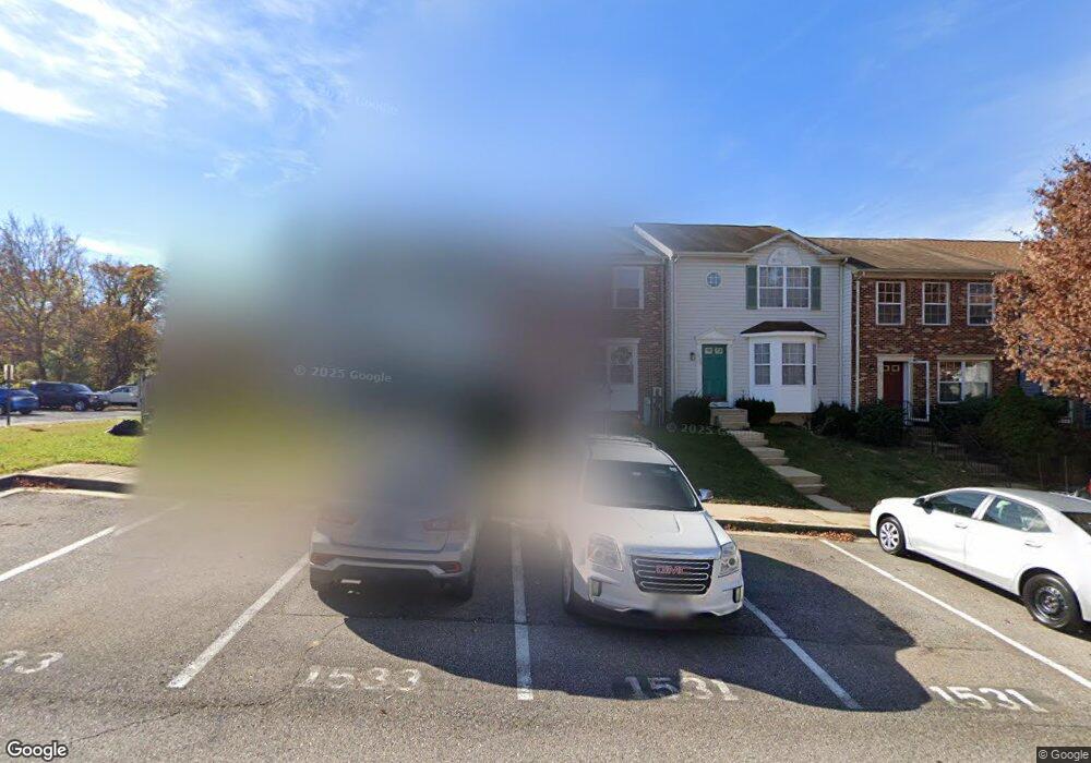
1531 Cathead Dr Arnold, MD 21012
Estimated Value: $340,000 - $396,000
Studio
2
Baths
1,360
Sq Ft
$272/Sq Ft
Est. Value
About This Home
This home is located at 1531 Cathead Dr, Arnold, MD 21012 and is currently estimated at $370,293, approximately $272 per square foot. 1531 Cathead Dr is a home located in Anne Arundel County with nearby schools including Windsor Farm Elementary School, Severn River Middle School, and Broadneck High School.
Ownership History
Date
Name
Owned For
Owner Type
Purchase Details
Closed on
Jul 7, 2000
Sold by
Cataldi Phillip P
Bought by
Wilkins Terrance E and Wilkins Christina M
Current Estimated Value
Purchase Details
Closed on
Sep 17, 1996
Sold by
Carroll P Mark
Bought by
Cataldi Phillip P and Gagnon Michele
Purchase Details
Closed on
Apr 3, 1991
Sold by
Brookfield Bldrs & Developers Inc
Bought by
Carroll P Mark
Home Financials for this Owner
Home Financials are based on the most recent Mortgage that was taken out on this home.
Original Mortgage
$74,700
Interest Rate
9.52%
Create a Home Valuation Report for This Property
The Home Valuation Report is an in-depth analysis detailing your home's value as well as a comparison with similar homes in the area
Home Values in the Area
Average Home Value in this Area
Purchase History
| Date | Buyer | Sale Price | Title Company |
|---|---|---|---|
| Wilkins Terrance E | $126,900 | -- | |
| Cataldi Phillip P | $117,500 | -- | |
| Carroll P Mark | $104,700 | -- |
Source: Public Records
Mortgage History
| Date | Status | Borrower | Loan Amount |
|---|---|---|---|
| Previous Owner | Carroll P Mark | $74,700 | |
| Closed | Cataldi Phillip P | -- |
Source: Public Records
Tax History
| Year | Tax Paid | Tax Assessment Tax Assessment Total Assessment is a certain percentage of the fair market value that is determined by local assessors to be the total taxable value of land and additions on the property. | Land | Improvement |
|---|---|---|---|---|
| 2025 | $3,037 | $298,500 | -- | -- |
| 2024 | $3,037 | $284,000 | $140,000 | $144,000 |
| 2023 | $2,913 | $276,767 | $0 | $0 |
| 2022 | $2,231 | $269,533 | $0 | $0 |
| 2020 | $2,499 | $248,167 | $0 | $0 |
| 2019 | $2,420 | $234,033 | $0 | $0 |
| 2018 | $2,230 | $219,900 | $85,000 | $134,900 |
| 2017 | $2,238 | $217,267 | $0 | $0 |
| 2016 | -- | $214,633 | $0 | $0 |
| 2015 | -- | $212,000 | $0 | $0 |
| 2014 | -- | $212,000 | $0 | $0 |
Source: Public Records
Map
Nearby Homes
- 1553 Star Pine Dr
- 1534 Lodge Pole Ct
- 1587 Lodge Pole Ct
- 1525 Hickory Wood Dr
- 1254 Masters Dr
- 0 Shot Town Rd Unit MDAA2113200
- 1411 Peregrine Path
- 1406 Bretton View Rd
- 371 Freshfield Ln
- 78 Old Mill Bottom Rd N
- 78 Old Mill Bottom Rd N Unit 305
- 78 Old Mill Bottom Rd N Unit 409
- 78 Old Mill Bottom Rd N Unit 209
- 78 Old Mill Bottom Rd N Unit 112
- 78 Old Mill Bottom Rd N Unit 307
- 1410 Greendale Ct Unit 2-1410
- 76 Old Mill Bottom Rd N Unit 205
- 76 Old Mill Bottom Rd N Unit 310
- 76 Old Mill Bottom Rd N Unit 102
- 76 Old Mill Bottom Rd N Unit 408
- 1529 Cathead Dr
- 1533 Cathead Dr
- 1527 Cathead Dr
- 1525 Cathead Dr
- 1526 Winterberry Dr
- 1524 Winterberry Dr
- 1522 Winterberry Dr
- 1520 Winterberry Dr
- 335 Capetowne Rd
- 337 Capetowne Rd
- 333 Capetowne Rd
- 339 Capetowne Rd
- 331 Capetowne Rd
- 341 Capetowne Rd
- 1528 Cathead Dr
- 1516 Winterberry Dr
- 343 Capetowne Rd
- 1526 Cathead Dr
- 345 Capetowne Rd
- 1524 Cathead Dr
Your Personal Tour Guide
Ask me questions while you tour the home.