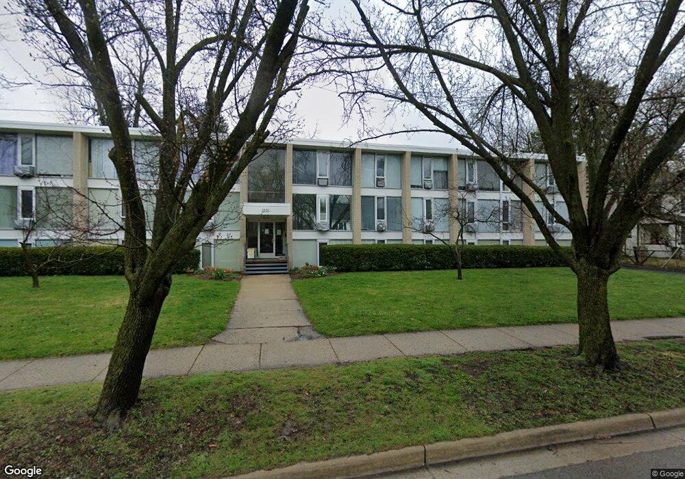
1531 Packard St Unit 17 Ann Arbor, MI 48104
North Burns Park NeighborhoodEstimated Value: $180,901 - $251,000
1
Bed
1
Bath
643
Sq Ft
$331/Sq Ft
Est. Value
About This Home
This home is located at 1531 Packard St Unit 17, Ann Arbor, MI 48104 and is currently estimated at $212,975, approximately $331 per square foot. 1531 Packard St Unit 17 is a home located in Washtenaw County with nearby schools including Burns Park Elementary School, Tappan Middle School, and Pioneer High School.
Ownership History
Date
Name
Owned For
Owner Type
Purchase Details
Closed on
Mar 21, 2017
Sold by
Kami Smadar and Lamm Doron
Bought by
Karni Smadar and Doron Lamm
Current Estimated Value
Purchase Details
Closed on
Aug 14, 2013
Sold by
Astor Carl N and Astor Sharon R
Bought by
Karni Smadar and Lamm Doron
Purchase Details
Closed on
Jul 5, 2005
Sold by
Patel Prerana
Bought by
Astor Abraham Y and Astor Carl N
Home Financials for this Owner
Home Financials are based on the most recent Mortgage that was taken out on this home.
Original Mortgage
$88,000
Interest Rate
5.68%
Mortgage Type
Fannie Mae Freddie Mac
Purchase Details
Closed on
May 24, 2000
Sold by
Connie Lee By Conservato
Bought by
Patel Prerana
Create a Home Valuation Report for This Property
The Home Valuation Report is an in-depth analysis detailing your home's value as well as a comparison with similar homes in the area
Home Values in the Area
Average Home Value in this Area
Purchase History
| Date | Buyer | Sale Price | Title Company |
|---|---|---|---|
| Karni Smadar | -- | None Available | |
| Karni Smadar | $87,500 | Liberty Title | |
| Astor Abraham Y | $110,000 | -- | |
| Patel Prerana | $79,000 | -- |
Source: Public Records
Mortgage History
| Date | Status | Borrower | Loan Amount |
|---|---|---|---|
| Previous Owner | Astor Abraham Y | $88,000 |
Source: Public Records
Tax History Compared to Growth
Tax History
| Year | Tax Paid | Tax Assessment Tax Assessment Total Assessment is a certain percentage of the fair market value that is determined by local assessors to be the total taxable value of land and additions on the property. | Land | Improvement |
|---|---|---|---|---|
| 2025 | $2,409 | $65,900 | $0 | $0 |
| 2024 | $2,409 | $64,400 | $0 | $0 |
| 2023 | $2,409 | $64,500 | $0 | $0 |
| 2022 | $2,262 | $60,900 | $0 | $0 |
| 2021 | $2,198 | $57,800 | $0 | $0 |
| 2020 | $2,129 | $56,200 | $0 | $0 |
| 2019 | $2,030 | $53,500 | $53,500 | $0 |
| 2018 | $1,992 | $49,000 | $0 | $0 |
| 2017 | $1,922 | $42,100 | $0 | $0 |
| 2016 | $1,873 | $30,265 | $0 | $0 |
| 2015 | $1,796 | $30,175 | $0 | $0 |
| 2014 | $1,796 | $29,081 | $0 | $0 |
| 2013 | -- | $29,081 | $0 | $0 |
Source: Public Records
Map
Nearby Homes
- 1305 E Stadium Blvd
- 1514 Golden Ave
- 1212 Wells St
- 1006 Granger Ave
- 1133 Michigan Ave
- 943 Dewey Ave
- 1108 Packard St
- 1704 Shadford Rd
- 1621 South Blvd
- 1718 E Stadium Blvd
- 1709 South Blvd
- 825 Sylvan Ave
- 1419 S State St
- 1412 Cambridge Rd
- 2316 Brockman Blvd
- 2010 Devonshire Rd
- 1928 Lorraine Place
- 1901 Lorraine Place
- 2323 Page Ave
- 1236 Kensington Dr
- 1531 Packard St Unit 5
- 1531 Packard St Unit 4
- 1531 Packard St Unit 15
- 1531 Packard St Unit 6
- 1531 Packard St Unit 11
- 1531 Packard St Unit 8
- 1531 Packard St Unit 16
- 1531 Packard St Unit 12
- 1531 Packard St Unit 10
- 1531 Packard St Unit 14
- 1531 Packard St Unit 13
- 1531 Packard St Unit 20
- 1531 Packard St Unit 19
- 1531 Packard St Unit 18
- 1531 Packard St Unit 9
- 1531 Packard St Unit 7
- 1531 Packard St Unit 3
- 1531 Packard St Unit 1
- 1531 Packard St
- 1531 Packard St