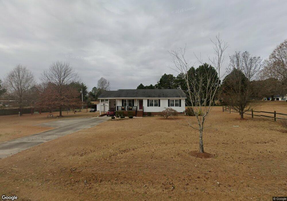
15313 Nc 96 Hwy N Zebulon, NC 27597
O'Neals NeighborhoodEstimated Value: $274,798 - $298,000
4
Beds
2
Baths
1,160
Sq Ft
$248/Sq Ft
Est. Value
About This Home
This home is located at 15313 Nc 96 Hwy N, Zebulon, NC 27597 and is currently estimated at $287,950, approximately $248 per square foot. 15313 Nc 96 Hwy N is a home located in Johnston County with nearby schools including Corinth Holders Elementary School, Archer Lodge Middle School, and Corinth Holders High School.
Ownership History
Date
Name
Owned For
Owner Type
Purchase Details
Closed on
Dec 21, 2006
Sold by
Tassilly Claude R and Tassilly Rosa H
Bought by
Oakley George B and Oakley Lois Evelyn
Current Estimated Value
Purchase Details
Closed on
Sep 19, 2006
Sold by
Reid Timothy Ray and Reid Tammy Q
Bought by
Oakley George B and Oakley Lois Evelyn
Home Financials for this Owner
Home Financials are based on the most recent Mortgage that was taken out on this home.
Original Mortgage
$24,000
Interest Rate
5.75%
Mortgage Type
Purchase Money Mortgage
Purchase Details
Closed on
Jan 24, 2006
Sold by
Holder Larry D and Lyon Anita M
Bought by
Reid Timothy Ray and Reid Tammy Q
Create a Home Valuation Report for This Property
The Home Valuation Report is an in-depth analysis detailing your home's value as well as a comparison with similar homes in the area
Home Values in the Area
Average Home Value in this Area
Purchase History
| Date | Buyer | Sale Price | Title Company |
|---|---|---|---|
| Oakley George B | $1,000 | None Available | |
| Oakley George B | $114,000 | None Available | |
| Reid Timothy Ray | $75,245 | None Available |
Source: Public Records
Mortgage History
| Date | Status | Borrower | Loan Amount |
|---|---|---|---|
| Previous Owner | Oakley George B | $24,000 |
Source: Public Records
Tax History Compared to Growth
Tax History
| Year | Tax Paid | Tax Assessment Tax Assessment Total Assessment is a certain percentage of the fair market value that is determined by local assessors to be the total taxable value of land and additions on the property. | Land | Improvement |
|---|---|---|---|---|
| 2025 | $947 | $285,020 | $67,600 | $217,420 |
| 2024 | $529 | $129,370 | $32,450 | $96,920 |
| 2023 | $522 | $129,370 | $32,450 | $96,920 |
| 2022 | $549 | $129,370 | $32,450 | $96,920 |
| 2021 | $549 | $129,370 | $32,450 | $96,920 |
| 2020 | $562 | $129,370 | $32,450 | $96,920 |
| 2019 | $562 | $129,370 | $32,450 | $96,920 |
| 2018 | $486 | $109,230 | $29,740 | $79,490 |
| 2017 | $486 | $109,230 | $29,740 | $79,490 |
| 2016 | $961 | $109,230 | $29,740 | $79,490 |
| 2015 | $961 | $109,230 | $29,740 | $79,490 |
| 2014 | $961 | $109,230 | $29,740 | $79,490 |
Source: Public Records
Map
Nearby Homes
- 295 Springtooth Dr
- 14 Tant Farm Ln
- 93 Butterbean Ct
- 404 Rye Way
- 422 Rye Way
- 320 Rye Way
- 244 Rye Way
- 268 Rye Way
- 57 Butterbean Ct
- 633 Springtooth Dr
- 26 Tant Farm Ln
- 80 Butterbean Ct
- 653 Springtooth Dr
- 67 Rice Rd
- 63 Rice Rd
- 685 Springtooth Dr
- 703 Springtooth Dr
- 725 Springtooth Dr
- 10317 Basmati Trail
- 10320 Basmati Trail
- 1670 Mudham Rd
- 1616 Mudham Rd
- 15354 Nc 96 Hwy N
- 2312 Earpsboro Rd
- 1614 Mudham Rd
- 15428 Nc 96 Hwy N Unit N
- 2196 Earpsboro Rd
- 1669 Mudham Rd
- 1651 Mudham Rd
- 15338 Nc 96 Hwy N
- 15330 Nc 96 Hwy N
- 1695 Mudham Rd
- 1633 Mudham Rd
- 1617 Mudham Rd
- 2072 Earpsboro Rd
- 20 Eagles Nest Dr
- 62 Soaring Eagle Trail
- 2169 Earpsboro Rd
- 36 Eagles Nest Dr
- 74 Soaring Eagle Trail