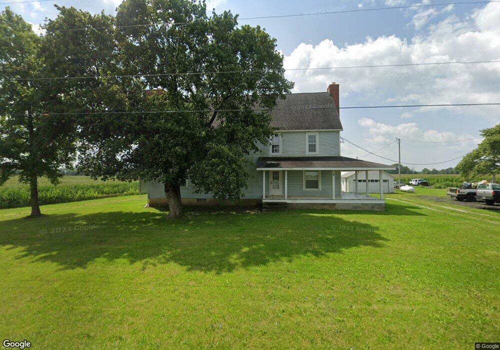
15315 State Route 67 Forest, OH 45843
Estimated Value: $200,000 - $234,822
4
Beds
2
Baths
2,888
Sq Ft
$78/Sq Ft
Est. Value
About This Home
This home is located at 15315 State Route 67, Forest, OH 45843 and is currently estimated at $223,956, approximately $77 per square foot. 15315 State Route 67 is a home located in Wyandot County with nearby schools including Upper Sandusky High School.
Ownership History
Date
Name
Owned For
Owner Type
Purchase Details
Closed on
Dec 2, 2020
Sold by
Weaver Samuel D and Weaver Jean Ann
Bought by
Adkins Jeremy
Current Estimated Value
Home Financials for this Owner
Home Financials are based on the most recent Mortgage that was taken out on this home.
Original Mortgage
$145,500
Outstanding Balance
$128,882
Interest Rate
2.8%
Mortgage Type
New Conventional
Estimated Equity
$95,074
Create a Home Valuation Report for This Property
The Home Valuation Report is an in-depth analysis detailing your home's value as well as a comparison with similar homes in the area
Purchase History
| Date | Buyer | Sale Price | Title Company |
|---|---|---|---|
| Adkins Jeremy | $150,000 | None Available |
Source: Public Records
Mortgage History
| Date | Status | Borrower | Loan Amount |
|---|---|---|---|
| Open | Adkins Jeremy | $145,500 |
Source: Public Records
Tax History
| Year | Tax Paid | Tax Assessment Tax Assessment Total Assessment is a certain percentage of the fair market value that is determined by local assessors to be the total taxable value of land and additions on the property. | Land | Improvement |
|---|---|---|---|---|
| 2025 | $1,761 | $58,460 | $7,700 | $50,760 |
| 2024 | $1,467 | $45,700 | $5,970 | $39,730 |
| 2023 | $1,467 | $45,700 | $5,970 | $39,730 |
| 2022 | $1,466 | $37,970 | $4,980 | $32,990 |
| 2021 | $1,278 | $37,970 | $4,980 | $32,990 |
| 2020 | $1,278 | $37,970 | $4,980 | $32,990 |
| 2019 | $1,275 | $37,970 | $4,980 | $32,990 |
| 2018 | $927 | $28,400 | $4,380 | $24,020 |
| 2017 | $941 | $28,400 | $4,380 | $24,020 |
| 2016 | $896 | $28,400 | $4,380 | $24,020 |
| 2015 | -- | $27,620 | $4,380 | $23,240 |
| 2014 | -- | $27,620 | $4,380 | $23,240 |
| 2013 | -- | $34,650 | $4,380 | $30,270 |
Source: Public Records
Map
Nearby Homes
- 20472 Ohio 37
- 3375 Fail Rd
- 18205 County Highway 96
- 23385 Township Road 126
- 16355 Township Highway 96
- 3132 Decliff Rd N
- 0 Osbun Rd Unit Lot 27 225032274
- 00 Osbun Rd Unit Lot 6
- 3096 Decliff Rd N
- 19507 County Highway 70
- 6699 Main Street Meeker
- 15047 Ohio 37
- 13750 County Road 227
- 12891 Township Road 209
- 0 Cr 215 Unit 11594771
- 0 Cr 215 Unit 11594600
- 0 Cr 215 Unit 25370311
- 0 Cr 215 Unit 11598074
- 2487 Cramer Rd
- 61 N Marsh St
- 15315 S H 67
- 15231 State Route 67
- 20567 County Highway 142
- 20710 County Highway 142
- 20567 Co Hwy
- 20748 County Highway 142
- 15603 Ohio 67
- 15603 S H 67
- 20826 County Highway 142
- 15603 State Route 67
- 20438 State Highway 67
- 20282 State Hwy
- 19925 Ohio 67
- 20678 State Highway 37
- 20678 Ohio 37
- 20100 State Highway 37
- 20918 County Highway 142
- 19998 State Highway 37
- 20591 State Highway 37
- 20546 State Highway 37
Your Personal Tour Guide
Ask me questions while you tour the home.