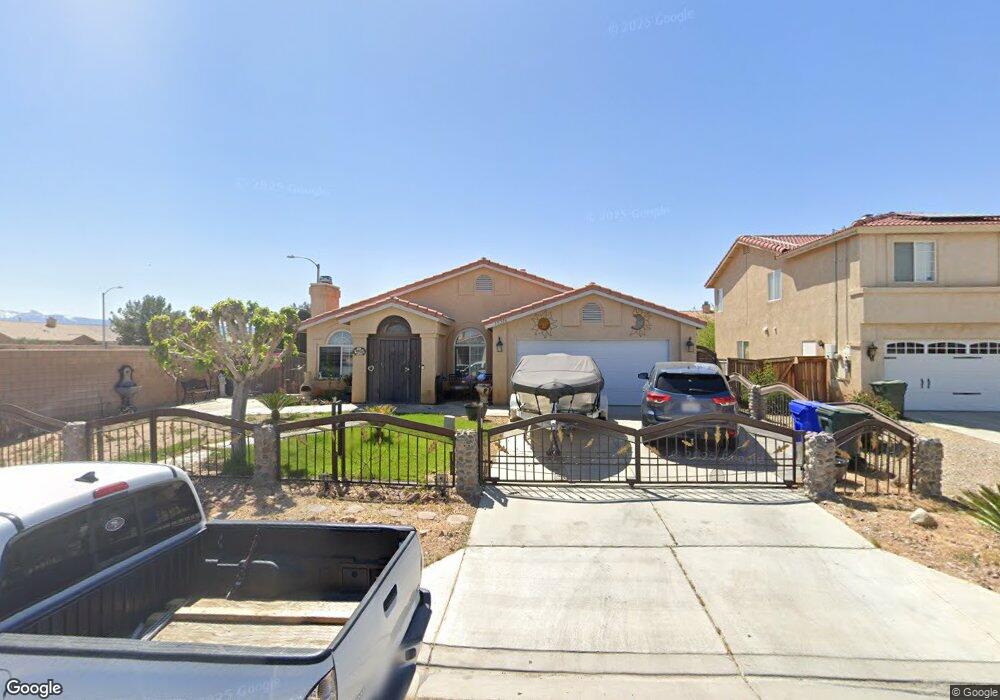
15316 Kearny Dr Adelanto, CA 92301
Mesa Linda NeighborhoodEstimated Value: $409,000 - $426,000
4
Beds
2
Baths
1,640
Sq Ft
$253/Sq Ft
Est. Value
About This Home
This home is located at 15316 Kearny Dr, Adelanto, CA 92301 and is currently estimated at $415,191, approximately $253 per square foot. 15316 Kearny Dr is a home located in San Bernardino County with nearby schools including Victoria Magathan Elementary School, Columbia Middle School, and Adelanto High School.
Ownership History
Date
Name
Owned For
Owner Type
Purchase Details
Closed on
Dec 12, 2017
Sold by
Mata Ana Maria and Luna Aida
Bought by
Hernandez Arturo Rangel and Cervantes Sonia Garcia
Current Estimated Value
Home Financials for this Owner
Home Financials are based on the most recent Mortgage that was taken out on this home.
Original Mortgage
$244,489
Outstanding Balance
$206,788
Interest Rate
4.12%
Mortgage Type
FHA
Estimated Equity
$208,403
Purchase Details
Closed on
Dec 21, 2008
Sold by
Luna Aida A and Mata Ana Maria
Bought by
Mata Ana Maria and Luna Aida A
Purchase Details
Closed on
Jun 13, 1996
Sold by
Adel 159 Inc
Bought by
Luna A Aida and Ana Maria Mata B
Home Financials for this Owner
Home Financials are based on the most recent Mortgage that was taken out on this home.
Original Mortgage
$94,950
Interest Rate
8.03%
Create a Home Valuation Report for This Property
The Home Valuation Report is an in-depth analysis detailing your home's value as well as a comparison with similar homes in the area
Home Values in the Area
Average Home Value in this Area
Purchase History
| Date | Buyer | Sale Price | Title Company |
|---|---|---|---|
| Hernandez Arturo Rangel | $249,000 | Chicago Title Company | |
| Mata Ana Maria | -- | None Available | |
| Luna A Aida | $100,000 | First American Title Ins Co |
Source: Public Records
Mortgage History
| Date | Status | Borrower | Loan Amount |
|---|---|---|---|
| Open | Hernandez Arturo Rangel | $244,489 | |
| Previous Owner | Luna A Aida | $94,950 |
Source: Public Records
Tax History
| Year | Tax Paid | Tax Assessment Tax Assessment Total Assessment is a certain percentage of the fair market value that is determined by local assessors to be the total taxable value of land and additions on the property. | Land | Improvement |
|---|---|---|---|---|
| 2025 | $3,862 | $283,320 | $56,664 | $226,656 |
| 2024 | $3,581 | $277,765 | $55,553 | $222,212 |
| 2023 | $3,600 | $272,319 | $54,464 | $217,855 |
| 2022 | $3,454 | $266,979 | $53,396 | $213,583 |
| 2021 | $3,635 | $261,744 | $52,349 | $209,395 |
| 2020 | $3,553 | $259,060 | $51,812 | $207,248 |
| 2019 | $3,524 | $253,980 | $50,796 | $203,184 |
| 2018 | $2,099 | $143,124 | $35,786 | $107,338 |
| 2017 | $2,030 | $140,317 | $35,084 | $105,233 |
| 2016 | $1,989 | $137,566 | $34,396 | $103,170 |
| 2015 | $1,907 | $135,499 | $33,879 | $101,620 |
| 2014 | $1,991 | $132,844 | $33,215 | $99,629 |
Source: Public Records
Map
Nearby Homes
- 15342 Kearny Dr
- 11830 Wolcott St
- 15249 Braxton St
- 15435 Kearny Dr
- 11840 Marshall Rd
- 15177 Braxton St
- 11807 Lupin Rd
- 32 Pearmain St
- 11747 Star St
- 11735 Star St
- 15024 Carrolton St
- 11532 Autumn St
- 11771 Dana Dr
- 11537 Winter Place
- 0 Pine St Unit HD25268649
- 15026 Richmond Ave
- 11732 Dawson Ln
- 0 Civic #1 Dr Unit HD25143721
- 11744 Dawson Ln
- 0 Kentwood #1 Blvd Unit HD25143435
- 15324 Kearny Dr
- 15327 Fremont Dr
- 15334 Kearny Dr
- 15319 Fremont Dr
- 15315 Kearny Dr
- 15333 Fremont Dr
- 15325 Kearny Dr
- 11828 Taylor St
- 15335 Kearny Dr
- 11834 Taylor St
- 11816 Taylor St
- 15343 Fremont Dr
- 11842 Taylor St
- 11800 Taylor St
- 15318 Fremont Dr
- 15352 Kearny Dr
- 15345 Kearny Dr
- 11856 Taylor St
- 11790 Taylor St
- 15324 Pearmain St
Your Personal Tour Guide
Ask me questions while you tour the home.