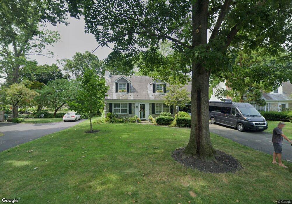
1532 Biltmore Ave Lancaster, PA 17601
Eden NeighborhoodEstimated Value: $446,320 - $510,000
3
Beds
2
Baths
1,699
Sq Ft
$280/Sq Ft
Est. Value
About This Home
This home is located at 1532 Biltmore Ave, Lancaster, PA 17601 and is currently estimated at $475,330, approximately $279 per square foot. 1532 Biltmore Ave is a home located in Lancaster County with nearby schools including Schaeffer Elementary School, Landis Run Intermediate School, and Manheim Township Middle School.
Ownership History
Date
Name
Owned For
Owner Type
Purchase Details
Closed on
Mar 27, 2003
Sold by
Wood David E and Wood Lisa Obrien
Bought by
Test Wendy Carol
Current Estimated Value
Home Financials for this Owner
Home Financials are based on the most recent Mortgage that was taken out on this home.
Original Mortgage
$146,000
Interest Rate
5.88%
Mortgage Type
Balloon
Purchase Details
Closed on
May 20, 1997
Bought by
Test Wendy Carol
Create a Home Valuation Report for This Property
The Home Valuation Report is an in-depth analysis detailing your home's value as well as a comparison with similar homes in the area
Home Values in the Area
Average Home Value in this Area
Purchase History
| Date | Buyer | Sale Price | Title Company |
|---|---|---|---|
| Test Wendy Carol | $182,500 | -- | |
| Test Wendy Carol | $136,000 | -- |
Source: Public Records
Mortgage History
| Date | Status | Borrower | Loan Amount |
|---|---|---|---|
| Closed | Test Wendy Carol | $146,000 |
Source: Public Records
Tax History Compared to Growth
Tax History
| Year | Tax Paid | Tax Assessment Tax Assessment Total Assessment is a certain percentage of the fair market value that is determined by local assessors to be the total taxable value of land and additions on the property. | Land | Improvement |
|---|---|---|---|---|
| 2025 | $5,072 | $234,400 | $85,600 | $148,800 |
| 2024 | $5,072 | $234,400 | $85,600 | $148,800 |
| 2023 | $4,856 | $234,400 | $85,600 | $148,800 |
| 2022 | $4,856 | $234,400 | $85,600 | $148,800 |
| 2021 | $4,802 | $234,400 | $85,600 | $148,800 |
| 2020 | $4,748 | $234,400 | $85,600 | $148,800 |
| 2019 | $4,702 | $234,400 | $85,600 | $148,800 |
| 2018 | $5,710 | $234,400 | $85,600 | $148,800 |
| 2017 | $4,448 | $174,800 | $48,200 | $126,600 |
| 2016 | $4,448 | $174,800 | $48,200 | $126,600 |
| 2015 | $1,118 | $174,800 | $48,200 | $126,600 |
| 2014 | $3,150 | $174,800 | $48,200 | $126,600 |
Source: Public Records
Map
Nearby Homes
- 1550 Euclid Dr
- 1150 Groff Ln
- 1100 Bluegrass Rd Unit NOTTINGHAM
- 1100 Bluegrass Rd Unit HAWTHORNE
- 1100 Bluegrass Rd Unit DEVONSHIRE
- 1100 Bluegrass Rd Unit AUGUSTA
- 1100 Bluegrass Rd Unit SAVANNAH
- 1100 Bluegrass Rd Unit COVINGTON
- 1100 Bluegrass Rd Unit ARCADIA
- 1914 Pickering Trail
- 1922 Pickering Trail
- Cedarbrook Plan at Somerford at Stoner Farm - Carriage Homes
- Crestwood Plan at Somerford at Stoner Farm - Carriage Homes
- 1231 Hershey Ln
- 1915 Pickering Trail
- 200 Hershey Ln Unit CRESTWOOD
- 200 Hershey Ln Unit CEDARBROOK
- 1923 Pickering Trail
- 1919 Pickering Trail
- 159 Melrose Ln
- 1526 Biltmore Ave
- 1537 Hollywood Dr
- 1520 Biltmore Ave
- 1545 Hollywood Dr
- 1521 Hollywood Dr
- 1527 Biltmore Ave
- 1553 Hollywood Dr
- 1538 Mission Rd
- 1515 Hollywood Dr
- 1534 Mission Rd
- 1561 Hollywood Dr
- 1517 Biltmore Ave
- 1538 Hollywood Dr
- 1530 Hollywood Dr
- 1501 Hollywood Dr
- 1520 Mission Rd
- 1550 Hollywood Dr
- 1518 Hollywood Dr
- 1558 Hollywood Dr
- 1506 Mission Rd