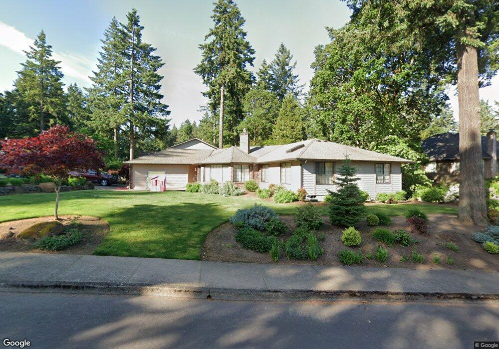
1532 Freedom Loop SE Salem, OR 97302
Morningside NeighborhoodEstimated Value: $546,000 - $627,000
3
Beds
2
Baths
2,618
Sq Ft
$225/Sq Ft
Est. Value
About This Home
This home is located at 1532 Freedom Loop SE, Salem, OR 97302 and is currently estimated at $589,481, approximately $225 per square foot. 1532 Freedom Loop SE is a home located in Marion County with nearby schools including Pringle Elementary School, Judson Middle School, and South Salem High School.
Ownership History
Date
Name
Owned For
Owner Type
Purchase Details
Closed on
Oct 8, 2021
Sold by
Cales Calvin L and Cales Sandra E
Bought by
Cales Calvin L and Calvin L Cales Jr Living Trust
Current Estimated Value
Purchase Details
Closed on
Sep 28, 2020
Sold by
Flores Jason and Wells Walter B
Bought by
Price William and Price Rebecca
Home Financials for this Owner
Home Financials are based on the most recent Mortgage that was taken out on this home.
Original Mortgage
$382,000
Interest Rate
2.9%
Mortgage Type
New Conventional
Create a Home Valuation Report for This Property
The Home Valuation Report is an in-depth analysis detailing your home's value as well as a comparison with similar homes in the area
Home Values in the Area
Average Home Value in this Area
Purchase History
| Date | Buyer | Sale Price | Title Company |
|---|---|---|---|
| Cales Calvin L | -- | None Available | |
| Calvin L Cales Jr Living Trust | -- | None Listed On Document | |
| Price William | $477,500 | Amerititle |
Source: Public Records
Mortgage History
| Date | Status | Borrower | Loan Amount |
|---|---|---|---|
| Previous Owner | Price William | $382,000 |
Source: Public Records
Tax History
| Year | Tax Paid | Tax Assessment Tax Assessment Total Assessment is a certain percentage of the fair market value that is determined by local assessors to be the total taxable value of land and additions on the property. | Land | Improvement |
|---|---|---|---|---|
| 2025 | $5,893 | $309,160 | -- | -- |
| 2024 | $5,893 | $300,162 | -- | -- |
| 2023 | $6,651 | $368,630 | $0 | $0 |
| 2022 | $6,054 | $346,520 | $0 | $0 |
| 2021 | $5,881 | $336,430 | $0 | $0 |
| 2020 | $5,710 | $299,410 | $0 | $0 |
| 2019 | $5,509 | $290,690 | $0 | $0 |
| 2018 | $5,607 | $0 | $0 | $0 |
| 2017 | $5,060 | $0 | $0 | $0 |
| 2016 | $4,820 | $0 | $0 | $0 |
| 2015 | $4,856 | $0 | $0 | $0 |
| 2014 | $4,356 | $0 | $0 | $0 |
Source: Public Records
Map
Nearby Homes
- 4417 Battle Creek Rd SE
- 1923 Riting Ct SE
- 2074 Celeen Ave SE
- 1165 Albert Dr SE
- 1714 Strong Rd SE
- 1710 Strong Rd SE
- 1720 Strong Rd SE
- 1771 Strong Rd SE
- 4943 Southampton Dr SE
- 4059 Dornoch Ln SE
- 4771 Chatham St SE
- 1633 Leslie Wind Ln SE
- 4039 Village Center Dr SE
- 1542 Barnes Ave SE
- 855 Idylwood Dr SE
- 4345 Sunnyside Rd SE
- 1145 Duffield Heights Ave SE
- 4150 Fraser Ln SE
- 2353 Audubon Ave SE
- 1852 Cousteau Lp SE
- 4520 Sunland St SE
- 1542 Freedom Loop SE
- 4530 Sunland St SE
- 1527 Freedom Loop SE
- 1537 Freedom Loop SE
- 1507 Freedom Loop SE
- 1552 Freedom Loop SE
- 4540 Sunland St SE
- 1517 Freedom Loop SE
- 1547 Freedom Loop SE
- 4525 Sunland St SE
- 4515 Sunland St SE
- 1455 Jamestown St SE
- 4545 Patriot Ct SE
- 1562 Freedom Loop SE
- 1557 Freedom Loop SE
- 4384 Sunland St SE
- 4437 Sunland St SE
- 4435 Gladmar St SE
- 1606 Pilgrim St SE
Your Personal Tour Guide
Ask me questions while you tour the home.