Estimated Value: $228,000 - $243,000
5
Beds
3
Baths
1,440
Sq Ft
$164/Sq Ft
Est. Value
About This Home
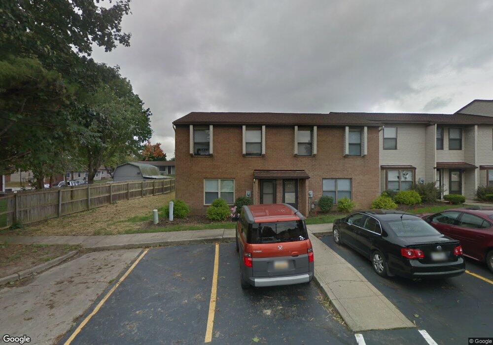
This home is located at 1532 Libra Ct, Kent, OH 44240 and is currently estimated at $236,667, approximately $164 per square foot. 1532 Libra Ct is a home located in Portage County with nearby schools including Walls Elementary School, Stanton Middle School, and Theodore Roosevelt High School.
Ownership History
Date
Name
Owned For
Owner Type
Purchase Details
Closed on
Jun 2, 2021
Sold by
Triple Rock Holding Llc
Bought by
Panther Invest Llc
Current Estimated Value
Purchase Details
Closed on
May 1, 2019
Sold by
Manning Properties Ltd
Bought by
Triple Rock Holding Llc
Purchase Details
Closed on
Aug 15, 2012
Sold by
Manning Carolyn and Manning Thomas P
Bought by
Manning Properties Ltd
Purchase Details
Closed on
Nov 6, 2005
Sold by
Manning Thomas P
Bought by
Manning Properties Ltd
Create a Home Valuation Report for This Property
The Home Valuation Report is an in-depth analysis detailing your home's value as well as a comparison with similar homes in the area
Home Values in the Area
Average Home Value in this Area
Purchase History
| Date | Buyer | Sale Price | Title Company |
|---|---|---|---|
| Panther Invest Llc | -- | None Available | |
| Triple Rock Holding Llc | -- | Bennett Land Title Agency | |
| Manning Properties Ltd | -- | Attorney | |
| Manning Properties Ltd | -- | -- |
Source: Public Records
Tax History
| Year | Tax Paid | Tax Assessment Tax Assessment Total Assessment is a certain percentage of the fair market value that is determined by local assessors to be the total taxable value of land and additions on the property. | Land | Improvement |
|---|---|---|---|---|
| 2024 | $2,835 | $61,640 | $4,730 | $56,910 |
| 2023 | $2,820 | $49,740 | $4,730 | $45,010 |
| 2022 | $2,818 | $49,740 | $4,730 | $45,010 |
| 2021 | $2,823 | $49,740 | $4,730 | $45,010 |
| 2020 | $2,440 | $38,330 | $4,730 | $33,600 |
| 2019 | $2,440 | $38,330 | $4,730 | $33,600 |
| 2017 | $2,479 | $36,020 | $4,730 | $31,290 |
| 2016 | $2,474 | $36,020 | $4,730 | $31,290 |
Source: Public Records
Map
Nearby Homes
- 1024E Cedar Ridge Dr
- 1426 Loop Rd Unit 1426
- 5109 Troyer Dr
- 1737 Holly Dr
- 835 Mae St
- 0 Meloy Rd Unit 5162435
- 1997 Sugar Maple Dr
- 2014 Sugar Maple Dr
- 1676 Countryview Dr
- 5088 Spruce Knoll Run
- 2092 Sugar Maple Dr
- 1233 Cedar Ridge Rd
- 5096 Spruce Knoll Run
- 410 Beryl Dr
- 4808 Sherman Rd
- 1005 Vine St
- 1585 Kent St
- 1103 Oakwood Dr
- 0 S Water St
- 6235 1st Ave
- 1530 Libra Ct
- 1534 Libra Ct
- 1528 Libra Ct
- 1526 Libra Ct
- 1524 Libra Ct
- 1522 Libra Ct
- 1898 E Summit St
- 1520 Libra Ct
- 1801 Gemini Ct
- 1536 Scorpio Ct
- 1803 Gemini Ct
- 1538 Scorpio Ct
- 1805 Gemini Ct
- 1540 Scorpio Ct
- 1542 Scorpio Ct
- 1807 Gemini Ct
- 1544 Scorpio Ct
- TBD Butternut Ridge
- 1809 Gemini Ct
- 1546 Scorpio Ct
Your Personal Tour Guide
Ask me questions while you tour the home.