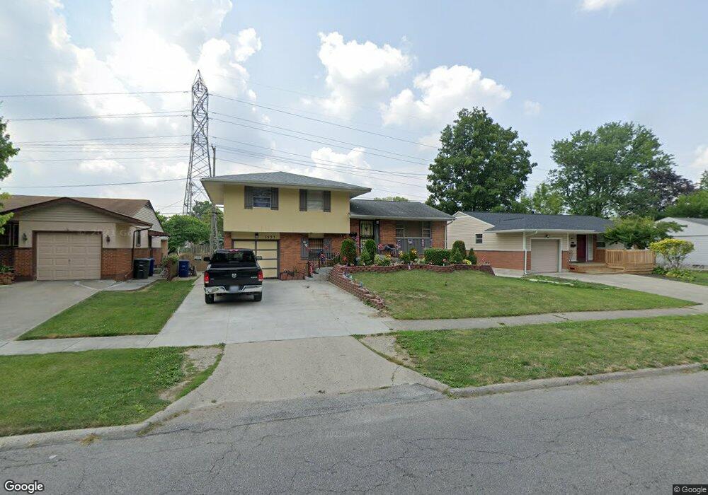
1533 Norma Rd Columbus, OH 43229
Woodward Park NeighborhoodEstimated Value: $250,000 - $254,000
3
Beds
2
Baths
1,284
Sq Ft
$196/Sq Ft
Est. Value
About This Home
This home is located at 1533 Norma Rd, Columbus, OH 43229 and is currently estimated at $252,275, approximately $196 per square foot. 1533 Norma Rd is a home located in Franklin County with nearby schools including Valley Forge Elementary School, Woodward Park Middle School, and Northland High School.
Ownership History
Date
Name
Owned For
Owner Type
Purchase Details
Closed on
Mar 17, 2023
Sold by
Appiah Sonya F and Robinson Sonya F
Bought by
Appiah Sonya F and Appiah George K
Current Estimated Value
Purchase Details
Closed on
Feb 27, 2023
Sold by
Robinson Sonya F
Bought by
Appiah Sonya F and Appiah George K
Purchase Details
Closed on
Jun 19, 2003
Sold by
Shaffer Carol I
Bought by
Robinson Sonya F
Home Financials for this Owner
Home Financials are based on the most recent Mortgage that was taken out on this home.
Original Mortgage
$107,670
Interest Rate
5.4%
Mortgage Type
Purchase Money Mortgage
Purchase Details
Closed on
Jul 2, 1993
Bought by
Shaffer Carol I
Purchase Details
Closed on
Sep 1, 1978
Create a Home Valuation Report for This Property
The Home Valuation Report is an in-depth analysis detailing your home's value as well as a comparison with similar homes in the area
Home Values in the Area
Average Home Value in this Area
Purchase History
| Date | Buyer | Sale Price | Title Company |
|---|---|---|---|
| Appiah Sonya F | -- | None Listed On Document | |
| Appiah Sonya F | -- | -- | |
| Robinson Sonya F | $111,000 | -- | |
| Shaffer Carol I | $76,600 | -- | |
| -- | $43,000 | -- |
Source: Public Records
Mortgage History
| Date | Status | Borrower | Loan Amount |
|---|---|---|---|
| Previous Owner | Robinson Sonya F | $107,670 |
Source: Public Records
Tax History
| Year | Tax Paid | Tax Assessment Tax Assessment Total Assessment is a certain percentage of the fair market value that is determined by local assessors to be the total taxable value of land and additions on the property. | Land | Improvement |
|---|---|---|---|---|
| 2025 | $3,175 | $70,740 | $22,960 | $47,780 |
| 2024 | $3,175 | $70,740 | $22,960 | $47,780 |
| 2023 | $3,134 | $70,740 | $22,960 | $47,780 |
| 2022 | $2,438 | $47,010 | $12,080 | $34,930 |
| 2021 | $2,443 | $47,010 | $12,080 | $34,930 |
| 2020 | $2,446 | $47,010 | $12,080 | $34,930 |
| 2019 | $2,344 | $38,640 | $9,660 | $28,980 |
| 2018 | $2,092 | $38,640 | $9,660 | $28,980 |
| 2017 | $2,343 | $38,640 | $9,660 | $28,980 |
| 2016 | $2,057 | $31,050 | $9,000 | $22,050 |
| 2015 | $1,844 | $30,670 | $9,000 | $21,670 |
| 2014 | $1,849 | $30,670 | $9,000 | $21,670 |
| 2013 | $959 | $32,270 | $9,450 | $22,820 |
Source: Public Records
Map
Nearby Homes
- 4923 Karl Rd Unit 4925
- 5004 Julie Place
- 1485 Norma Rd
- 4795 Colonel Perry Dr
- 4800 Bourke Rd
- 1705 Ivyhill Loop S
- 4857 Tamarack Blvd
- 4979 Lyle Rd
- 4904 Almont Dr
- 4983 Almont Dr
- 1905 Denise Dr
- 1638 Arrowood Loop N
- 1469 Sandalwood Place
- 1116 Tulsa Dr
- 4714 Ascot Dr
- 1310 Fowler Dr
- 4735 Heatherton Dr
- 5480 Rockwood Ct Unit R1
- 5318 Eisenhower Rd
- 4885 Northtowne Blvd
- 1541 Norma Rd
- 1525 Norma Rd
- 1517 Norma Rd
- 1549 Norma Rd
- 4927 Karl Rd Unit 929
- 4927-4929 Karl Rd
- 1520 Fullen Rd
- 1509 Norma Rd
- 4929 Karl Rd Unit 4929
- 4920 Colonel Perry Dr
- 1532 Norma Rd
- 1540 Norma Rd
- 4984 Julie Place
- 1514 Fullen Rd
- 4923 Karl Rd Unit 925
- 4923 Karl Rd Unit 25
- 4923-4925 Karl Rd Unit 25
- 1501 Norma Rd
- 4917 Karl Rd Unit 919
- 4917 Karl Rd Unit 19
Your Personal Tour Guide
Ask me questions while you tour the home.