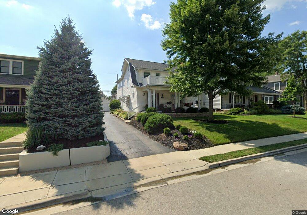
1533 Wyandotte Rd Columbus, OH 43212
Estimated Value: $676,989 - $719,000
4
Beds
3
Baths
2,464
Sq Ft
$285/Sq Ft
Est. Value
About This Home
This home is located at 1533 Wyandotte Rd, Columbus, OH 43212 and is currently estimated at $701,497, approximately $284 per square foot. 1533 Wyandotte Rd is a home located in Franklin County with nearby schools including Robert Louis Stevenson Elementary School, Larson Middle School, and Grandview Heights High School.
Ownership History
Date
Name
Owned For
Owner Type
Purchase Details
Closed on
Jul 31, 1980
Bought by
Short Robert A and Short Diana L
Current Estimated Value
Create a Home Valuation Report for This Property
The Home Valuation Report is an in-depth analysis detailing your home's value as well as a comparison with similar homes in the area
Home Values in the Area
Average Home Value in this Area
Purchase History
| Date | Buyer | Sale Price | Title Company |
|---|---|---|---|
| Short Robert A | $60,000 | -- |
Source: Public Records
Tax History Compared to Growth
Tax History
| Year | Tax Paid | Tax Assessment Tax Assessment Total Assessment is a certain percentage of the fair market value that is determined by local assessors to be the total taxable value of land and additions on the property. | Land | Improvement |
|---|---|---|---|---|
| 2024 | $10,597 | $181,690 | $72,800 | $108,890 |
| 2023 | $9,283 | $181,685 | $72,800 | $108,885 |
| 2022 | $10,794 | $179,900 | $54,600 | $125,300 |
| 2021 | $10,105 | $179,900 | $54,600 | $125,300 |
| 2020 | $10,063 | $179,900 | $54,600 | $125,300 |
| 2019 | $10,099 | $159,780 | $54,600 | $105,180 |
| 2018 | $9,202 | $159,780 | $54,600 | $105,180 |
| 2017 | $9,416 | $159,780 | $54,600 | $105,180 |
| 2016 | $8,349 | $121,280 | $43,190 | $78,090 |
| 2015 | $8,349 | $121,280 | $43,190 | $78,090 |
| 2014 | $8,375 | $121,280 | $43,190 | $78,090 |
| 2013 | $3,679 | $110,250 | $39,270 | $70,980 |
Source: Public Records
Map
Nearby Homes
- 1561 Glenn Ave
- 1459 Elmwood Ave Unit 1459
- 2015 W 5th Ave Unit 211
- 2015 W 5th Ave Unit 102
- 2015 W 5th Ave Unit 108
- 1313 Lincoln Rd
- 1631 Roxbury Rd Unit F3
- 1631 Roxbury Rd Unit B6
- 1655-1657 Ashland Ave
- 1661 Ashland Ave Unit 663
- 1782 Wyandotte Rd
- 1733 Elmwood Ave
- 1263 Oakland Ave
- 1475 W 3rd Ave Unit 204
- 1825 Northwest Ct Unit D
- 1364 W 7th Ave
- 1324 Lake Shore Dr Unit B
- 1301 Lake Shore Dr Unit 199
- 00 W 7th Ave
- 1398 Lower Green Cir Unit 1398
- 1529 Wyandotte Rd
- 1543 Wyandotte Rd
- 1549 Wyandotte Rd
- 1519 Wyandotte Rd
- 1544 Lincoln Rd
- 1546 Lincoln Rd
- 1542 Lincoln Rd
- 1552 Lincoln Rd
- 1553 Wyandotte Rd
- 1515 Wyandotte Rd
- 1530 Lincoln Rd
- 1558 Lincoln Rd Unit 560
- 1536 Wyandotte Rd
- 1528 Wyandotte Rd
- 1542 Wyandotte Rd
- 1528 Lincoln Rd
- 1566 Lincoln Rd
- 1520 Wyandotte Rd
- 1546 Wyandotte Rd
- 1555 Wyandotte Rd