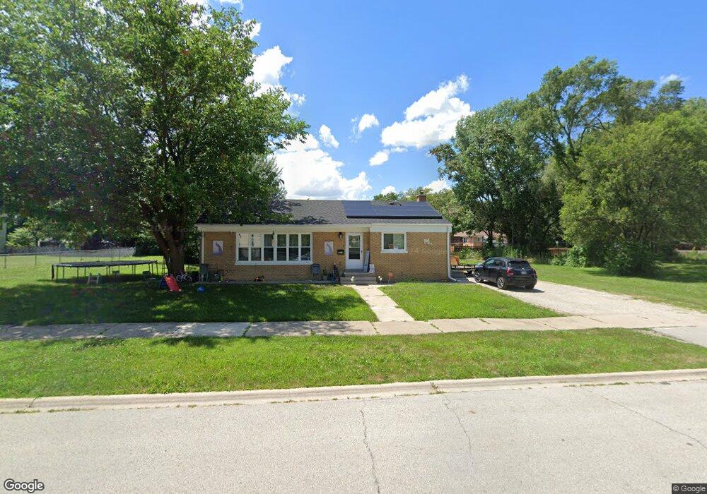
15332 5th Ave Phoenix, IL 60426
Estimated Value: $68,000 - $151,000
3
Beds
2
Baths
864
Sq Ft
$117/Sq Ft
Est. Value
About This Home
This home is located at 15332 5th Ave, Phoenix, IL 60426 and is currently estimated at $100,959, approximately $116 per square foot. 15332 5th Ave is a home located in Cook County with nearby schools including Taft School, Eisenhower School, and Coolidge Middle School.
Ownership History
Date
Name
Owned For
Owner Type
Purchase Details
Closed on
Oct 17, 2019
Sold by
Village Of Phoenix
Bought by
Flores Mayra and Flores Juan
Current Estimated Value
Purchase Details
Closed on
Jun 27, 2019
Sold by
Green Cathleen
Bought by
Village Of Thornton
Purchase Details
Closed on
Aug 31, 2006
Sold by
Dright Margie Lyn
Bought by
Green Cathleen C
Home Financials for this Owner
Home Financials are based on the most recent Mortgage that was taken out on this home.
Original Mortgage
$69,600
Interest Rate
8.5%
Mortgage Type
Unknown
Create a Home Valuation Report for This Property
The Home Valuation Report is an in-depth analysis detailing your home's value as well as a comparison with similar homes in the area
Home Values in the Area
Average Home Value in this Area
Purchase History
| Date | Buyer | Sale Price | Title Company |
|---|---|---|---|
| Flores Mayra | -- | None Available | |
| Village Of Thornton | -- | None Available | |
| Green Cathleen C | $87,000 | First American Title |
Source: Public Records
Mortgage History
| Date | Status | Borrower | Loan Amount |
|---|---|---|---|
| Previous Owner | Green Cathleen C | $69,600 |
Source: Public Records
Tax History
| Year | Tax Paid | Tax Assessment Tax Assessment Total Assessment is a certain percentage of the fair market value that is determined by local assessors to be the total taxable value of land and additions on the property. | Land | Improvement |
|---|---|---|---|---|
| 2025 | $1,001 | $2,865 | $930 | $1,935 |
| 2024 | $1,001 | $2,865 | $930 | $1,935 |
| 2023 | $120 | $2,865 | $930 | $1,935 |
| 2022 | $120 | $1,845 | $930 | $915 |
| 2021 | $161 | $1,844 | $930 | $914 |
| 2020 | $266 | $1,844 | $930 | $914 |
| 2019 | $0 | $1,574 | $852 | $722 |
| 2018 | $0 | $1,574 | $852 | $722 |
| 2017 | $0 | $1,574 | $852 | $722 |
| 2016 | $310 | $1,663 | $775 | $888 |
| 2015 | $249 | $1,663 | $775 | $888 |
| 2014 | $258 | $1,663 | $775 | $888 |
| 2013 | $350 | $1,881 | $775 | $1,106 |
Source: Public Records
Map
Nearby Homes
- 15351 3rd Ave
- 740 E 155th St
- 629 E 154th St
- 633 E 153rd St
- 630 Belle Ct
- 615 Frances St
- 718 E 152nd St
- 928 E 153rd St
- 15711 Lowe Ave
- 15025 Riverside Dr
- 14955 Riverside Dr
- 14951 Riverside Dr
- 15817 Union Ave
- 14925 Riverside Dr
- 14921 Oakdale Ave
- 15741 Finch Ave
- 15661 State St
- 15444 State St
- 15536 State St
- 565 E 149th St
Your Personal Tour Guide
Ask me questions while you tour the home.