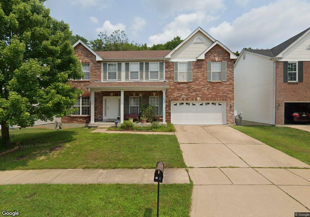
1534 Buckhurst Ct Ballwin, MO 63021
Estimated Value: $549,000 - $615,000
4
Beds
4
Baths
3,116
Sq Ft
$186/Sq Ft
Est. Value
About This Home
This home is located at 1534 Buckhurst Ct, Ballwin, MO 63021 and is currently estimated at $580,062, approximately $186 per square foot. 1534 Buckhurst Ct is a home located in St. Louis County with nearby schools including Ridge Meadows Elementary School, Selvidge Middle School, and Marquette Sr. High School.
Ownership History
Date
Name
Owned For
Owner Type
Purchase Details
Closed on
Dec 1, 2022
Sold by
Barakat Adnan
Bought by
Barakat Fakiha
Current Estimated Value
Purchase Details
Closed on
Sep 2, 1999
Sold by
The Jones Company Custom Homes Inc
Bought by
Barakat Adnan and Barakat Fakiha
Home Financials for this Owner
Home Financials are based on the most recent Mortgage that was taken out on this home.
Original Mortgage
$110,000
Interest Rate
7.58%
Create a Home Valuation Report for This Property
The Home Valuation Report is an in-depth analysis detailing your home's value as well as a comparison with similar homes in the area
Home Values in the Area
Average Home Value in this Area
Purchase History
| Date | Buyer | Sale Price | Title Company |
|---|---|---|---|
| Barakat Fakiha | -- | -- | |
| Barakat Adnan | $253,192 | -- |
Source: Public Records
Mortgage History
| Date | Status | Borrower | Loan Amount |
|---|---|---|---|
| Previous Owner | Barakat Adnan | $110,000 |
Source: Public Records
Tax History
| Year | Tax Paid | Tax Assessment Tax Assessment Total Assessment is a certain percentage of the fair market value that is determined by local assessors to be the total taxable value of land and additions on the property. | Land | Improvement |
|---|---|---|---|---|
| 2025 | $6,847 | $104,970 | $31,460 | $73,510 |
| 2024 | $6,847 | $98,060 | $17,460 | $80,600 |
| 2023 | $6,841 | $98,060 | $17,460 | $80,600 |
| 2022 | $6,070 | $80,770 | $20,980 | $59,790 |
| 2021 | $6,025 | $80,770 | $20,980 | $59,790 |
| 2020 | $5,853 | $74,790 | $20,980 | $53,810 |
| 2019 | $5,876 | $74,790 | $20,980 | $53,810 |
| 2018 | $5,700 | $68,400 | $15,730 | $52,670 |
| 2017 | $5,564 | $68,400 | $15,730 | $52,670 |
| 2016 | $5,468 | $64,640 | $15,730 | $48,910 |
Source: Public Records
Map
Nearby Homes
- 439 Chukker Valley
- 847 Arbor Chase Dr
- 589 Wetherby Terrace Dr
- 16015 Canterbury Estates Dr
- 16038 Pierside Ln
- 217 Carmel Woods Dr Unit 217
- 16016 Cinderella Ct
- 16004 Cinderella Ct
- 16008 Cinderella Ct
- 2 Burlington at Regal Pines Meadows
- 1396 Parkview Estates Dr
- 2 Belmont at Regal Pines Meadows
- 2 Meadows
- 16033 Cinderella Ct
- 2 Nottingham at Regal Pines Enclave
- 2 Hickory at Regal Pines Enclave
- 2 Sequoia at Regal Pines Enclave
- 847 Palm Bay Dr
- 325 Fox Village Ct
- 2 Hermitage II at Regal Pines Enclave
- 1538 Buckhurst Ct
- 1530 Buckhurst Ct
- 1526 Buckhurst Ct
- 1542 Buckhurst Ct
- 1522 Buckhurst Ct
- 1535 Buckhurst Ct
- 1546 Buckhurst Ct
- 1531 Buckhurst Ct
- 1539 Buckhurst Ct
- 1527 Buckhurst Ct
- 1518 Buckhurst Ct
- 1550 Buckhurst Ct
- 1523 Buckhurst Ct
- 1519 Buckhurst Ct
- 1514 Buckhurst Ct
- 1432 Buckhurst Ct
- 1554 Buckhurst Ct
- 1433 Buckhurst Ct
- 1424 Buckhurst Ct
- 1515 Buckhurst Ct
Your Personal Tour Guide
Ask me questions while you tour the home.