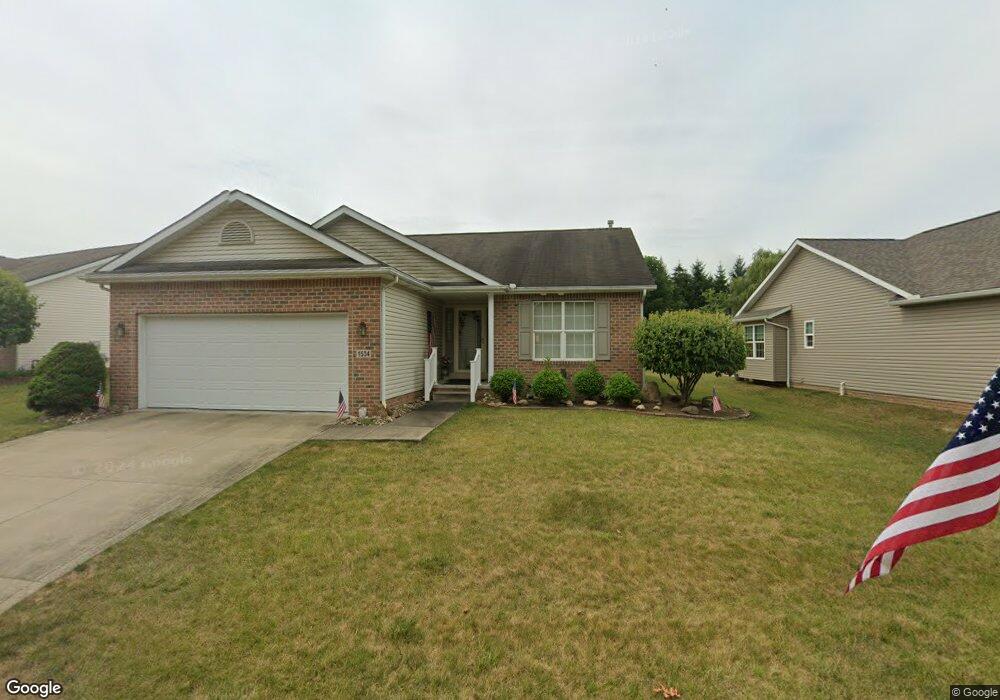
1534 Presidents St Unit 23 Louisville, OH 44641
Estimated Value: $258,000 - $290,000
2
Beds
2
Baths
1,560
Sq Ft
$178/Sq Ft
Est. Value
About This Home
This home is located at 1534 Presidents St Unit 23, Louisville, OH 44641 and is currently estimated at $278,395, approximately $178 per square foot. 1534 Presidents St Unit 23 is a home located in Stark County with nearby schools including Louisville High School and St. Thomas Aquinas High School & Middle School.
Ownership History
Date
Name
Owned For
Owner Type
Purchase Details
Closed on
Aug 4, 2005
Sold by
Miranoma Inc
Bought by
Clapper Allen R and Clapper Mary M
Current Estimated Value
Home Financials for this Owner
Home Financials are based on the most recent Mortgage that was taken out on this home.
Original Mortgage
$132,150
Interest Rate
5.71%
Mortgage Type
Fannie Mae Freddie Mac
Create a Home Valuation Report for This Property
The Home Valuation Report is an in-depth analysis detailing your home's value as well as a comparison with similar homes in the area
Home Values in the Area
Average Home Value in this Area
Purchase History
| Date | Buyer | Sale Price | Title Company |
|---|---|---|---|
| Clapper Allen R | $176,200 | -- |
Source: Public Records
Mortgage History
| Date | Status | Borrower | Loan Amount |
|---|---|---|---|
| Closed | Clapper Allen R | $132,150 |
Source: Public Records
Tax History Compared to Growth
Tax History
| Year | Tax Paid | Tax Assessment Tax Assessment Total Assessment is a certain percentage of the fair market value that is determined by local assessors to be the total taxable value of land and additions on the property. | Land | Improvement |
|---|---|---|---|---|
| 2025 | -- | $94,960 | $16,210 | $78,750 |
| 2024 | -- | $94,960 | $16,210 | $78,750 |
| 2023 | $2,589 | $69,410 | $12,570 | $56,840 |
| 2022 | $2,613 | $69,410 | $12,570 | $56,840 |
| 2021 | $2,620 | $69,410 | $12,570 | $56,840 |
| 2020 | $2,149 | $62,940 | $11,310 | $51,630 |
| 2019 | $2,164 | $62,940 | $11,310 | $51,630 |
| 2018 | $2,156 | $62,940 | $11,310 | $51,630 |
| 2017 | $1,850 | $53,620 | $10,500 | $43,120 |
| 2016 | $1,888 | $53,620 | $10,500 | $43,120 |
| 2015 | $1,894 | $53,620 | $10,500 | $43,120 |
| 2014 | $1,885 | $50,270 | $11,100 | $39,170 |
| 2013 | $946 | $50,270 | $11,100 | $39,170 |
Source: Public Records
Map
Nearby Homes
- 1715 High St
- 2110 Edmar St
- 641 S Nickelplate St
- 1812 E Broad St
- 908 Sand Lot Cir
- 520 S Silver St
- 308 Superior St
- 728 E Broad St
- 3390 Meese Rd NE
- 204 E Broad St
- 0 Michigan Blvd
- 107 E Broad St
- 2015 E Main St
- 1702 View Pointe Ave
- 8225 Georgetown St
- 1639 Horizon Dr
- 325 Lincoln Ave
- 1170 Winding Ridge Ave
- 910 Crosswyck Cir
- 428 Honeycrisp Dr NE
- 1528 Presidents St
- 1522 Presidents St Unit 21
- 36 Presidents Ave
- 46 Presidents Ave
- VL #46 Presidents Ave
- VL #39 Presidents Ave
- VL #37 Presidents Ave
- VL #22 Presidents Ave
- 39 Presidents Ave
- 38 Presidents Ave
- 37 Presidents Ave
- 1516 Presidents St Unit 20
- 1604 Presidents Square Unit 25
- 1536 Edmar St
- 1526 Edmar St
- 1610 Presidents Square Unit 26
- 1604 Edmar St
- 1506 Presidents St Unit 19
- 1617 Presidents Square Unit 45
- 1616 Presidents Square Unit 27