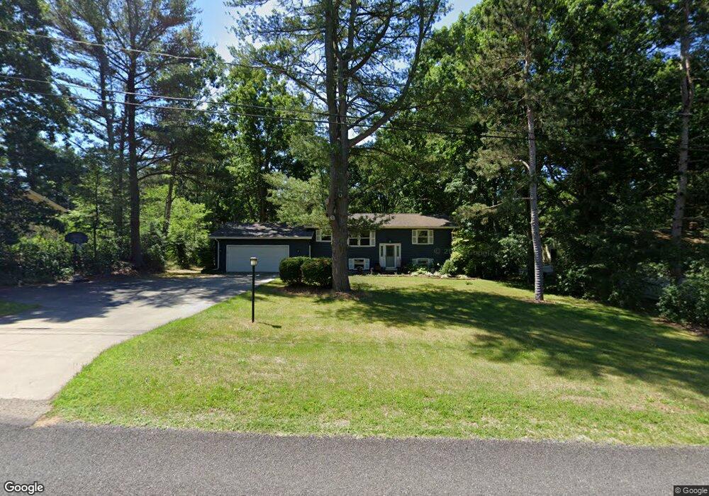
15340 Barry St West Olive, MI 49460
Estimated Value: $305,000 - $367,000
3
Beds
2
Baths
1,645
Sq Ft
$199/Sq Ft
Est. Value
About This Home
This home is located at 15340 Barry St, West Olive, MI 49460 and is currently estimated at $327,624, approximately $199 per square foot. 15340 Barry St is a home located in Ottawa County with nearby schools including Lakeshore Elementary School, Harbor Lights Middle School, and West Ottawa High School.
Ownership History
Date
Name
Owned For
Owner Type
Purchase Details
Closed on
Nov 6, 2008
Sold by
Ensing Donna
Bought by
The Huntington National Bank
Current Estimated Value
Purchase Details
Closed on
May 14, 2004
Sold by
Frost Barry L and Frost Christine A
Bought by
Ensing Donna
Home Financials for this Owner
Home Financials are based on the most recent Mortgage that was taken out on this home.
Original Mortgage
$146,500
Interest Rate
6.49%
Mortgage Type
Purchase Money Mortgage
Create a Home Valuation Report for This Property
The Home Valuation Report is an in-depth analysis detailing your home's value as well as a comparison with similar homes in the area
Home Values in the Area
Average Home Value in this Area
Purchase History
| Date | Buyer | Sale Price | Title Company |
|---|---|---|---|
| The Huntington National Bank | $111,750 | None Available | |
| Ensing Donna | $146,500 | -- |
Source: Public Records
Mortgage History
| Date | Status | Borrower | Loan Amount |
|---|---|---|---|
| Previous Owner | Ensing Donna | $146,500 |
Source: Public Records
Tax History Compared to Growth
Tax History
| Year | Tax Paid | Tax Assessment Tax Assessment Total Assessment is a certain percentage of the fair market value that is determined by local assessors to be the total taxable value of land and additions on the property. | Land | Improvement |
|---|---|---|---|---|
| 2025 | $2,211 | $119,700 | $0 | $0 |
| 2024 | $1,911 | $113,400 | $0 | $0 |
| 2023 | $1,844 | $95,100 | $0 | $0 |
| 2022 | $2,026 | $83,300 | $0 | $0 |
| 2021 | $1,967 | $77,700 | $0 | $0 |
| 2020 | $1,946 | $75,200 | $0 | $0 |
| 2019 | $1,862 | $71,100 | $0 | $0 |
| 2018 | -- | $72,600 | $0 | $0 |
| 2017 | -- | $72,600 | $0 | $0 |
| 2016 | -- | $69,900 | $0 | $0 |
| 2015 | -- | $66,600 | $0 | $0 |
| 2014 | -- | $63,700 | $0 | $0 |
Source: Public Records
Map
Nearby Homes
- 5577 Timberstone Ln
- 5195 Sand Dr
- 0 Butternut Dr (Parcel A)
- 0 Butternut Dr Unit 25050553
- 6060 152nd Ave
- VL Barry St Unit Par 4
- VL Barry St Unit Par 3
- VL Barry St Unit Par 2
- 14236 Phoenix Place
- 4728 MacAtawa Legends Blvd Unit 19
- 16183 Red Pine Ct
- The Marley Plan at Macatawa Legends - Americana Series
- The Sanibel Plan at Macatawa Legends - Americana Series
- The Wisteria Plan at Macatawa Legends - Americana Series
- The Grayson Plan at Macatawa Legends - Americana Series
- The Fitzgerald Plan at Macatawa Legends - Americana Series
- The Preston Plan at Macatawa Legends - Americana Series
- The Marigold Plan at Macatawa Legends - Parkside Series
- The Jamestown Plan at Macatawa Legends - Designer Series
- The Windsor Plan at Macatawa Legends - Legacy Series
- 15358 Barry St
- 15330 Barry St
- 15370 Barry St
- 15320 Barry St
- 15323 Barry St
- 15323 Barry St
- 15380 Barry St
- 15286 Barry St
- 15293 Barry St
- 15381 Barry St
- 15268 Barry St
- 15359 Red Fox Walk
- 15252 Barry St
- 15460 Barry St
- 15388 Barry St
- 15261 Barry St
- 15234 Barry St
- 15396 Barry St
- 15405 Barry St
- 15251 Red Fox Walk