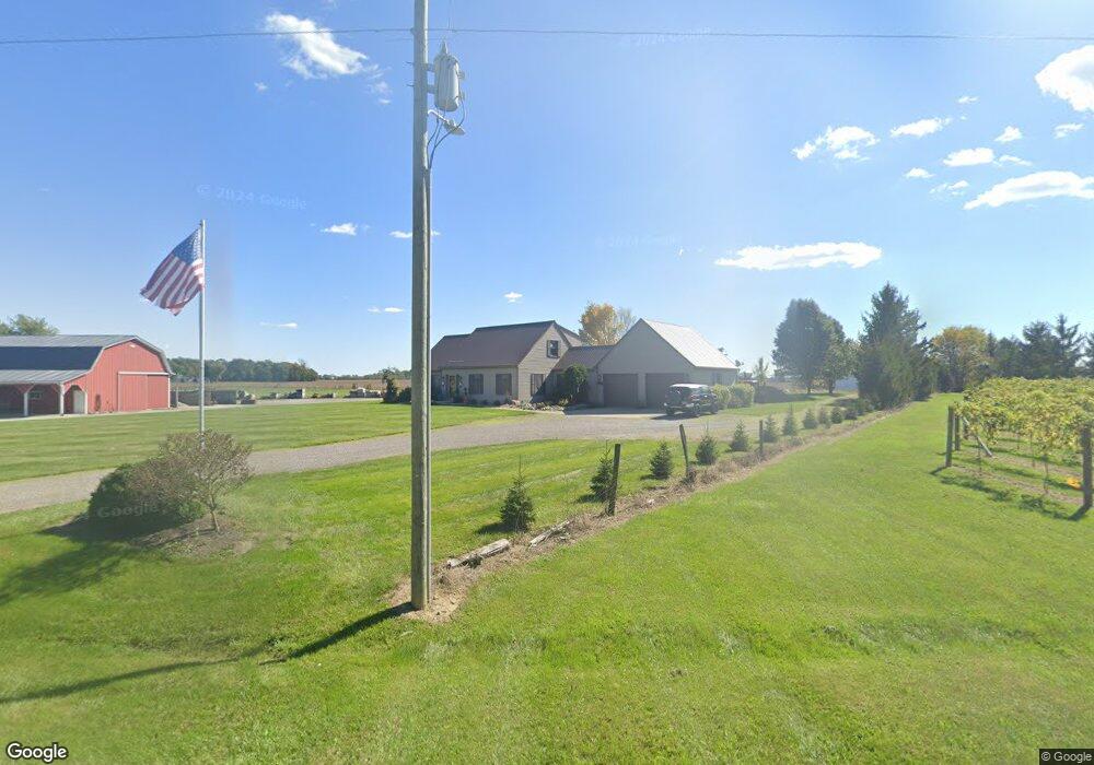
15348 State Route 67 Wapakoneta, OH 45895
Estimated Value: $314,000 - $521,000
3
Beds
3
Baths
2,082
Sq Ft
$200/Sq Ft
Est. Value
About This Home
This home is located at 15348 State Route 67, Wapakoneta, OH 45895 and is currently estimated at $415,777, approximately $199 per square foot. 15348 State Route 67 is a home located in Auglaize County with nearby schools including Wapakoneta Elementary School, Wapakoneta High School, and Wapakoneta Middle School.
Ownership History
Date
Name
Owned For
Owner Type
Purchase Details
Closed on
Sep 13, 2011
Sold by
Geren Gary L and Geren Raelene A
Bought by
Allman Tommy J and Allman Tracie L
Current Estimated Value
Home Financials for this Owner
Home Financials are based on the most recent Mortgage that was taken out on this home.
Original Mortgage
$60,000
Outstanding Balance
$24,034
Interest Rate
4.59%
Mortgage Type
Future Advance Clause Open End Mortgage
Estimated Equity
$391,743
Purchase Details
Closed on
Sep 29, 1997
Sold by
Allman Tommy J
Bought by
Allman Tom J
Purchase Details
Closed on
Aug 6, 1993
Sold by
Steveley Kevin L
Bought by
Allman Tommy J
Purchase Details
Closed on
Sep 17, 1991
Sold by
Benny Arnold J
Bought by
Steveley Kevin L
Purchase Details
Closed on
Apr 1, 1989
Create a Home Valuation Report for This Property
The Home Valuation Report is an in-depth analysis detailing your home's value as well as a comparison with similar homes in the area
Home Values in the Area
Average Home Value in this Area
Purchase History
| Date | Buyer | Sale Price | Title Company |
|---|---|---|---|
| Allman Tommy J | $41,733 | None Available | |
| Allman Tom J | -- | -- | |
| Allman Tommy J | $144,000 | -- | |
| Steveley Kevin L | $134,000 | -- | |
| -- | $13,000 | -- |
Source: Public Records
Mortgage History
| Date | Status | Borrower | Loan Amount |
|---|---|---|---|
| Open | Allman Tommy J | $60,000 |
Source: Public Records
Tax History Compared to Growth
Tax History
| Year | Tax Paid | Tax Assessment Tax Assessment Total Assessment is a certain percentage of the fair market value that is determined by local assessors to be the total taxable value of land and additions on the property. | Land | Improvement |
|---|---|---|---|---|
| 2024 | $5,834 | $117,270 | $13,600 | $103,670 |
| 2023 | $3,888 | $117,100 | $13,600 | $103,500 |
| 2022 | $3,043 | $84,340 | $11,330 | $73,010 |
| 2021 | $3,023 | $84,340 | $11,330 | $73,010 |
| 2020 | $3,029 | $84,343 | $11,333 | $73,010 |
| 2019 | $2,580 | $69,132 | $9,289 | $59,843 |
| 2018 | $2,588 | $69,132 | $9,289 | $59,843 |
| 2017 | $2,573 | $69,132 | $9,289 | $59,843 |
| 2016 | $2,354 | $63,543 | $8,848 | $54,695 |
| 2015 | $2,352 | $63,543 | $8,848 | $54,695 |
| 2014 | $2,338 | $63,543 | $8,848 | $54,695 |
| 2013 | $2,397 | $63,543 | $8,848 | $54,695 |
Source: Public Records
Map
Nearby Homes
- 15388 State Route 67
- 15377 State Route 67
- 15398 State Route 67
- 15271 State Route 67
- 15271 Ohio 67
- 15286 State Route 67
- 15257 State Route 67
- 15200 State Route 67
- 15560 Blackhoof Creek Rd
- 15223 State Route 67
- 15468 Ohio 67
- 15194 Ohio 67
- 15468 State Route 67
- 15194 State Route 67
- 15187 State Route 67
- 15590 Blackhoof Creek Rd
- 15115 State Route 67
- 15608 Blackhoof Creek Rd
- 15668 Blackhoof Creek Rd