Estimated Value: $416,000 - $880,639
4
Beds
3
Baths
2,240
Sq Ft
$317/Sq Ft
Est. Value
About This Home
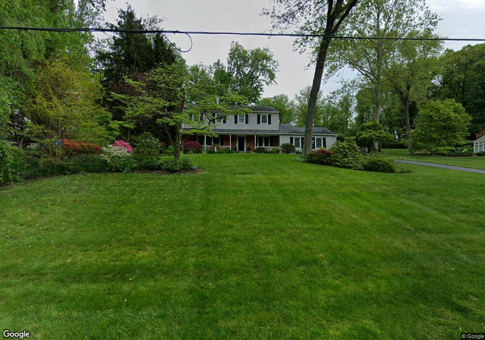
This home is located at 1535 Ashby Rd, Paoli, PA 19301 and is currently estimated at $709,410, approximately $316 per square foot. 1535 Ashby Rd is a home located in Chester County with nearby schools including Beaumont Elementary School, Tredyffrin-Easttown Middle School, and Conestoga Senior High School.
Ownership History
Date
Name
Owned For
Owner Type
Purchase Details
Closed on
Dec 12, 2017
Sold by
May R Martha
Bought by
Boyle John and Boyle Frances
Current Estimated Value
Home Financials for this Owner
Home Financials are based on the most recent Mortgage that was taken out on this home.
Original Mortgage
$200,000
Outstanding Balance
$111,196
Interest Rate
3.9%
Mortgage Type
New Conventional
Estimated Equity
$598,214
Purchase Details
Closed on
Sep 27, 1999
Sold by
Chaffe Ann Lukens
Bought by
Boyle John F and Boyle Frances G
Home Financials for this Owner
Home Financials are based on the most recent Mortgage that was taken out on this home.
Original Mortgage
$239,950
Interest Rate
7.85%
Create a Home Valuation Report for This Property
The Home Valuation Report is an in-depth analysis detailing your home's value as well as a comparison with similar homes in the area
Home Values in the Area
Average Home Value in this Area
Purchase History
| Date | Buyer | Sale Price | Title Company |
|---|---|---|---|
| Boyle John | $215,000 | -- | |
| Boyle John F | $305,000 | Commonwealth Land Title Ins |
Source: Public Records
Mortgage History
| Date | Status | Borrower | Loan Amount |
|---|---|---|---|
| Open | Boyle John | $200,000 | |
| Previous Owner | Boyle John F | $239,950 |
Source: Public Records
Tax History Compared to Growth
Tax History
| Year | Tax Paid | Tax Assessment Tax Assessment Total Assessment is a certain percentage of the fair market value that is determined by local assessors to be the total taxable value of land and additions on the property. | Land | Improvement |
|---|---|---|---|---|
| 2025 | $8,744 | $234,430 | $69,110 | $165,320 |
| 2024 | $8,744 | $234,430 | $69,110 | $165,320 |
| 2023 | $8,176 | $234,430 | $69,110 | $165,320 |
| 2022 | $7,952 | $234,430 | $69,110 | $165,320 |
| 2021 | $7,780 | $234,430 | $69,110 | $165,320 |
| 2020 | $7,563 | $234,430 | $69,110 | $165,320 |
| 2019 | $7,353 | $234,430 | $69,110 | $165,320 |
| 2018 | $7,225 | $234,430 | $69,110 | $165,320 |
| 2017 | $7,062 | $234,430 | $69,110 | $165,320 |
| 2016 | -- | $234,430 | $69,110 | $165,320 |
| 2015 | -- | $229,060 | $69,110 | $159,950 |
| 2014 | -- | $229,060 | $69,110 | $159,950 |
Source: Public Records
Map
Nearby Homes
- 1441 Berwyn Paoli Rd
- 5 Kent Ln
- 521 Foxwood Ln
- 2102 Quail Ridge Dr
- 1242 Old Lancaster Rd
- 1304 Weatherstone Dr Unit 1304
- 1602 Weatherstone Dr Unit 1602
- 2104 Weatherstone Dr Unit 2104
- 109 Vincent Rd
- 32 Manchester Ct
- 520 Hawthorne Place
- 106 N Valley Rd
- 896 Conestoga Rd
- 340 Beechwood Rd
- 2000 Saint Andrews Dr
- 650 Augusta Ct
- 211 Wooded Way
- 1 Whitworth Ave
- 114 Manor Rd
- 91 Central Ave
- 1529 Ashby Rd
- 1539 Ashby Rd
- 1516 Pennsylvania Ave
- 1536 Ashby Rd
- 1510 Pennsylvania Ave
- 1522 Pennsylvania Ave
- 1525 Ashby Rd
- 1540 Ashby Rd
- 1543 Ashby Rd
- 1504 Pennsylvania Ave
- 1526 Ashby Rd
- 1544 Ashby Rd
- 1530 Pennsylvania Ave
- 1521 Ashby Rd
- 1515 Pennsylvania Ave
- 1521 Pennsylvania Ave
- 1506 Greenlawn Rd
- 1549 Ashby Rd
- 1448 Pennsylvania Ave
- 1548 Ashby Rd