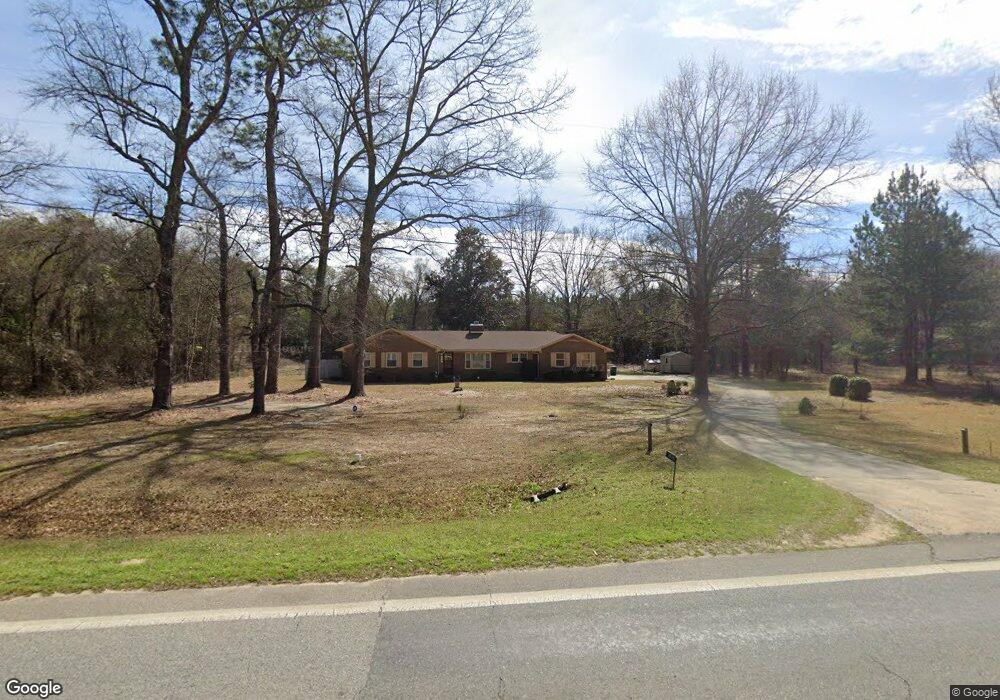
1535 Ga Highway 26 W Oglethorpe, GA 31068
Estimated Value: $88,000 - $216,000
--
Bed
1
Bath
1,620
Sq Ft
$95/Sq Ft
Est. Value
About This Home
This home is located at 1535 Ga Highway 26 W, Oglethorpe, GA 31068 and is currently estimated at $153,338, approximately $94 per square foot. 1535 Ga Highway 26 W is a home with nearby schools including Macon County Elementary School, Macon County Middle School, and Macon County High School.
Ownership History
Date
Name
Owned For
Owner Type
Purchase Details
Closed on
Dec 12, 2022
Sold by
Northcut Ben
Bought by
Northcut Geraldine
Current Estimated Value
Purchase Details
Closed on
Jul 29, 2011
Sold by
Stephens Beverly D
Bought by
Northcut Geraldine Neal
Purchase Details
Closed on
Mar 23, 2009
Sold by
Stephens Larry
Bought by
Stephens Beverly Denise
Purchase Details
Closed on
Nov 14, 1996
Sold by
Stewart William Dav
Bought by
Stephens Beverly D
Purchase Details
Closed on
Feb 5, 1991
Sold by
Stewart William Dav
Bought by
Stewart William Dav
Purchase Details
Closed on
Aug 8, 1986
Bought by
Stewart William Dav
Create a Home Valuation Report for This Property
The Home Valuation Report is an in-depth analysis detailing your home's value as well as a comparison with similar homes in the area
Home Values in the Area
Average Home Value in this Area
Purchase History
| Date | Buyer | Sale Price | Title Company |
|---|---|---|---|
| Northcut Geraldine | $74,520 | -- | |
| Northcut Geraldine Neal | $78,000 | -- | |
| Stephens Beverly Denise | -- | -- | |
| Stephens Beverly D | $56,000 | -- | |
| Stewart William Dav | -- | -- | |
| Stewart William Dav | $57,000 | -- |
Source: Public Records
Tax History Compared to Growth
Tax History
| Year | Tax Paid | Tax Assessment Tax Assessment Total Assessment is a certain percentage of the fair market value that is determined by local assessors to be the total taxable value of land and additions on the property. | Land | Improvement |
|---|---|---|---|---|
| 2024 | $1,265 | $47,042 | $4,090 | $42,952 |
| 2023 | $1,265 | $47,042 | $4,090 | $42,952 |
| 2022 | $927 | $35,018 | $4,090 | $30,928 |
| 2021 | $794 | $27,402 | $5,234 | $22,168 |
| 2020 | $754 | $28,016 | $5,234 | $22,782 |
| 2019 | $812 | $28,016 | $5,234 | $22,782 |
| 2018 | $756 | $28,016 | $5,234 | $22,782 |
| 2017 | $762 | $28,016 | $5,234 | $22,782 |
| 2016 | $763 | $28,016 | $5,234 | $22,782 |
| 2015 | -- | $30,708 | $5,234 | $25,474 |
| 2014 | -- | $30,708 | $5,234 | $25,474 |
| 2013 | -- | $32,146 | $5,234 | $26,912 |
Source: Public Records
Map
Nearby Homes
- 562 W Anderson St
- 432 Clifton Bradley Dr
- Whitewater Rd
- Whitewater Rd
- 0 Georgia 49
- 204 Jordan St
- 4265 Georgia 49
- 45 Oakwood Dr
- 110 Head Rd Unit LotWP001
- 2668 Coogle Rd
- 511 Forsyth St
- 399 Travelers Rest Rd
- 326 N Dooly St
- 103 E Artesian Ave
- 514 Patricia Dr
- 504 Patricia Dr
- 510 Patricia Dr
- 803 Vienna Rd
- 100 Minor Ave
- 416 Engram St
- 1489 Ga Highway 26 W
- 1451 Ga Highway 26 W
- 1590 Ga Highway 26 W
- 1781 Ga Highway 49 S
- 1696 Ga Highway 26 W
- 1755 Ga Highway 26 W
- 1311 Ga Highway 26 W
- 1877 Ga Highway 49 S
- 1951 Ga Highway 49 S
- 1291 Ga Highway 26 W
- 1271 Georgia 26
- 1826 Ga Highway 49 S
- 1784 Ga Highway 49 S
- 1766 Ga Highway 26 W
- 1766 Georgia 26
- 1674 Ga Highway 49 S
- 1638 Ga Highway 49 S
- 1269 Ga Highway 26 W
- 1564 S Ga Highway 49 Rd S
- 1846 Ga Highway 49 S