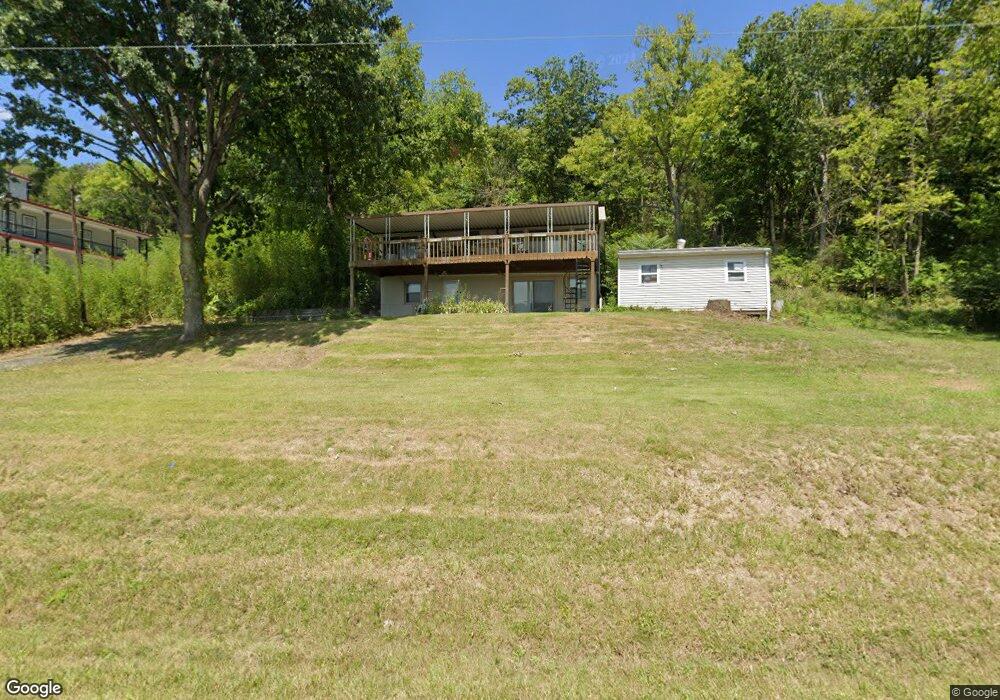
1535 Us Highway 52 Georgetown, OH 45121
Estimated Value: $175,000 - $355,000
2
Beds
1
Bath
960
Sq Ft
$254/Sq Ft
Est. Value
About This Home
This home is located at 1535 Us Highway 52, Georgetown, OH 45121 and is currently estimated at $243,447, approximately $253 per square foot. 1535 Us Highway 52 is a home located in Brown County with nearby schools including Ripley Union Lewis Huntington Elementary School, Ripley Union Lewis Huntington Middle School, and Ripley-Union-Lewis-Huntington High School.
Ownership History
Date
Name
Owned For
Owner Type
Purchase Details
Closed on
Aug 3, 2010
Sold by
Rasinske Edward P and Rasinske Vicky L
Bought by
Hite Betsy A and Hite Richard F
Current Estimated Value
Home Financials for this Owner
Home Financials are based on the most recent Mortgage that was taken out on this home.
Original Mortgage
$100,800
Interest Rate
4.99%
Mortgage Type
New Conventional
Purchase Details
Closed on
May 12, 2005
Sold by
Newton Dale and Newton Amy
Bought by
Rasinske Edward P and Rasinske Vicky L
Home Financials for this Owner
Home Financials are based on the most recent Mortgage that was taken out on this home.
Original Mortgage
$81,600
Interest Rate
5.68%
Mortgage Type
Fannie Mae Freddie Mac
Create a Home Valuation Report for This Property
The Home Valuation Report is an in-depth analysis detailing your home's value as well as a comparison with similar homes in the area
Home Values in the Area
Average Home Value in this Area
Purchase History
| Date | Buyer | Sale Price | Title Company |
|---|---|---|---|
| Hite Betsy A | $126,000 | Prominent Title | |
| Rasinske Edward P | $102,000 | -- |
Source: Public Records
Mortgage History
| Date | Status | Borrower | Loan Amount |
|---|---|---|---|
| Previous Owner | Hite Betsy A | $100,800 | |
| Previous Owner | Rasinske Edward P | $81,600 |
Source: Public Records
Tax History Compared to Growth
Tax History
| Year | Tax Paid | Tax Assessment Tax Assessment Total Assessment is a certain percentage of the fair market value that is determined by local assessors to be the total taxable value of land and additions on the property. | Land | Improvement |
|---|---|---|---|---|
| 2024 | $1,636 | $52,600 | $15,410 | $37,190 |
| 2023 | $1,636 | $38,070 | $11,010 | $27,060 |
| 2022 | $1,337 | $38,070 | $11,010 | $27,060 |
| 2021 | $1,248 | $38,070 | $11,010 | $27,060 |
| 2020 | $1,150 | $33,100 | $9,570 | $23,530 |
| 2019 | $571 | $33,100 | $9,570 | $23,530 |
| 2018 | $566 | $33,100 | $9,570 | $23,530 |
| 2017 | $1,050 | $30,310 | $10,530 | $19,780 |
| 2016 | $1,031 | $30,310 | $10,530 | $19,780 |
| 2015 | $1,030 | $30,310 | $10,530 | $19,780 |
| 2014 | $1,062 | $29,350 | $9,570 | $19,780 |
| 2013 | $984 | $29,350 | $9,570 | $19,780 |
Source: Public Records
Map
Nearby Homes
- 404 E 2nd St
- 414 E 2nd St
- 508 E 3rd St
- 310 E 3rd St
- 207 E 3rd St
- 305 Bracken St
- 307 Hamilton Ave
- 301 Elizabeth St
- 401 E 4th St
- 105 E 4th St
- 114 E 4th St
- Lot 49 Boudes Ferry Rd
- 4900 Mary Ingles Hwy E
- 4465 W Augusta Chatham Rd
- 1920 Shinkles Ridge
- ac Shinkle Ridge Rd
- 312 White Oak St
- 5104 Dutch Ridge Rd
- 2845 Mary Ingles Hwy E
- 1308 Skiffsville Rd
- 1535 Us Rt 52
- 1513 Us Highway 52
- 1713 U S Route 52
- 1016 U S Route 52
- 1489 Us Highway 52
- 1489 Us Highway 52
- 1006 Us Rt 52 Unit 1016
- 1369 Us Highway 52
- 1369 Us Highway 52
- 1348 Us Highway 52
- 1348 Us Rt 52
- 1356 Us Highway 52
- 101 Frankfort St
- 1713 Us Highway 52
- 1713 Us Highway 52
- 308 E Riverside Dr
- 1769 Us Highway 52
- 1769 U S 52
- 1769 Us Rt 52
- 412 Cherry Alley