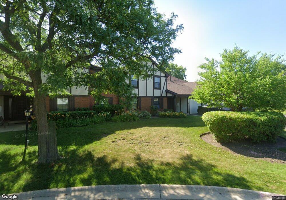
1536 Buxton Ct Unit 116D1 Wheeling, IL 60090
Estimated Value: $228,160 - $284,000
2
Beds
--
Bath
139,350
Sq Ft
$2/Sq Ft
Est. Value
About This Home
This home is located at 1536 Buxton Ct Unit 116D1, Wheeling, IL 60090 and is currently estimated at $259,790, approximately $1 per square foot. 1536 Buxton Ct Unit 116D1 is a home located in Cook County with nearby schools including Booth Tarkington Elementary School, Jack London Middle School, and Wheeling High School.
Ownership History
Date
Name
Owned For
Owner Type
Purchase Details
Closed on
Jul 23, 2008
Sold by
Snoad Margo
Bought by
Snoad Margo and Margo Snoad Trust
Current Estimated Value
Purchase Details
Closed on
Jun 10, 2005
Sold by
Cook Maynard B
Bought by
Snoad Charles G and Snoad Margo
Home Financials for this Owner
Home Financials are based on the most recent Mortgage that was taken out on this home.
Original Mortgage
$121,000
Outstanding Balance
$63,616
Interest Rate
5.87%
Mortgage Type
Fannie Mae Freddie Mac
Estimated Equity
$196,174
Purchase Details
Closed on
Jun 30, 1998
Sold by
Szatkowski Dolores M
Bought by
Cook Maynard B
Create a Home Valuation Report for This Property
The Home Valuation Report is an in-depth analysis detailing your home's value as well as a comparison with similar homes in the area
Home Values in the Area
Average Home Value in this Area
Purchase History
| Date | Buyer | Sale Price | Title Company |
|---|---|---|---|
| Snoad Margo | -- | None Available | |
| Snoad Charles G | $191,000 | Attorneys Title Guaranty Fun | |
| Cook Maynard B | $109,000 | -- |
Source: Public Records
Mortgage History
| Date | Status | Borrower | Loan Amount |
|---|---|---|---|
| Open | Snoad Charles G | $121,000 |
Source: Public Records
Tax History Compared to Growth
Tax History
| Year | Tax Paid | Tax Assessment Tax Assessment Total Assessment is a certain percentage of the fair market value that is determined by local assessors to be the total taxable value of land and additions on the property. | Land | Improvement |
|---|---|---|---|---|
| 2024 | $3,570 | $16,621 | $875 | $15,746 |
| 2023 | $3,344 | $16,621 | $875 | $15,746 |
| 2022 | $3,344 | $16,621 | $875 | $15,746 |
| 2021 | $969 | $9,948 | $485 | $9,463 |
| 2020 | $880 | $9,948 | $485 | $9,463 |
| 2019 | $883 | $11,051 | $485 | $10,566 |
| 2018 | $1,295 | $10,420 | $388 | $10,032 |
| 2017 | $948 | $10,420 | $388 | $10,032 |
| 2016 | $1,649 | $10,420 | $388 | $10,032 |
| 2015 | $1,850 | $9,713 | $1,457 | $8,256 |
| 2014 | $1,767 | $9,713 | $1,457 | $8,256 |
| 2013 | $1,670 | $9,713 | $1,457 | $8,256 |
Source: Public Records
Map
Nearby Homes
- 705 Lakeside Circle Dr Unit 2
- 671 Cedarwood Ct Unit 2
- 691 Lakeside Circle Dr
- 791 Lakeside Circle Dr Unit 1
- 528 Surf Ct
- 2812 Jackson Dr
- 2822 Jackson Dr
- 1485 Chippewa Trail
- 441 Commanche Trail Unit 3100
- 2616 N Prindle Ave
- 3026 Jackson Dr
- 1637 Tahoe Circle Dr Unit 209
- 1038 Harbour Ct Unit 2A
- 1054 Harbour Ct Unit 1A
- 413 Buffalo Trail Unit 10601
- 1925 E Waverly Ln
- 1500 Harbour Dr Unit 1D
- 1044 Creekside Ct Unit 2B
- 2143 E Peachtree Ln
- 2608 N Wilshire Ln
- 1536 Buxton Ct Unit 116D2
- 1536 Buxton Ct Unit 116C2
- 1536 Buxton Ct Unit 116C1
- 1536 Buxton Ct Unit C1
- 1538 Buxton Ct Unit 116A2
- 1538 Buxton Ct Unit 116A1
- 1538 Buxton Ct Unit 116B2
- 1538 Buxton Ct
- 1538 Buxton Ct Unit 116B1
- 1538 Buxton Ct Unit B1
- 1538 Buxton Ct Unit A1
- 1542 Heather Ct Unit A1
- 1542 Heather Ct Unit 143A1
- 1542 Heather Ct Unit 143B1
- 1542 Heather Ct Unit 143B2
- 1542 Heather Ct Unit 143A2
- 1542 Heather Ct Unit B-1
- 1542 Heather Ct Unit A2
- 716 Clearwater Ct Unit 1
- 718 Clearwater Ct Unit 1