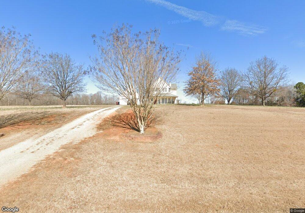
1536 Charlie Tapp Rd Roxboro, NC 27574
Estimated Value: $333,788 - $464,000
3
Beds
3
Baths
1,833
Sq Ft
$222/Sq Ft
Est. Value
About This Home
This home is located at 1536 Charlie Tapp Rd, Roxboro, NC 27574 and is currently estimated at $406,697, approximately $221 per square foot. 1536 Charlie Tapp Rd is a home located in Person County with nearby schools including Person High School.
Ownership History
Date
Name
Owned For
Owner Type
Purchase Details
Closed on
Nov 23, 2009
Sold by
Mooney Janice Vaughan and Mooney Ryan K
Bought by
Wall John Dustin
Current Estimated Value
Home Financials for this Owner
Home Financials are based on the most recent Mortgage that was taken out on this home.
Original Mortgage
$172,000
Outstanding Balance
$110,865
Interest Rate
4.75%
Mortgage Type
New Conventional
Estimated Equity
$295,832
Purchase Details
Closed on
Mar 17, 2008
Sold by
Landrum Ricky W and Landrum Rickey W
Bought by
Mooney Janice and Landrum Janice
Create a Home Valuation Report for This Property
The Home Valuation Report is an in-depth analysis detailing your home's value as well as a comparison with similar homes in the area
Home Values in the Area
Average Home Value in this Area
Purchase History
| Date | Buyer | Sale Price | Title Company |
|---|---|---|---|
| Wall John Dustin | $171,000 | -- | |
| Mooney Janice | -- | -- |
Source: Public Records
Mortgage History
| Date | Status | Borrower | Loan Amount |
|---|---|---|---|
| Open | Wall John Dustin | $172,000 |
Source: Public Records
Tax History Compared to Growth
Tax History
| Year | Tax Paid | Tax Assessment Tax Assessment Total Assessment is a certain percentage of the fair market value that is determined by local assessors to be the total taxable value of land and additions on the property. | Land | Improvement |
|---|---|---|---|---|
| 2025 | $2,042 | $301,227 | $0 | $0 |
| 2024 | $1,842 | $235,248 | $0 | $0 |
| 2023 | $1,927 | $246,293 | $0 | $0 |
| 2022 | $1,921 | $246,293 | $0 | $0 |
| 2021 | $1,865 | $246,293 | $0 | $0 |
| 2020 | $1,500 | $197,474 | $0 | $0 |
| 2019 | $1,520 | $197,474 | $0 | $0 |
| 2018 | $1,426 | $197,474 | $0 | $0 |
| 2017 | $1,406 | $197,474 | $0 | $0 |
| 2016 | $1,406 | $197,474 | $0 | $0 |
| 2015 | $1,406 | $197,474 | $0 | $0 |
| 2014 | $1,406 | $197,474 | $0 | $0 |
Source: Public Records
Map
Nearby Homes
- 3735 Cates Mill Rd
- 6318 Hurdle Mills Rd
- 1225 Flat River Church Rd
- 60 Forest Dr
- 00 Bessie Daniel Rd
- 369 Historic Village Dr
- 119 Chole Marie Ln
- 226 Fletcher Ridge Rd
- 427 Fletcher Ridge Rd
- 31 Harrow Terrace
- 2551 Old Durham Rd
- 42 S 2nd St
- 0 Somerset Dr
- 65 Crow Field St
- 1221 Antioch Church Rd
- 26 Crow Field St
- 77 Running Deer Path
- 12 Crow Field St
- 1225 Antioch Church Rd
- 55 Running Deer Path
- 1499 Charlie Tapp Rd
- 1575 Charlie Tapp Rd
- 2400 Cates Mill Rd
- 2400 Cates Mill Rd
- 1401 Charlie Tapp Rd
- 2310 Cates Mill Rd
- 2285 Cates Mill Rd
- 85 Charlie Tapp Rd
- 1416 Blackard Rd
- 2635 Cates Mill Rd
- 1324 Blackard Rd
- 2708 Cates Mill Rd
- 1387 Blackard Rd
- 79 acres Cates Mill Rd
- 1233 Blackard Rd
- 1029 Charlie Tapp Rd
- 0 Cates Mill Rd Unit 1904024
- 000 Cates Mill Rd
- 0 Cates Mill Rd Unit 1 TR1904024
- 1 Cates Mill Rd