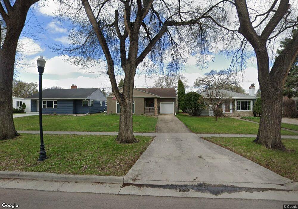
1537 10th St S Fargo, ND 58103
Clara Barton NeighborhoodEstimated Value: $261,000 - $306,000
2
Beds
1
Bath
2,092
Sq Ft
$133/Sq Ft
Est. Value
About This Home
This home is located at 1537 10th St S, Fargo, ND 58103 and is currently estimated at $278,606, approximately $133 per square foot. 1537 10th St S is a home located in Cass County with nearby schools including Clara Barton Elementary School, Carl Ben Eielson Middle School, and South High School.
Ownership History
Date
Name
Owned For
Owner Type
Purchase Details
Closed on
Aug 3, 2018
Sold by
Bostandzija Mevlida and Bostandzija Esad
Bought by
Bieber Timothy
Current Estimated Value
Home Financials for this Owner
Home Financials are based on the most recent Mortgage that was taken out on this home.
Original Mortgage
$183,715
Outstanding Balance
$159,549
Interest Rate
4.5%
Mortgage Type
VA
Estimated Equity
$119,057
Create a Home Valuation Report for This Property
The Home Valuation Report is an in-depth analysis detailing your home's value as well as a comparison with similar homes in the area
Home Values in the Area
Average Home Value in this Area
Purchase History
| Date | Buyer | Sale Price | Title Company |
|---|---|---|---|
| Bieber Timothy | $201,000 | Plains Title Llc |
Source: Public Records
Mortgage History
| Date | Status | Borrower | Loan Amount |
|---|---|---|---|
| Open | Bieber Timothy | $183,715 |
Source: Public Records
Tax History Compared to Growth
Tax History
| Year | Tax Paid | Tax Assessment Tax Assessment Total Assessment is a certain percentage of the fair market value that is determined by local assessors to be the total taxable value of land and additions on the property. | Land | Improvement |
|---|---|---|---|---|
| 2024 | $3,323 | $129,950 | $40,500 | $89,450 |
| 2023 | $3,351 | $113,000 | $40,500 | $72,500 |
| 2022 | $3,342 | $110,800 | $40,500 | $70,300 |
| 2021 | $2,983 | $99,400 | $34,250 | $65,150 |
| 2020 | $2,730 | $90,350 | $34,250 | $56,100 |
| 2019 | $2,477 | $81,400 | $21,550 | $59,850 |
| 2018 | $2,450 | $81,400 | $21,550 | $59,850 |
| 2017 | $2,366 | $79,050 | $21,550 | $57,500 |
| 2016 | $2,144 | $76,750 | $21,550 | $55,200 |
| 2015 | $2,001 | $66,300 | $13,300 | $53,000 |
| 2014 | $2,016 | $64,800 | $13,300 | $51,500 |
| 2013 | $2,106 | $64,800 | $13,300 | $51,500 |
Source: Public Records
Map
Nearby Homes
- 1439 10th St S
- 1550 13 1 2 St S
- 1425 11th St S
- 1361 16th Ave S
- 1710 14th St S
- 1550 14 1 2 St S
- 1301 10th St S
- 1314 14th St S
- 1545 15th St S
- 1718 15th St S
- 1208 University Dr S
- 1124 University Dr S
- 1112 University Dr S
- 1418 12th Ave S
- 1834 14 1 2 St S
- 1418 11th Ave S
- 1414 10th Ave S
- 910 University Dr S
- 1020 9th Ave S
- 1301 16 1 2 St S
- 1541 10th St S
- 1533 10th St S
- 1545 10th St S
- 1529 10th St S
- 1528 11th St S
- 1001 16th Ave S
- 1009 16th Ave S
- 1521 10th St S
- 1524 11th St S
- 1013 16th Ave S
- 1538 10th St S
- 1534 10th St S
- 1102 15 1/2 Ave S
- 1542 10th St S
- 1517 10th St S
- 1520 11th St S
- 1530 10th St S
- 1017 16th Ave S
- 909 16th Ave S
- 1601 10th St S