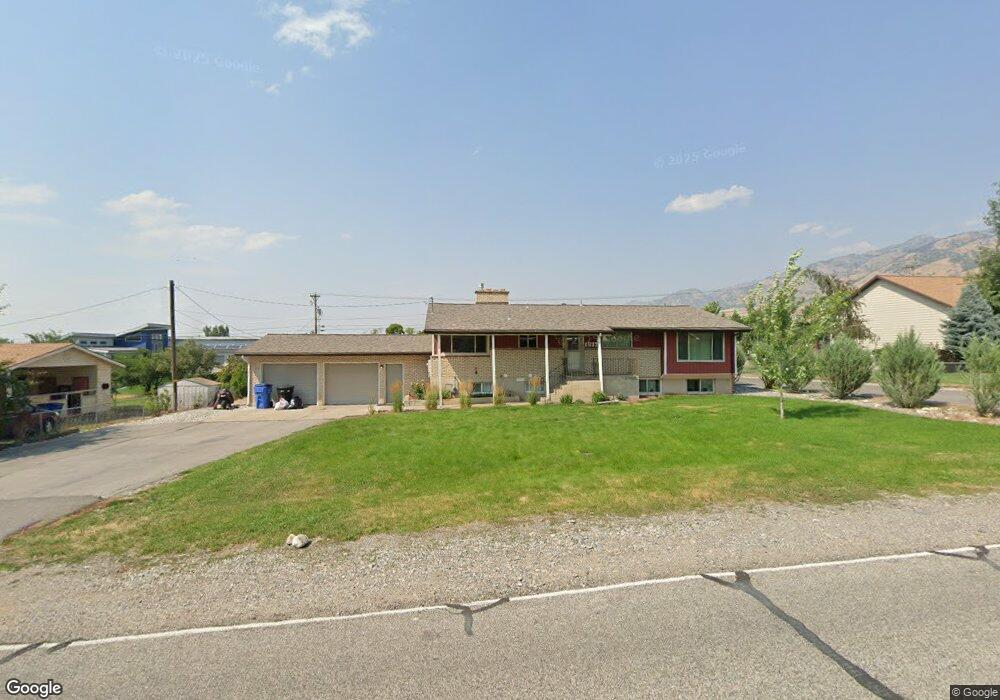
1537 E 2100 N North Logan, UT 84341
Estimated Value: $443,000 - $593,000
5
Beds
3
Baths
3,236
Sq Ft
$162/Sq Ft
Est. Value
About This Home
This home is located at 1537 E 2100 N, North Logan, UT 84341 and is currently estimated at $525,268, approximately $162 per square foot. 1537 E 2100 N is a home located in Cache County with nearby schools including Greenville School, Cedar Ridge School, and Cedar Ridge Middle School.
Ownership History
Date
Name
Owned For
Owner Type
Purchase Details
Closed on
Nov 1, 2023
Sold by
Larson Matthew and Larson Carolynn
Bought by
Pabst Anthony Christopher and Pabst Carrie Fawn
Current Estimated Value
Home Financials for this Owner
Home Financials are based on the most recent Mortgage that was taken out on this home.
Original Mortgage
$500,762
Outstanding Balance
$490,591
Interest Rate
7.19%
Mortgage Type
FHA
Estimated Equity
$34,677
Purchase Details
Closed on
Nov 21, 2013
Sold by
The Secretary Of Housing & Urban Develop
Bought by
Larson Matthew and Larson Carolynn
Home Financials for this Owner
Home Financials are based on the most recent Mortgage that was taken out on this home.
Original Mortgage
$157,120
Interest Rate
3.25%
Mortgage Type
Construction
Purchase Details
Closed on
Nov 2, 2012
Sold by
Everbank
Bought by
The Secretary Of Housing & Urban Develop
Purchase Details
Closed on
May 31, 2012
Sold by
Tingey Robert W and Mortgage Electronic Registrati
Bought by
Everbank
Create a Home Valuation Report for This Property
The Home Valuation Report is an in-depth analysis detailing your home's value as well as a comparison with similar homes in the area
Home Values in the Area
Average Home Value in this Area
Purchase History
| Date | Buyer | Sale Price | Title Company |
|---|---|---|---|
| Pabst Anthony Christopher | -- | Cache Title | |
| Larson Matthew | -- | Hickman Land Title Company | |
| The Secretary Of Housing & Urban Develop | -- | Security Title Ins Agency | |
| Everbank | $128,415 | Accommodation |
Source: Public Records
Mortgage History
| Date | Status | Borrower | Loan Amount |
|---|---|---|---|
| Open | Pabst Anthony Christopher | $500,762 | |
| Previous Owner | Larson Matthew | $157,120 |
Source: Public Records
Tax History Compared to Growth
Tax History
| Year | Tax Paid | Tax Assessment Tax Assessment Total Assessment is a certain percentage of the fair market value that is determined by local assessors to be the total taxable value of land and additions on the property. | Land | Improvement |
|---|---|---|---|---|
| 2025 | $2,009 | $281,175 | $0 | $0 |
| 2024 | $160 | $208,115 | $0 | $0 |
| 2023 | $1,713 | $208,855 | $0 | $0 |
| 2022 | $1,930 | $224,820 | $0 | $0 |
| 2021 | $1,805 | $325,860 | $89,000 | $236,860 |
| 2020 | $1,602 | $271,200 | $89,000 | $182,200 |
| 2019 | $1,677 | $271,200 | $89,000 | $182,200 |
| 2018 | $987 | $154,680 | $55,000 | $99,680 |
| 2017 | $960 | $79,200 | $0 | $0 |
| 2016 | $975 | $79,200 | $0 | $0 |
| 2015 | $978 | $79,200 | $0 | $0 |
| 2014 | $1,415 | $117,325 | $0 | $0 |
| 2013 | -- | $115,280 | $0 | $0 |
Source: Public Records
Map
Nearby Homes
- 2025 N 1550 E
- 945 N 1600 E
- 1491 E 2300 N
- 1495 E 2300 N
- 1901 N 1380 E
- 1335 E 2300 N
- 1872 N 1850 E
- 1593 N 110 W Unit 201
- 611 E 2450 N Unit 1
- 1593 N 110 W Unit 202
- 1593 N 110 W Unit 204
- 1593 N 110 W Unit 203
- 1200 W 1400 N
- 2950 N Mahogony Valley Rd E Unit 7
- 1598 N Sharptail Cir
- 1000 W 2500 N
- 3073 N 1200 E Unit 3
- 1963 N 1000 E
- 1901 Southpointe Ct
- 2143 N 950 E