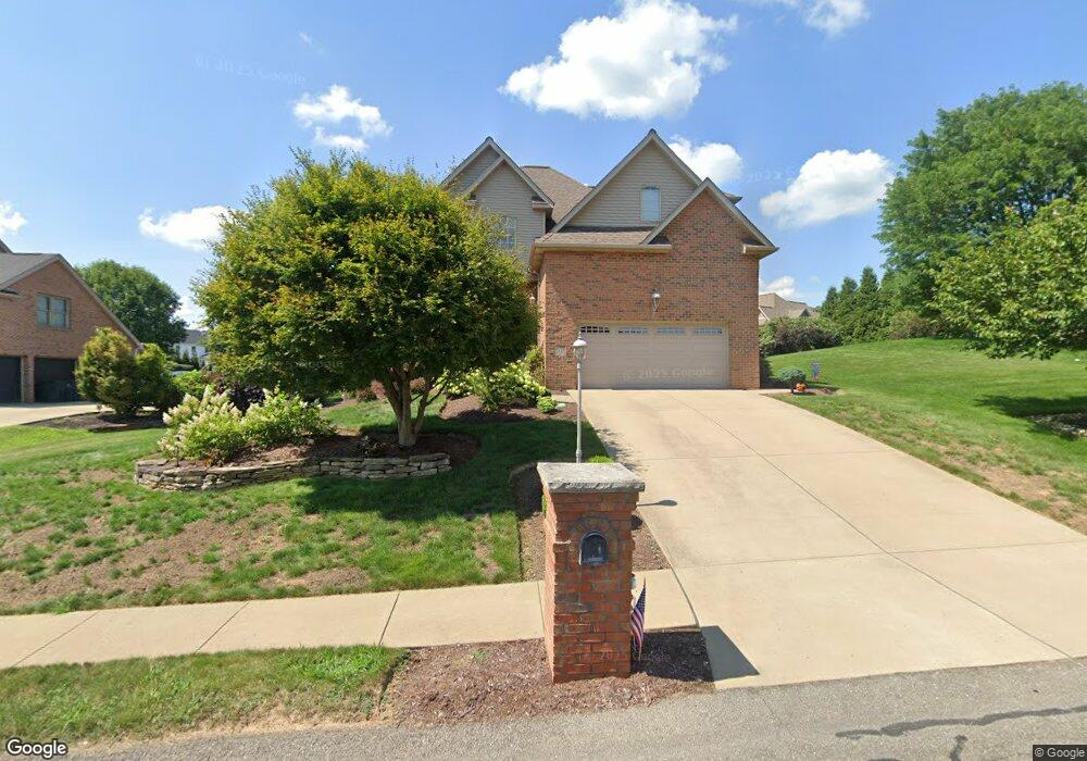
1537 Network Dr Canonsburg, PA 15317
Estimated Value: $737,717 - $856,000
4
Beds
4
Baths
3,470
Sq Ft
$227/Sq Ft
Est. Value
About This Home
This home is located at 1537 Network Dr, Canonsburg, PA 15317 and is currently estimated at $787,679, approximately $226 per square foot. 1537 Network Dr is a home located in Washington County with nearby schools including Canon-Mcmillan Senior High School.
Ownership History
Date
Name
Owned For
Owner Type
Purchase Details
Closed on
Sep 21, 2007
Sold by
Bucci James A
Bought by
Mazzoni Marcel
Current Estimated Value
Home Financials for this Owner
Home Financials are based on the most recent Mortgage that was taken out on this home.
Original Mortgage
$200,000
Outstanding Balance
$127,015
Interest Rate
6.63%
Mortgage Type
New Conventional
Estimated Equity
$660,664
Purchase Details
Closed on
Oct 11, 2002
Sold by
Highland Enter Inc
Bought by
Bucci James A
Home Financials for this Owner
Home Financials are based on the most recent Mortgage that was taken out on this home.
Original Mortgage
$300,700
Interest Rate
6.18%
Create a Home Valuation Report for This Property
The Home Valuation Report is an in-depth analysis detailing your home's value as well as a comparison with similar homes in the area
Home Values in the Area
Average Home Value in this Area
Purchase History
| Date | Buyer | Sale Price | Title Company |
|---|---|---|---|
| Mazzoni Marcel | $424,500 | -- | |
| Bucci James A | $425,000 | -- |
Source: Public Records
Mortgage History
| Date | Status | Borrower | Loan Amount |
|---|---|---|---|
| Open | Mazzoni Marcel | $200,000 | |
| Previous Owner | Bucci James A | $300,700 |
Source: Public Records
Tax History Compared to Growth
Tax History
| Year | Tax Paid | Tax Assessment Tax Assessment Total Assessment is a certain percentage of the fair market value that is determined by local assessors to be the total taxable value of land and additions on the property. | Land | Improvement |
|---|---|---|---|---|
| 2025 | $8,406 | $499,200 | $93,100 | $406,100 |
| 2024 | $7,952 | $499,200 | $93,100 | $406,100 |
| 2023 | $7,952 | $499,200 | $93,100 | $406,100 |
| 2022 | $7,929 | $499,200 | $93,100 | $406,100 |
| 2021 | $7,929 | $499,200 | $93,100 | $406,100 |
| 2020 | $7,778 | $499,200 | $93,100 | $406,100 |
| 2019 | $7,653 | $499,200 | $93,100 | $406,100 |
| 2018 | $7,498 | $499,200 | $93,100 | $406,100 |
| 2017 | $1,154 | $499,200 | $93,100 | $406,100 |
| 2016 | $1,154 | $46,329 | $6,949 | $39,380 |
| 2015 | $741 | $46,329 | $6,949 | $39,380 |
| 2014 | $1,154 | $46,329 | $6,949 | $39,380 |
| 2013 | $1,154 | $46,329 | $6,949 | $39,380 |
Source: Public Records
Map
Nearby Homes
- 1582 Network Dr
- 1041 Skyline Dr
- 1037 Skyline Dr
- 1033 Skyline Dr
- 1065 Skyline Dr
- 1272 Mcewen Rd
- 29 Virginia Ln
- 1163 Mcewen Ave
- 1382 Lucia Dr
- 214 Hooks Ln
- 3016 Brookstone Dr
- 510 Panorama Dr
- 9 Puskar Ln
- 4084 Overview Dr
- 1521 Eagle Pointe Dr
- 209 Joseph Dr
- 3029 Brookstone Dr
- 520 Panorama Dr
- 107 Fairway Landings Dr
- 1021 Coldstream Dr
- 1533 Network Dr
- 1013 Oak Ridge Rd
- 1541 Network Dr
- 1529 Network Dr
- 1538 Network Dr
- 2077 Breezewood Dr
- 1017 Oak Ridge Rd
- 1542 Network Dr
- 1542 Network Dr
- 1525 Network Dr
- 1546 Network Dr
- 1021 Oak Ridge Rd
- 1521 Network Dr
- 1016 Buck Run Rd
- 1012 Oak Ridge Rd
- 1012 Buck Run Rd
- 1008 Oak Ridge Rd
- 1000 Oak Ridge Rd
- 2069 Breezewood Dr
- 1004 Oak Ridge Rd