Estimated Value: $302,416 - $362,000
3
Beds
3
Baths
1,760
Sq Ft
$188/Sq Ft
Est. Value
About This Home
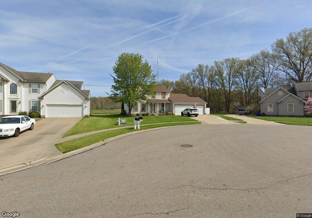
This home is located at 1537 Parsons Dr, Kent, OH 44240 and is currently estimated at $330,104, approximately $187 per square foot. 1537 Parsons Dr is a home located in Portage County with nearby schools including Brimfield Elementary School, Field Middle School, and Field High School.
Ownership History
Date
Name
Owned For
Owner Type
Purchase Details
Closed on
Jan 2, 2004
Sold by
Wagler Homes Of Akron Inc
Bought by
Lopane Anthony and Lopane Michelle
Current Estimated Value
Home Financials for this Owner
Home Financials are based on the most recent Mortgage that was taken out on this home.
Original Mortgage
$185,250
Outstanding Balance
$87,154
Interest Rate
5.88%
Mortgage Type
Purchase Money Mortgage
Estimated Equity
$242,950
Create a Home Valuation Report for This Property
The Home Valuation Report is an in-depth analysis detailing your home's value as well as a comparison with similar homes in the area
Home Values in the Area
Average Home Value in this Area
Purchase History
| Date | Buyer | Sale Price | Title Company |
|---|---|---|---|
| Lopane Anthony | $48,750 | -- |
Source: Public Records
Mortgage History
| Date | Status | Borrower | Loan Amount |
|---|---|---|---|
| Open | Lopane Anthony | $185,250 |
Source: Public Records
Tax History
| Year | Tax Paid | Tax Assessment Tax Assessment Total Assessment is a certain percentage of the fair market value that is determined by local assessors to be the total taxable value of land and additions on the property. | Land | Improvement |
|---|---|---|---|---|
| 2025 | $4,589 | $95,100 | $10,890 | $84,210 |
| 2024 | $4,513 | $95,100 | $10,890 | $84,210 |
| 2023 | $4,224 | $71,620 | $10,890 | $60,730 |
| 2022 | $4,236 | $71,620 | $10,890 | $60,730 |
| 2021 | $4,269 | $71,620 | $10,890 | $60,730 |
| 2020 | $4,164 | $65,110 | $10,890 | $54,220 |
| 2019 | $4,105 | $65,110 | $10,890 | $54,220 |
| 2018 | $3,321 | $58,000 | $10,890 | $47,110 |
| 2017 | $3,321 | $58,000 | $10,890 | $47,110 |
| 2016 | $3,089 | $58,000 | $10,890 | $47,110 |
| 2015 | $3,181 | $58,000 | $10,890 | $47,110 |
| 2014 | $3,018 | $58,000 | $10,890 | $47,110 |
| 2013 | $2,975 | $58,000 | $10,890 | $47,110 |
Source: Public Records
Map
Nearby Homes
- 4360 Beal Dr
- 4545 State Route 43
- 4088 Lynwood Dr
- 3834 Morley Dr
- 3910 Willow Way
- 3666 Duffield Rd
- 1680 Countryview Dr
- 3890 Grace Dr
- 3532 Gary Dr
- 3800 Grace Dr
- 5088 Spruce Knoll Run
- 3415 Hanover Dr
- 2092 Sugar Maple Dr
- 4647 Creekside Dr Unit 4647
- 4620 Briar Hill Dr
- 4700 Gooseberry Knoll
- 4184 Hunters Ridge Dr
- 0 Meloy Rd Unit 5162435
- 1997 Sugar Maple Dr
- 1233 Cedar Ridge Rd
- 1531 Parsons Dr
- 4258 Chapman Dr
- 4252 Chapman Dr
- 1523 Parsons Dr
- 4244 Chapman Dr
- 4245 Chapman Dr
- 1515 Parsons Dr
- 4237 Chapman Dr
- 1518 Parsons Dr
- 1507 Parsons Dr
- 4230 Chapman Dr
- 1510 Parsons Dr
- 4229 Chapman Dr
- 1499 Parsons Dr
- 4222 Chapman Dr
- 1502 Parsons Dr
- 1502 Parson Dr
- 4219 Chapman Dr
- 4214 Chapman Dr
- 4238 Chapman Dr
Your Personal Tour Guide
Ask me questions while you tour the home.