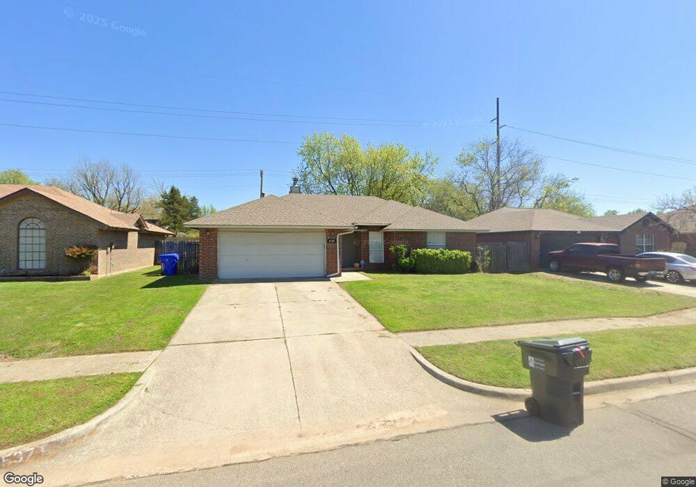
1537 Tree Line Dr Norman, OK 73071
Southeast Norman NeighborhoodEstimated Value: $182,496 - $222,000
3
Beds
2
Baths
1,370
Sq Ft
$145/Sq Ft
Est. Value
About This Home
This home is located at 1537 Tree Line Dr, Norman, OK 73071 and is currently estimated at $199,124, approximately $145 per square foot. 1537 Tree Line Dr is a home located in Cleveland County with nearby schools including Kennedy Elementary School, Irving Middle School, and Norman High School.
Ownership History
Date
Name
Owned For
Owner Type
Purchase Details
Closed on
Oct 17, 2008
Sold by
Waskom Emmit F and Adler Andrea Diane
Bought by
Ok Yon Lundby Revocable Living Trust
Current Estimated Value
Purchase Details
Closed on
Mar 21, 2006
Sold by
Jeremy Mark and Leahy Mark J
Bought by
Waskom Emmit F and Waskom Andrea D
Home Financials for this Owner
Home Financials are based on the most recent Mortgage that was taken out on this home.
Original Mortgage
$84,249
Interest Rate
6.21%
Mortgage Type
New Conventional
Create a Home Valuation Report for This Property
The Home Valuation Report is an in-depth analysis detailing your home's value as well as a comparison with similar homes in the area
Home Values in the Area
Average Home Value in this Area
Purchase History
| Date | Buyer | Sale Price | Title Company |
|---|---|---|---|
| Ok Yon Lundby Revocable Living Trust | $100,000 | Agt | |
| Waskom Emmit F | $109,500 | None Available |
Source: Public Records
Mortgage History
| Date | Status | Borrower | Loan Amount |
|---|---|---|---|
| Previous Owner | Waskom Emmit F | $84,249 |
Source: Public Records
Tax History
| Year | Tax Paid | Tax Assessment Tax Assessment Total Assessment is a certain percentage of the fair market value that is determined by local assessors to be the total taxable value of land and additions on the property. | Land | Improvement |
|---|---|---|---|---|
| 2025 | $1,992 | $16,608 | $2,893 | $13,715 |
| 2023 | $1,809 | $15,064 | $2,731 | $12,333 |
| 2022 | $1,652 | $14,347 | $2,400 | $11,947 |
| 2021 | $1,742 | $14,347 | $2,400 | $11,947 |
| 2020 | $1,705 | $14,347 | $2,400 | $11,947 |
| 2019 | $1,733 | $14,347 | $2,400 | $11,947 |
| 2018 | $1,681 | $14,347 | $2,400 | $11,947 |
| 2017 | $1,700 | $14,347 | $0 | $0 |
| 2016 | $1,728 | $14,347 | $2,400 | $11,947 |
| 2015 | -- | $13,791 | $1,369 | $12,422 |
| 2014 | -- | $13,791 | $1,369 | $12,422 |
Source: Public Records
Map
Nearby Homes
- 1708 Creekside Ct
- 1301 Whippoorwill Dr
- 1924 Burnt Oak St
- 1515 Oakhurst Ave
- 1817 E Lindsey St Unit 1
- 1711 E Lindsey St Unit 3
- 1723 E Lindsey St Unit 2
- 1723 E Lindsey St Unit 4
- 1715 E Lindsey St Unit 2
- 1827 E Lindsey St Unit 3
- 2125 Allenhurst St
- 3810 Muir Forest Way
- 1701 Sumac Dr
- 1 E Lindsey St
- 2007 Oakhurst Ave
- 1600 Hazelwood Dr
- 1320 12th Ave SE Unit 2205
- 1330 12th Ave SE Unit 2306
- 1230 12th Ave SE Unit 1308
- 1220 12th Ave SE Unit 1205
- 1533 Tree Line Dr
- 1541 Tree Line Dr
- 1545 Tree Line Dr
- 1430 Whippoorwill Dr
- 1529 Tree Line Dr
- 1426 Whippoorwill Dr
- 1721 Windchime Dr
- 1532 Tree Line Dr
- 1528 Tree Line Dr
- 1728 Windchime Dr
- 1420 Whippoorwill Dr
- 1524 Tree Line Dr
- 1724 Windchime Dr
- 1800 Elmhurst Dr
- 1717 Windchime Dr
- 1801 Burnt Oak St
- 1521 Tree Line Dr
- 1502 Oakcliff Rd
- 1414 Whippoorwill Dr
- 1709 Creekside Ct
Your Personal Tour Guide
Ask me questions while you tour the home.