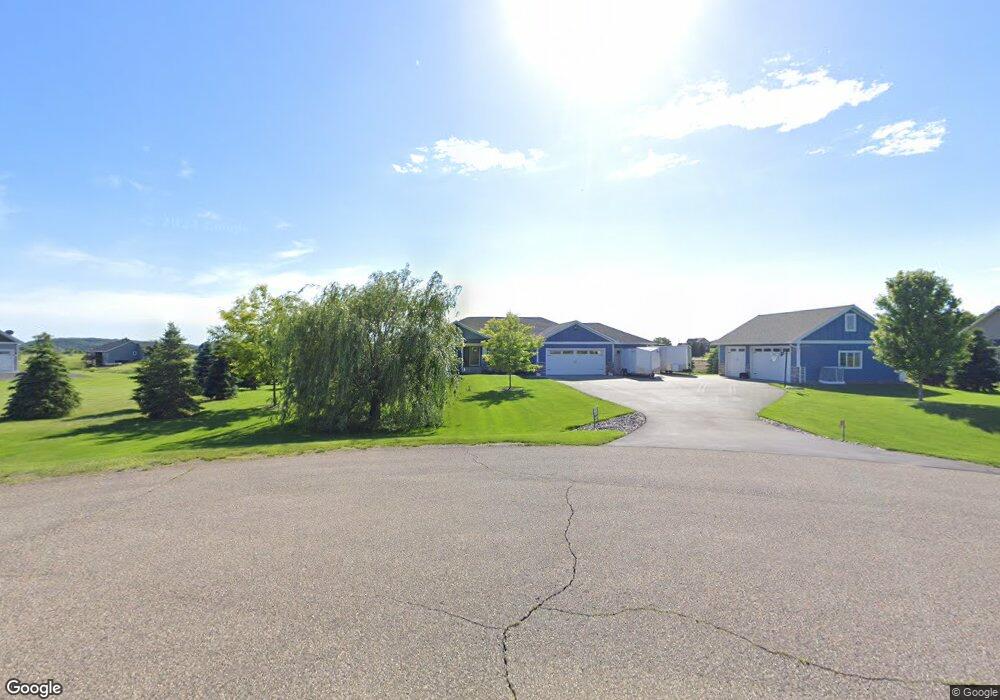
1538 97th St New Richmond, WI 54017
Richmond NeighborhoodEstimated Value: $560,095 - $675,000
--
Bed
--
Bath
--
Sq Ft
1.55
Acres
About This Home
This home is located at 1538 97th St, New Richmond, WI 54017 and is currently estimated at $601,274. 1538 97th St is a home located in St. Croix County with nearby schools including New Richmond High School.
Ownership History
Date
Name
Owned For
Owner Type
Purchase Details
Closed on
Oct 20, 2017
Sold by
Willow River Of St Croix Llc
Bought by
Rivard Jessy and Rivard Alicia
Current Estimated Value
Purchase Details
Closed on
Jun 23, 2015
Sold by
One Corporation
Bought by
Willow River Of St Croix Llc
Purchase Details
Closed on
Dec 21, 2011
Sold by
First National Community Bank
Bought by
One Corporation
Purchase Details
Closed on
Jul 23, 2009
Sold by
Sienna Corporation
Bought by
First National Community Bank and First National Bank Of New Richmond
Create a Home Valuation Report for This Property
The Home Valuation Report is an in-depth analysis detailing your home's value as well as a comparison with similar homes in the area
Home Values in the Area
Average Home Value in this Area
Purchase History
| Date | Buyer | Sale Price | Title Company |
|---|---|---|---|
| Rivard Jessy | $47,900 | -- | |
| Willow River Of St Croix Llc | $1,435,000 | St Croix County Abstract & T | |
| One Corporation | $1,156,800 | None Available | |
| First National Community Bank | $1,675,000 | None Available |
Source: Public Records
Tax History Compared to Growth
Tax History
| Year | Tax Paid | Tax Assessment Tax Assessment Total Assessment is a certain percentage of the fair market value that is determined by local assessors to be the total taxable value of land and additions on the property. | Land | Improvement |
|---|---|---|---|---|
| 2024 | $58 | $461,000 | $54,000 | $407,000 |
| 2023 | $5,363 | $461,000 | $54,000 | $407,000 |
| 2022 | $4,879 | $461,000 | $54,000 | $407,000 |
| 2021 | $4,106 | $461,000 | $54,000 | $407,000 |
| 2020 | $4,509 | $251,200 | $17,600 | $233,600 |
| 2019 | $1,010 | $249,600 | $17,600 | $232,000 |
| 2018 | $300 | $60,900 | $17,600 | $43,300 |
| 2017 | $294 | $17,600 | $17,600 | $0 |
| 2016 | $294 | $17,600 | $17,600 | $0 |
| 2015 | $305 | $17,600 | $17,600 | $0 |
| 2014 | $295 | $17,600 | $17,600 | $0 |
| 2013 | -- | $17,600 | $17,600 | $0 |
Source: Public Records
Map
Nearby Homes
- 943 146th Ave
- 1655 85th St
- 1653 85th St
- 875 167th Ave
- 1705 107th St
- 883 174th Ave
- 906 131st Ave
- 1561 Creekwood Dr
- 726 160th Ave
- 1549 Creekwood Dr
- 1539 Creekwood Dr
- TBD Cattail Ln Unit Lot 9
- 1824 White Pine Way
- 1565 Ponderosa Ln
- 1418 Bluff Border Rd
- 1149 Sugar Pine Ln
- 1137 Sugar Pine Ln
- 1047 & 1061 Sugar Pine Ln Unit 1047 & 1061
- 1778 Sequoia Ln
- 1513 Creekwood Dr
- 1538 97th St
- 1536 97th (Lot 49) St
- 1536 97th St
- 1540 97th St
- 1513 96th St
- 1529 96th (Lot 45) St
- 1529 96th St
- 1540 97th (Lot 47) St
- 1539 97th St
- 1539 97th St
- 965 154th Ave
- 965 154th Ave
- 1527 96th (Lot 44) St
- 1535 97th St
- 1535 97th-Street-
- 1523 96th (Lot 43) St
- 1523 96th St
- 1544 97th St
- 1544 97th St
- 981 154th (Lot 52) Ave