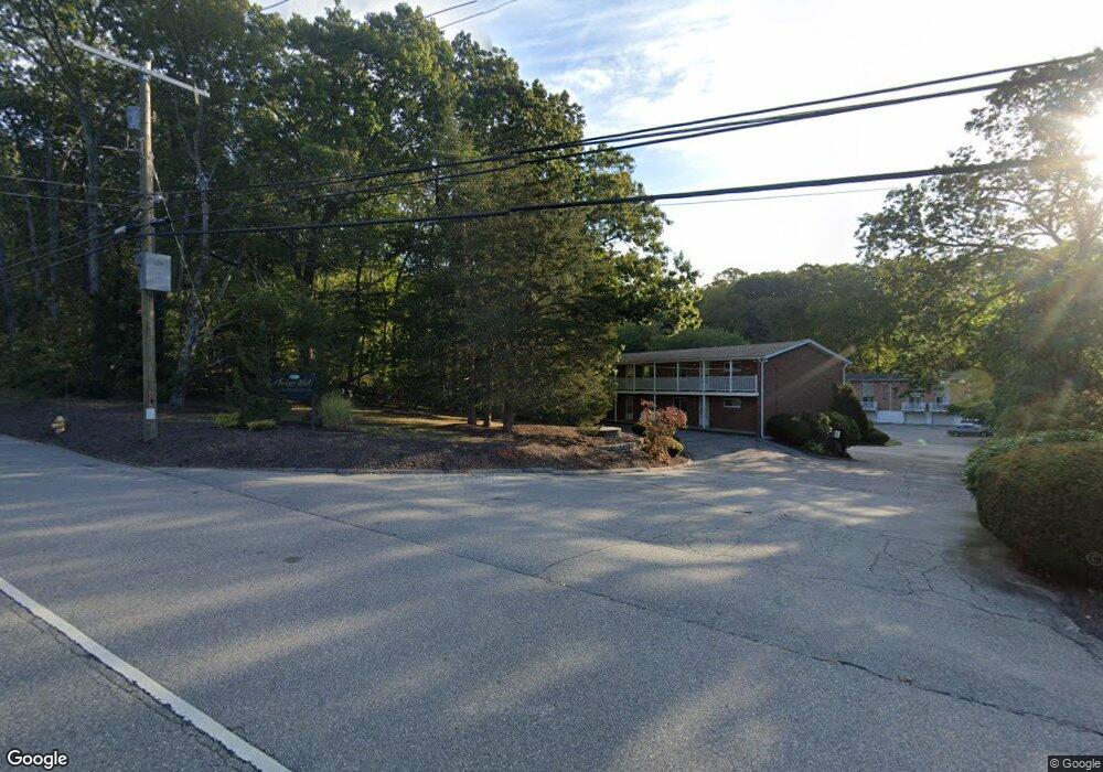
1538 Route 12 Unit C23 Gales Ferry, CT 06335
Estimated Value: $162,354 - $213,000
2
Beds
1
Bath
860
Sq Ft
$220/Sq Ft
Est. Value
About This Home
This home is located at 1538 Route 12 Unit C23, Gales Ferry, CT 06335 and is currently estimated at $189,089, approximately $219 per square foot. 1538 Route 12 Unit C23 is a home located in New London County with nearby schools including Ledyard Middle School, Ledyard High School, and Academy Of St Therese.
Ownership History
Date
Name
Owned For
Owner Type
Purchase Details
Closed on
Sep 12, 2019
Sold by
Delrusso Richard L
Bought by
Grasso David E
Current Estimated Value
Home Financials for this Owner
Home Financials are based on the most recent Mortgage that was taken out on this home.
Original Mortgage
$62,400
Outstanding Balance
$47,684
Interest Rate
3.6%
Mortgage Type
New Conventional
Estimated Equity
$141,405
Purchase Details
Closed on
Jul 28, 2005
Sold by
Swan Heidi Jo
Bought by
Delrusso Richard
Home Financials for this Owner
Home Financials are based on the most recent Mortgage that was taken out on this home.
Original Mortgage
$91,900
Interest Rate
5.67%
Mortgage Type
Purchase Money Mortgage
Purchase Details
Closed on
Apr 30, 2002
Sold by
Ellis David J
Bought by
Denoia Joseph R and Denoia Linda
Home Financials for this Owner
Home Financials are based on the most recent Mortgage that was taken out on this home.
Original Mortgage
$37,500
Interest Rate
7.05%
Mortgage Type
Purchase Money Mortgage
Create a Home Valuation Report for This Property
The Home Valuation Report is an in-depth analysis detailing your home's value as well as a comparison with similar homes in the area
Home Values in the Area
Average Home Value in this Area
Purchase History
| Date | Buyer | Sale Price | Title Company |
|---|---|---|---|
| Grasso David E | -- | -- | |
| Delrusso Richard | $115,000 | -- | |
| Denoia Joseph R | $50,000 | -- |
Source: Public Records
Mortgage History
| Date | Status | Borrower | Loan Amount |
|---|---|---|---|
| Open | Grasso David E | $62,400 | |
| Previous Owner | Denoia Joseph R | $91,900 | |
| Previous Owner | Denoia Joseph R | $37,500 |
Source: Public Records
Tax History Compared to Growth
Tax History
| Year | Tax Paid | Tax Assessment Tax Assessment Total Assessment is a certain percentage of the fair market value that is determined by local assessors to be the total taxable value of land and additions on the property. | Land | Improvement |
|---|---|---|---|---|
| 2025 | $1,412 | $38,010 | $0 | $38,010 |
| 2024 | $1,338 | $38,010 | $0 | $38,010 |
| 2023 | $1,314 | $38,010 | $0 | $38,010 |
| 2022 | $1,285 | $38,010 | $0 | $38,010 |
| 2021 | $1,277 | $38,010 | $0 | $38,010 |
| 2020 | $1,689 | $48,300 | $0 | $48,300 |
| 2019 | $1,693 | $48,300 | $0 | $48,300 |
| 2018 | $1,656 | $48,300 | $0 | $48,300 |
| 2017 | $1,572 | $48,300 | $0 | $48,300 |
| 2016 | $1,541 | $48,300 | $0 | $48,300 |
| 2015 | $1,468 | $48,300 | $0 | $48,300 |
| 2014 | $1,921 | $64,260 | $0 | $64,260 |
Source: Public Records
Map
Nearby Homes
- 1513 Connecticut 12
- 17 Inchcliffe Dr
- 932 Long Cove Rd Unit TRLR 4
- 1010 Long Cove Rd
- 31 Richard Rd
- 5 Ledgewood Dr
- 14 Woodland Ln
- 7 Harvard Rd
- 47 Norman Dr
- 16 Marty's Way
- 95 Murphys Dr Unit 95
- 9 West Dr
- 64 Scotch Cap Rd Unit 102
- 11 Marty's Way
- 25 Marty's Way
- 18 Marty's Way
- 2 Garden Ct
- 205 Old Norwich Rd
- 176 Old Norwich Rd
- 39 Richards Grove Rd
- 1538 Route 12 Unit C26
- 1538 Route 12 Unit C20
- 1538 Route 12 Unit A2
- 1538 Route 12 Unit B12
- 1538 Route 12 Unit B14
- 1538 Route 12 Unit B17
- 1538 Route 12 Unit B16
- 1538 Route 12 Unit B10
- 1538 Route 12 Unit C24
- 1538 Route 12 Unit C30
- 1538 Route 12 Unit C29
- 1538 Route 12 Unit A3
- 1538 Route 12 Unit B9
- 1538 Route 12 Unit A8
- 1538 Route 12 Unit B18
- 1538 Route 12 Unit C28
- 1538 Route 12 Unit C21
- 1538 Route 12 Unit C25
- 1538 Route 12 Unit C27
- 1538 Route 12 Unit C19