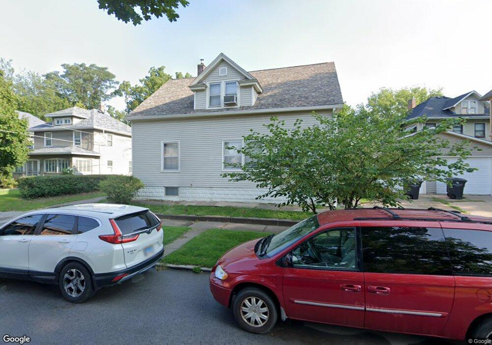
1539 10th Ave Rock Island, IL 61201
Broadway NeighborhoodEstimated Value: $63,489 - $113,000
--
Bed
--
Bath
1,380
Sq Ft
$65/Sq Ft
Est. Value
About This Home
This home is located at 1539 10th Ave, Rock Island, IL 61201 and is currently estimated at $89,622, approximately $64 per square foot. 1539 10th Ave is a home located in Rock Island County with nearby schools including Rock Island Academy, Washington Junior High School, and Rock Island High School.
Create a Home Valuation Report for This Property
The Home Valuation Report is an in-depth analysis detailing your home's value as well as a comparison with similar homes in the area
Home Values in the Area
Average Home Value in this Area
Tax History Compared to Growth
Tax History
| Year | Tax Paid | Tax Assessment Tax Assessment Total Assessment is a certain percentage of the fair market value that is determined by local assessors to be the total taxable value of land and additions on the property. | Land | Improvement |
|---|---|---|---|---|
| 2024 | -- | $20,520 | $657 | $19,863 |
| 2023 | -- | $19,580 | $627 | $18,953 |
| 2022 | $0 | $18,160 | $589 | $17,571 |
| 2021 | $0 | $17,428 | $565 | $16,863 |
| 2020 | $0 | $0 | $0 | $0 |
| 2019 | $0 | $17,003 | $551 | $16,452 |
| 2018 | $0 | $16,669 | $540 | $16,129 |
| 2017 | $0 | $16,423 | $532 | $15,891 |
| 2016 | $0 | $16,101 | $522 | $15,579 |
| 2015 | $0 | $15,262 | $495 | $14,767 |
| 2014 | -- | $12,048 | $497 | $11,551 |
| 2013 | -- | $12,048 | $497 | $11,551 |
Source: Public Records
Map
Nearby Homes
- 1018 17th St Unit 1
- 1008 16th St
- 903 17th St
- 1043 19th St
- 1900 13th Ave
- 1215-1215 1/2 20th St
- 1045 12th St Unit 1047
- 718 17th St
- 1037 22nd St
- 728 21st St
- 1234 12th St
- 1215 Glenhurst Ct
- 1030 23rd St
- 1212 Glenhurst Ct
- 1031 10th Ave
- 1635 20th St
- 1621 14 1 2 St
- 1625 14 1 2 St
- 1620 18th Ave Unit 26
- 1628 18th Ave Unit 10