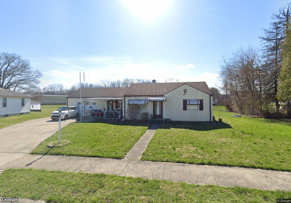
1539 Memorial Dr Springfield, OH 45505
Estimated Value: $122,000 - $163,000
2
Beds
1
Bath
1,156
Sq Ft
$123/Sq Ft
Est. Value
About This Home
This home is located at 1539 Memorial Dr, Springfield, OH 45505 and is currently estimated at $142,247, approximately $123 per square foot. 1539 Memorial Dr is a home located in Clark County with nearby schools including Kenwood Elementary School, Hayward Middle School, and Springfield High School.
Ownership History
Date
Name
Owned For
Owner Type
Purchase Details
Closed on
Oct 15, 2013
Sold by
Crable Roy L and Crable Judy
Bought by
Crable Rodger L and Crable Elsie
Current Estimated Value
Home Financials for this Owner
Home Financials are based on the most recent Mortgage that was taken out on this home.
Original Mortgage
$45,431
Outstanding Balance
$33,830
Interest Rate
4.5%
Mortgage Type
FHA
Estimated Equity
$108,417
Purchase Details
Closed on
Dec 13, 2011
Sold by
Crable Judy
Bought by
Crable Roy L
Home Financials for this Owner
Home Financials are based on the most recent Mortgage that was taken out on this home.
Original Mortgage
$32,000
Interest Rate
4.02%
Mortgage Type
Future Advance Clause Open End Mortgage
Purchase Details
Closed on
Jan 6, 1989
Create a Home Valuation Report for This Property
The Home Valuation Report is an in-depth analysis detailing your home's value as well as a comparison with similar homes in the area
Home Values in the Area
Average Home Value in this Area
Purchase History
| Date | Buyer | Sale Price | Title Company |
|---|---|---|---|
| Crable Rodger L | $47,000 | Acs Title & Closing Services | |
| Crable Roy L | $40,000 | Attorney | |
| -- | $40,000 | -- |
Source: Public Records
Mortgage History
| Date | Status | Borrower | Loan Amount |
|---|---|---|---|
| Open | Crable Rodger L | $45,431 | |
| Previous Owner | Crable Roy L | $32,000 |
Source: Public Records
Tax History
| Year | Tax Paid | Tax Assessment Tax Assessment Total Assessment is a certain percentage of the fair market value that is determined by local assessors to be the total taxable value of land and additions on the property. | Land | Improvement |
|---|---|---|---|---|
| 2025 | $1,646 | $45,210 | $6,850 | $38,360 |
| 2024 | $1,604 | $32,480 | $5,970 | $26,510 |
| 2023 | $1,604 | $32,480 | $5,970 | $26,510 |
| 2022 | $1,644 | $32,480 | $5,970 | $26,510 |
| 2021 | $1,443 | $26,250 | $3,670 | $22,580 |
| 2020 | $1,446 | $26,250 | $3,670 | $22,580 |
| 2019 | $1,449 | $26,250 | $3,670 | $22,580 |
| 2018 | $1,143 | $19,880 | $3,090 | $16,790 |
| 2017 | $1,143 | $21,673 | $3,091 | $18,582 |
| 2016 | $1,144 | $21,673 | $3,091 | $18,582 |
| 2015 | $1,180 | $21,673 | $3,091 | $18,582 |
| 2014 | $1,175 | $21,673 | $3,091 | $18,582 |
| 2013 | $1,162 | $21,673 | $3,091 | $18,582 |
Source: Public Records
Map
Nearby Homes
- 1621 Victory Dr
- 1716 N Sweetbriar Ln
- 1806 N Sweetbriar Ln
- 1440 Selma Rd
- 2040 N Hadley Rd
- 1823 Rutland Ave
- 2390 Old Selma Rd
- 2218 Tanager Rd
- 1846 Ohio Ave
- 1247 Selma Rd
- 1225 Beacon St
- 2108 Sunset Ave
- 1213 Gable St
- 1111 Lafayette Ave
- 1820 Clay St
- 1823 Clay St
- 1724 Clay St
- 1519 Tibbetts Ave
- 908 Pine St
- 1714 Kenton St
- 1545 Memorial Dr
- 1531 Memorial Dr
- 1930 Selma Rd
- 1942 Selma Rd
- 1548 Memorial Dr
- 1553 Memorial Dr
- 1916 Selma Rd
- 1525 Victory Dr
- 0 Selma Rd Unit 538552
- 0 Selma Rd Unit 375764
- 1517 Victory Dr
- 1545 Victory Dr
- 1563 Memorial Dr
- 1562 Memorial Dr
- 1906 Selma Rd
- 1555 Victory Dr
- 1573 Memorial Dr
- 1565 Victory Dr
- 1530 Victory Dr
- 1520 Victory Dr
Your Personal Tour Guide
Ask me questions while you tour the home.