Estimated Value: $71,083 - $213,000
--
Bed
--
Bath
--
Sq Ft
32
Acres
About This Home
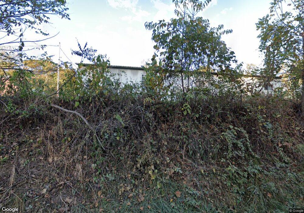
This home is located at 1539 Mount Unger Rd, Otway, OH 45657 and is currently estimated at $120,694. 1539 Mount Unger Rd is a home located in Adams County with nearby schools including West Union Elementary School and West Union High School.
Ownership History
Date
Name
Owned For
Owner Type
Purchase Details
Closed on
Jun 5, 2025
Sold by
Ames John Stewart
Bought by
Tewell Ronald and Tewell Janet
Current Estimated Value
Purchase Details
Closed on
Oct 21, 2021
Sold by
Ames John S
Bought by
Ames Mary Louise and Ames John Stewart
Purchase Details
Closed on
Sep 5, 2019
Sold by
Minton Patrick
Bought by
Ames John and Ames Mary
Home Financials for this Owner
Home Financials are based on the most recent Mortgage that was taken out on this home.
Interest Rate
3.49%
Purchase Details
Closed on
Oct 24, 2008
Sold by
Grooms Betty A
Bought by
Lewis Rhonda and Maynard Regina
Purchase Details
Closed on
Jun 13, 2008
Sold by
Burdette Brandon M and Harris Jayne B
Bought by
Kendall James E and Kendall Wanda J
Create a Home Valuation Report for This Property
The Home Valuation Report is an in-depth analysis detailing your home's value as well as a comparison with similar homes in the area
Home Values in the Area
Average Home Value in this Area
Purchase History
| Date | Buyer | Sale Price | Title Company |
|---|---|---|---|
| Tewell Ronald | -- | None Listed On Document | |
| Ames Mary Louise | -- | -- | |
| Ames John | $10,000 | -- | |
| Lewis Rhonda | -- | None Available | |
| Kendall James E | $4,200 | None Available |
Source: Public Records
Mortgage History
| Date | Status | Borrower | Loan Amount |
|---|---|---|---|
| Previous Owner | Ames John | -- |
Source: Public Records
Tax History Compared to Growth
Tax History
| Year | Tax Paid | Tax Assessment Tax Assessment Total Assessment is a certain percentage of the fair market value that is determined by local assessors to be the total taxable value of land and additions on the property. | Land | Improvement |
|---|---|---|---|---|
| 2024 | $68 | $3,680 | $2,280 | $1,400 |
| 2023 | $166 | $3,680 | $2,280 | $1,400 |
| 2022 | $136 | $2,800 | $1,540 | $1,260 |
| 2021 | $112 | $2,380 | $1,540 | $840 |
| 2020 | $97 | $2,380 | $1,540 | $840 |
| 2019 | $100 | $2,380 | $1,540 | $840 |
| 2018 | $93 | $2,240 | $1,540 | $700 |
| 2017 | $0 | $0 | $0 | $0 |
Source: Public Records
Map
Nearby Homes
- 0 Golley Rd
- 2472 Rocky Fork Rd
- 4345 Mt Unger Rd
- 0 Blue Creek Rd
- 8.307 Ac Churn Creek Rd
- 0 Oppy Hill Rd
- Oppy Hill Rd Lot Unit Wp001
- 12808 Ohio 348
- 12808 Ohio 348
- 858 Randalls Run Rd
- 0 St Rt 348 Unit 1855893
- 2603 Cassel Run Rd
- 7851 Ohio 348
- 1460 Hamilton Rd
- 3380 Blue Creek Rd
- 6421 Big Spruce-Little Bear Rd
- 9 Coon Hollow Rd
- acres Coon Hollow Rd
- 0 Coon Hollow Rd Unit 947967
- 2030 Long Lick Rd
- 1524 Mount Unger Rd
- 1679 Mount Unger Rd
- 1811 Mount Unger Rd
- 1244 Mount Unger Rd
- 357 Allen Rd
- 1141 Mount Unger Rd
- 1927 Mount Unger Rd
- 953 Mount Unger Rd
- 1690 Mt Unger Rd
- 1690 Mount Unger Rd
- 2206 Mount Unger Rd
- 2176 Mount Unger Rd
- 2222 Mount Unger Rd
- 200 Oil Spring Rd
- 2091 Mount Unger Rd
- 505 Oil Spring Rd
- 1555 Mount Unger Rd
- 704 Mount Unger Rd
- 306 Oil Spring Rd
- 3453 Mount Unger Rd