Estimated Value: $187,000 - $238,000
3
Beds
2
Baths
1,120
Sq Ft
$185/Sq Ft
Est. Value
About This Home
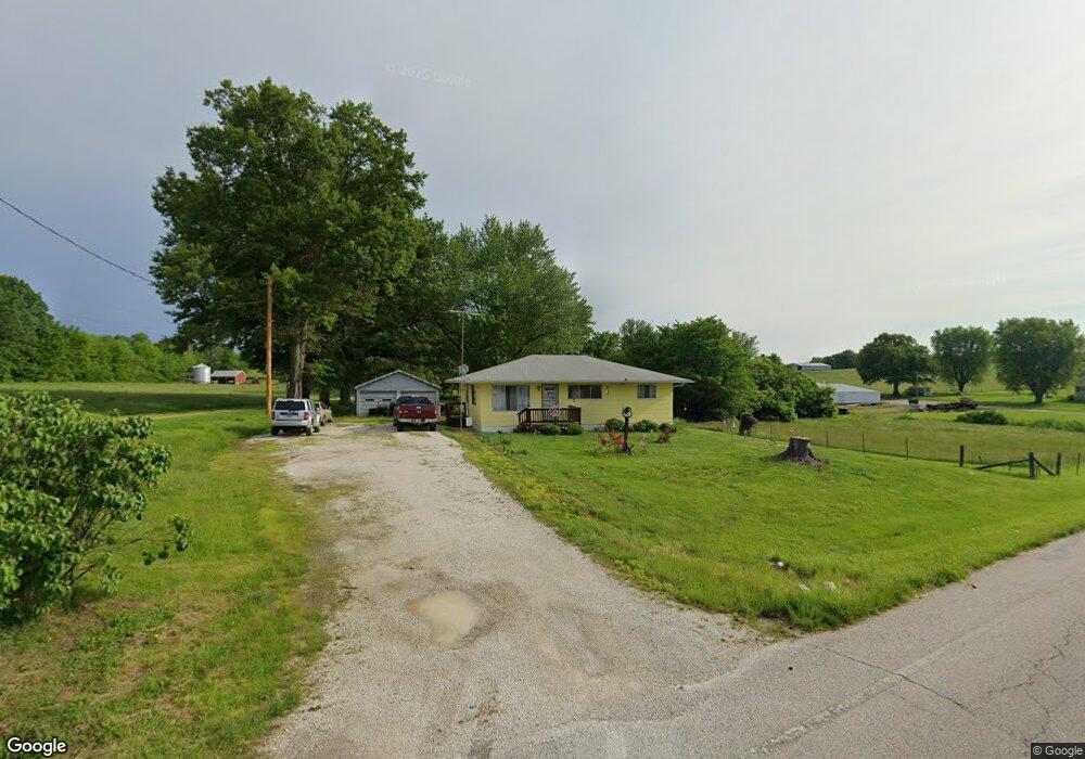
This home is located at 1539 Old Highway 50 E, Union, MO 63084 and is currently estimated at $207,088, approximately $184 per square foot. 1539 Old Highway 50 E is a home located in Franklin County with nearby schools including Union High School, Immaculate Conception School, and Crosspoint Christian School.
Ownership History
Date
Name
Owned For
Owner Type
Purchase Details
Closed on
Apr 30, 2007
Sold by
Snelling Gregory and Wolfe Deanne
Bought by
Douglas David I and Douglas Sheila M
Current Estimated Value
Home Financials for this Owner
Home Financials are based on the most recent Mortgage that was taken out on this home.
Original Mortgage
$93,000
Outstanding Balance
$55,797
Interest Rate
6.1%
Mortgage Type
New Conventional
Estimated Equity
$151,291
Purchase Details
Closed on
Aug 16, 2006
Sold by
Holtmeier Mary Jeanne
Bought by
Snelling Grefory and Wolefe Deanne
Home Financials for this Owner
Home Financials are based on the most recent Mortgage that was taken out on this home.
Original Mortgage
$87,300
Interest Rate
6.79%
Mortgage Type
New Conventional
Create a Home Valuation Report for This Property
The Home Valuation Report is an in-depth analysis detailing your home's value as well as a comparison with similar homes in the area
Home Values in the Area
Average Home Value in this Area
Purchase History
| Date | Buyer | Sale Price | Title Company |
|---|---|---|---|
| Douglas David I | -- | None Available | |
| Snelling Grefory | -- | None Available |
Source: Public Records
Mortgage History
| Date | Status | Borrower | Loan Amount |
|---|---|---|---|
| Open | Douglas David I | $93,000 | |
| Previous Owner | Snelling Grefory | $87,300 |
Source: Public Records
Tax History
| Year | Tax Paid | Tax Assessment Tax Assessment Total Assessment is a certain percentage of the fair market value that is determined by local assessors to be the total taxable value of land and additions on the property. | Land | Improvement |
|---|---|---|---|---|
| 2025 | $1,209 | $22,899 | $0 | $0 |
| 2024 | $1,209 | $19,961 | $0 | $0 |
| 2023 | $1,065 | $19,961 | $0 | $0 |
| 2022 | $937 | $17,510 | $0 | $0 |
| 2021 | $938 | $17,510 | $0 | $0 |
| 2020 | $882 | $16,224 | $0 | $0 |
| 2019 | $880 | $16,224 | $0 | $0 |
| 2018 | $766 | $14,976 | $0 | $0 |
| 2017 | $769 | $14,976 | $0 | $0 |
| 2016 | $766 | $14,531 | $0 | $0 |
| 2015 | $752 | $14,531 | $0 | $0 |
| 2014 | $759 | $14,588 | $0 | $0 |
Source: Public Records
Map
Nearby Homes
- 1527 Rigby Ridge
- 1502 Old Highway 50 E
- 2288 Prairie Dell Rd
- 462 Klenke Valley Dr
- 308 Century Farm Dr
- 317 Century Farm Dr
- 457 Klenke Valley Dr
- 447 Klenke Valley Dr
- 446 Klenke Valley Dr
- 340 Century Farm Dr
- 1009 Hawk Ridge Dr
- 305 Hawk Nest Ct
- 605 Hawk Nest Ct
- 1041 Vardon Meadows Dr
- 1056 Vardon Meadows Dr
- 204 Boardwalk Ct
- 1007 Watson Ridge Dr
- 1064 Vardon Meadows Dr
- 2 Aspen at St Andrews Manors
- 1005 Braid Trail Dr
- 1561 Old Highway 50 E
- 1523 Rigby Ridge
- 1528 Old Us Highway 50 E
- 1569 Old Highway 50 E
- 101 Henry Dr
- 1531 Rigby Ridge
- 1519 Rigby Ridge
- 1535 Rigby Ridge
- 1522 Rigby Ridge
- 1522 Rigby Ridge
- 1516 Old Us Highway 50 E
- 1505 Lucy Ln
- 1539 Rigby Ridge
- 1573 Old Us Highway 50 E
- 1533 Old Highway 50 E
- 1513 Lucy Ln
- 1534 Rigby Ridge
- 1509 Lucy Ln
- 1514 Rigby Ridge
- 1315 Denmark Rd
Your Personal Tour Guide
Ask me questions while you tour the home.