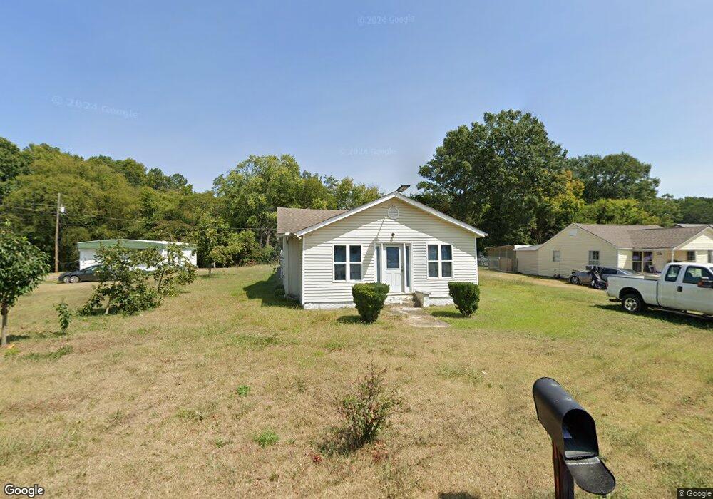
1539 Riverbend Rd Dalton, GA 30721
Estimated Value: $164,542 - $286,000
--
Bed
1
Bath
1,391
Sq Ft
$153/Sq Ft
Est. Value
About This Home
This home is located at 1539 Riverbend Rd, Dalton, GA 30721 and is currently estimated at $213,136, approximately $153 per square foot. 1539 Riverbend Rd is a home located in Whitfield County with nearby schools including Eastside Elementary School, Eastbrook Middle School, and Southeast Whitfield County High School.
Ownership History
Date
Name
Owned For
Owner Type
Purchase Details
Closed on
Apr 11, 2025
Sold by
Castaneda Pablo Gomez and Gomez Pablo
Bought by
Flores Alonso Gomez
Current Estimated Value
Purchase Details
Closed on
Mar 2, 2012
Bought by
Gomez Pablo
Purchase Details
Closed on
Aug 2, 2011
Sold by
Wells Fargo Bank
Bought by
Secretary Of Housing
Purchase Details
Closed on
Sep 3, 2004
Sold by
Perez Octavio
Bought by
Moreno Jose D
Purchase Details
Closed on
Jul 1, 1998
Bought by
Perez Octavio
Create a Home Valuation Report for This Property
The Home Valuation Report is an in-depth analysis detailing your home's value as well as a comparison with similar homes in the area
Home Values in the Area
Average Home Value in this Area
Purchase History
| Date | Buyer | Sale Price | Title Company |
|---|---|---|---|
| Flores Alonso Gomez | -- | None Listed On Document | |
| Flores Alonso Gomez | -- | None Listed On Document | |
| Gomez Pablo | $17,000 | -- | |
| Secretary Of Housing | $93,713 | -- | |
| Wells Fargo Bank | $93,713 | -- | |
| Moreno Jose D | $82,300 | -- | |
| Perez Octavio | $87,000 | -- |
Source: Public Records
Tax History Compared to Growth
Tax History
| Year | Tax Paid | Tax Assessment Tax Assessment Total Assessment is a certain percentage of the fair market value that is determined by local assessors to be the total taxable value of land and additions on the property. | Land | Improvement |
|---|---|---|---|---|
| 2024 | $1,253 | $57,486 | $7,000 | $50,486 |
| 2023 | $1,253 | $42,157 | $4,505 | $37,652 |
| 2022 | $918 | $31,121 | $4,505 | $26,616 |
| 2021 | $918 | $31,121 | $4,505 | $26,616 |
| 2020 | $949 | $31,121 | $4,505 | $26,616 |
| 2019 | $965 | $31,121 | $4,505 | $26,616 |
| 2018 | $981 | $31,121 | $4,505 | $26,616 |
| 2017 | $981 | $31,121 | $4,505 | $26,616 |
| 2016 | $872 | $28,762 | $4,505 | $24,257 |
| 2014 | $774 | $28,762 | $4,505 | $24,257 |
| 2013 | -- | $28,762 | $4,504 | $24,257 |
Source: Public Records
Map
Nearby Homes
- Lot 3 Riverbend Rd
- Lot 2 Riverbend Rd
- 945 Riverbend Rd
- 1712 Wendell St
- 1401 Eastbrook Rd SE
- 1320 Coker Dr
- Lot 4 Liberty Dr
- Lot 10 Liberty Dr
- Lot 9 Liberty Dr
- 1412 Stevenson Dr
- 11 Liberty St
- 1302 Jackson Rd
- 1401 Eastbrook Dr SE
- 1629 Roosevelt Dr
- 1007 Locke Dr
- trac 2 Roosevelt Dr
- trac 3 Roosevelt Dr
- 00 Hill Rd
- Lot 5 River Bend Rd
- Lot 4 Riverbend Rd
- 1541 Riverbend Rd
- 141 AND 128 Warren Way
- 1545 Riverbend Rd
- 1531 Riverbend Rd
- Lot 5 Riverbend Rd
- Lot E-F Riverbend Rd
- 2600 Riverbend Rd
- TRACT D Riverbend Rd
- Tract C Riverbend Rd
- Lot10-12 Riverbend Rd
- 141 Warren Way
- 1505 Antioch Dr
- 1307 Eastbrook Rd SE
- 1515 Riverbend Rd
- 1515 Riverbend Rd
- 1515 Riverbend Rd
- 1529 Riverbend Rd
- 1514 Riverbend Rd
- 1516 Riverbend Rd
- 1330 Coogler Rd