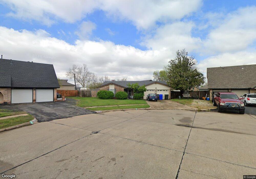
1539 Woods Cir Norman, OK 73069
Westwood Park NeighborhoodEstimated Value: $262,000 - $297,042
5
Beds
4
Baths
2,301
Sq Ft
$119/Sq Ft
Est. Value
About This Home
This home is located at 1539 Woods Cir, Norman, OK 73069 and is currently estimated at $273,761, approximately $118 per square foot. 1539 Woods Cir is a home located in Cleveland County with nearby schools including Cleveland Elementary School, Whittier Middle School, and Norman North High School.
Ownership History
Date
Name
Owned For
Owner Type
Purchase Details
Closed on
Apr 20, 2006
Sold by
Weimer Bert A and Weimer Tamara R
Bought by
Sanocki Joseph M and Sanocki Kira D
Current Estimated Value
Home Financials for this Owner
Home Financials are based on the most recent Mortgage that was taken out on this home.
Original Mortgage
$116,400
Outstanding Balance
$66,737
Interest Rate
6.32%
Mortgage Type
New Conventional
Estimated Equity
$207,025
Create a Home Valuation Report for This Property
The Home Valuation Report is an in-depth analysis detailing your home's value as well as a comparison with similar homes in the area
Home Values in the Area
Average Home Value in this Area
Purchase History
| Date | Buyer | Sale Price | Title Company |
|---|---|---|---|
| Sanocki Joseph M | $145,500 | Stewart Abstract & Title Of |
Source: Public Records
Mortgage History
| Date | Status | Borrower | Loan Amount |
|---|---|---|---|
| Open | Sanocki Joseph M | $116,400 |
Source: Public Records
Tax History Compared to Growth
Tax History
| Year | Tax Paid | Tax Assessment Tax Assessment Total Assessment is a certain percentage of the fair market value that is determined by local assessors to be the total taxable value of land and additions on the property. | Land | Improvement |
|---|---|---|---|---|
| 2024 | $2,064 | $18,229 | $2,836 | $15,393 |
| 2023 | $2,004 | $17,698 | $3,043 | $14,655 |
| 2022 | $1,864 | $17,183 | $2,458 | $14,725 |
| 2021 | $1,905 | $16,683 | $1,800 | $14,883 |
| 2020 | $1,863 | $16,683 | $1,800 | $14,883 |
| 2019 | $1,895 | $16,683 | $1,800 | $14,883 |
| 2018 | $1,837 | $16,683 | $1,800 | $14,883 |
| 2017 | $1,859 | $16,683 | $0 | $0 |
| 2016 | $1,889 | $16,683 | $1,800 | $14,883 |
| 2015 | $1,860 | $16,922 | $1,388 | $15,534 |
| 2014 | $1,878 | $16,922 | $1,388 | $15,534 |
Source: Public Records
Map
Nearby Homes
- 1103 Woods Ave
- 916 Canterbury Ave
- 1713 Canterbury St
- 1603 Denison Dr
- 1702 Denison Dr
- 1502 Denison Dr
- 1337 Regent St
- 748 Highland Pkwy
- 1502 Iowa St
- 2128 Parkland Way
- 718 Highland Pkwy
- 1213 Iowa St
- 717 Denison Dr
- 336 N Sherry Ave
- 1313 Dorchester Dr
- 2324 Parkland Way
- 713 Dakota St
- 344 Royal Oak Dr
- 239 Foreman Ave
- 1803 Crestmont St
- 1535 Woods Cir
- 1544 Woods Cir
- 1136 Woods Ave
- 1540 Woods Cir
- 1836 W Robinson St
- 1836 W Robinson St
- 1536 Woods Cir
- 1129 Woods Ave
- 1123 Woods Ave
- 1531 Hayes St
- 1527 Ashley Cir
- 1521 Ashley Cir
- 1515 Ashley Cir
- 1525 Hayes St
- 1530 Hayes St
- 1533 Ashley Cir
- 1111 Woods Ave
- 1519 Hayes St
- 1542 Ashley Cir
- 1516 Ashley Cir