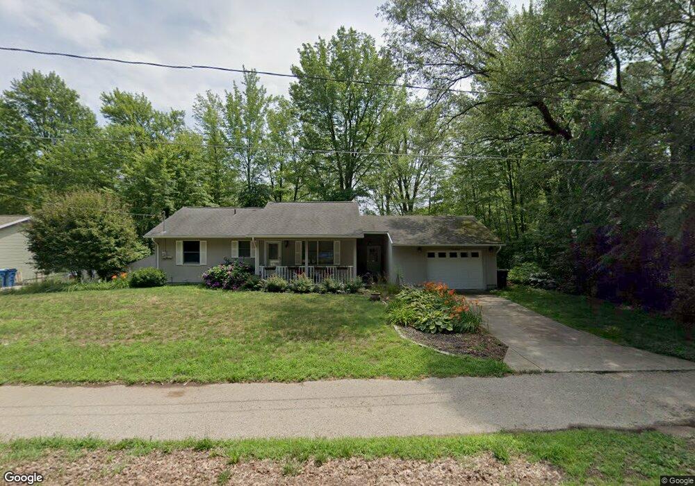
15390 State Rd Spring Lake, MI 49456
Estimated Value: $288,000 - $352,000
2
Beds
2
Baths
1,100
Sq Ft
$295/Sq Ft
Est. Value
About This Home
This home is located at 15390 State Rd, Spring Lake, MI 49456 and is currently estimated at $324,854, approximately $295 per square foot. 15390 State Rd is a home located in Ottawa County with nearby schools including Spring Lake High School and St. Mary's School.
Ownership History
Date
Name
Owned For
Owner Type
Purchase Details
Closed on
Apr 13, 2007
Sold by
Mcdonough Robert H
Bought by
Hammill Marcia J
Current Estimated Value
Home Financials for this Owner
Home Financials are based on the most recent Mortgage that was taken out on this home.
Original Mortgage
$118,500
Outstanding Balance
$72,041
Interest Rate
6.25%
Mortgage Type
New Conventional
Estimated Equity
$252,813
Purchase Details
Closed on
Jul 29, 2004
Sold by
Jones Lee R and Jones Mary E
Bought by
Mcdonough Robert H
Home Financials for this Owner
Home Financials are based on the most recent Mortgage that was taken out on this home.
Original Mortgage
$11,100
Interest Rate
6.35%
Mortgage Type
Credit Line Revolving
Create a Home Valuation Report for This Property
The Home Valuation Report is an in-depth analysis detailing your home's value as well as a comparison with similar homes in the area
Home Values in the Area
Average Home Value in this Area
Purchase History
| Date | Buyer | Sale Price | Title Company |
|---|---|---|---|
| Hammill Marcia J | $118,500 | Lighthouse Title Inc | |
| Mcdonough Robert H | -- | Harbor Title |
Source: Public Records
Mortgage History
| Date | Status | Borrower | Loan Amount |
|---|---|---|---|
| Open | Hammill Marcia J | $118,500 | |
| Previous Owner | Mcdonough Robert H | $11,100 | |
| Previous Owner | Mcdonough Robert H | $88,800 |
Source: Public Records
Tax History
| Year | Tax Paid | Tax Assessment Tax Assessment Total Assessment is a certain percentage of the fair market value that is determined by local assessors to be the total taxable value of land and additions on the property. | Land | Improvement |
|---|---|---|---|---|
| 2025 | $1,802 | $128,900 | $0 | $0 |
| 2024 | $17 | $129,800 | $0 | $0 |
| 2023 | $1,653 | $113,700 | $0 | $0 |
| 2022 | $2,071 | $93,400 | $0 | $0 |
| 2021 | $2,001 | $80,200 | $0 | $0 |
| 2020 | $2,006 | $75,700 | $0 | $0 |
| 2019 | $1,945 | $73,900 | $0 | $0 |
| 2018 | $1,829 | $64,900 | $4,500 | $60,400 |
| 2017 | $1,785 | $66,000 | $0 | $0 |
| 2016 | $1,775 | $64,600 | $0 | $0 |
| 2015 | -- | $62,300 | $0 | $0 |
| 2014 | -- | $59,100 | $0 | $0 |
Source: Public Records
Map
Nearby Homes
- 17247 N Fruitport Rd
- 17526 N Fruitport Rd Unit 9
- 17533 N Fruitport Rd Unit 6
- 17321 Coles Park Rd
- 904 E Savidge St
- 17312 Oak St
- 15762 Prospect Point Dr
- 215 S Fruitport Rd
- 16759 152nd Ave
- 15574 Howard St
- 15328 Oak Ridge Dr
- 17708 Oakwood Dr
- 16211 148th Ave
- 16249 148th Ave
- 601 Lakeview Ln Unit 1
- 206 N Lake Ave Unit A & B
- 14035 Blue Wing Dr
- 17871 N Fruitport Rd
- 14815 Cross Ln
- 18154 Newgate Ln Unit Lot 14
- 15374 State Rd
- 17226 Arthur Ct Unit 1
- 17220 Arthur Ct Unit 2
- 17212 Arthur Ct
- 17515 Arthur Ct
- 17223 Arthur Ct Unit 4
- 17217 Arthur Ct
- 17217 Arthur Ct Unit 3
- 17217 Arthur Ct Unit 5
- 17207 Arthur Ct
- 17203 Arthur Ct
- 15497 State Rd
- 17187 Arthur Ct Unit 9
- 15362 State Rd
- 17178 Arthur Ct
- 17179 Arthur Ct
- 15514 State Rd
- 17177 Arthur Ct
- 17172 Arthur Ct
- 17168 Arthur Ct
Your Personal Tour Guide
Ask me questions while you tour the home.