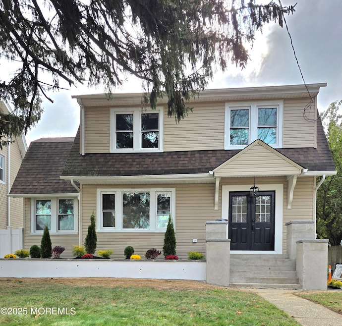


154 Atlantic Ave Long Branch, NJ 07740
Estimated payment $4,753/month
Highlights
- Custom Home
- Deck
- Attic
- Granite Flooring
- Main Floor Bedroom
- No HOA
About This Home
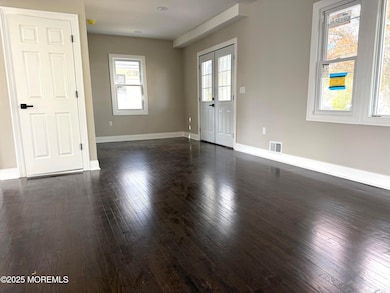
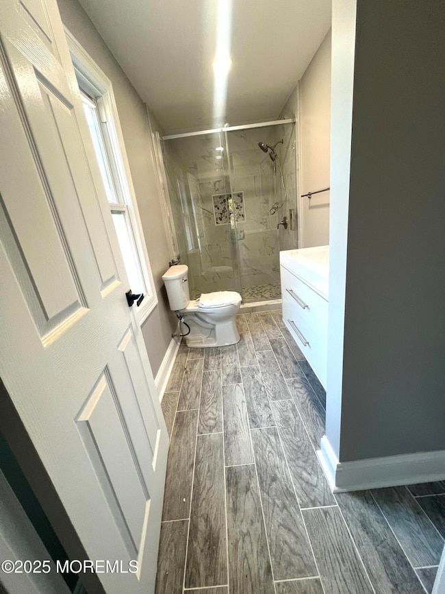
Stunning Custom Colonial Home - Completely Renovated from the Ground Up! This beautifully redesigned Colonial home has been gutted to the studs and meticulously renovated to offer a modern open-concept layout while maintaining its timeless charm. Featuring 4 Spacious Bedrooms & 3.5 Luxurious Baths - this home is perfect for contemporary living & entertaining. The open concept living space features high end finishes throughout, creating a seamless flow from room to room. The gourmet kitchen is a chef's dream w/ custom cabinetry, sleek countertops & top-of-the-line appliances. The luxurious bathrooms are spa-inspired, boasting modern fixtures & finishes. Outside you will find a large 16x16 deck, perfect for outdoor gatherings & relaxation. The home also includes a detached 1-car garage & an oversized driveway. Located just moments from the beach, Pier Village, shopping, restaurants, and more, this home offers the ultimate coastal lifestyle.
Listing Agent
RE/MAX Synergy Brokerage Phone: 212-639-9292 License #2076047 Listed on: 11/07/2025

Home Details
Home Type
- Single Family
Est. Annual Taxes
- $6,400
Year Built
- Built in 1930
Lot Details
- 6,098 Sq Ft Lot
- Lot Dimensions are 50 x 120
- Fenced
Parking
- 1 Car Garage
- Driveway
Home Design
- Custom Home
- Colonial Architecture
- Shingle Roof
- Vinyl Siding
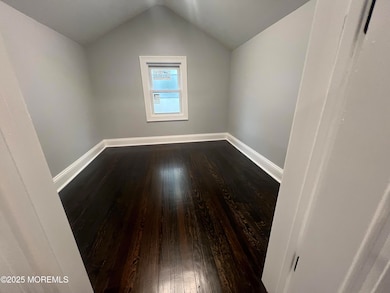
Interior Spaces
- 1,650 Sq Ft Home
- 2-Story Property
- Unfinished Basement
- Basement Fills Entire Space Under The House
- Attic
Kitchen
- Stove
- Range Hood
- Dishwasher
- Kitchen Island
Flooring
- Wood
- Granite
- Porcelain Tile
Bedrooms and Bathrooms
- 4 Bedrooms
- Main Floor Bedroom
- Walk-In Closet
- Primary Bathroom is a Full Bathroom
- Primary Bathroom includes a Walk-In Shower
Outdoor Features
- Deck
- Porch
Schools
- Long Branch Middle School
- Long Branch High School
Utilities
- Forced Air Heating and Cooling System
- Heating System Uses Natural Gas
- Natural Gas Water Heater
Community Details
- No Home Owners Association
Listing and Financial Details
- Assessor Parcel Number 27-00384-0000-00020
Map
Home Values in the Area
Average Home Value in this Area
Tax History
| Year | Tax Paid | Tax Assessment Tax Assessment Total Assessment is a certain percentage of the fair market value that is determined by local assessors to be the total taxable value of land and additions on the property. | Land | Improvement |
|---|---|---|---|---|
| 2025 | $6,400 | $490,200 | $279,400 | $210,800 |
| 2024 | $5,936 | $416,400 | $214,700 | $201,700 |
| 2023 | $5,936 | $382,200 | $189,700 | $192,500 |
| 2022 | $5,421 | $331,900 | $162,300 | $169,600 |
| 2021 | $5,421 | $290,900 | $132,300 | $158,600 |
| 2020 | $5,936 | $284,000 | $126,300 | $157,700 |
| 2019 | $5,604 | $266,600 | $116,300 | $150,300 |
| 2018 | $5,435 | $257,100 | $112,300 | $144,800 |
| 2017 | $5,099 | $247,400 | $105,300 | $142,100 |
| 2016 | $5,067 | $250,700 | $112,300 | $138,400 |
| 2015 | $4,512 | $202,600 | $76,000 | $126,600 |
| 2014 | $4,289 | $203,000 | $90,700 | $112,300 |
Property History
| Date | Event | Price | List to Sale | Price per Sq Ft |
|---|---|---|---|---|
| 11/21/2025 11/21/25 | Pending | -- | -- | -- |
| 11/07/2025 11/07/25 | For Sale | $799,000 | -- | $484 / Sq Ft |
Purchase History
| Date | Type | Sale Price | Title Company |
|---|---|---|---|
| Deed | $340,000 | Nu World Title | |
| Deed | $340,000 | Nu World Title |
Mortgage History
| Date | Status | Loan Amount | Loan Type |
|---|---|---|---|
| Open | $517,480 | Construction | |
| Closed | $517,480 | Construction |
Source: MOREMLS (Monmouth Ocean Regional REALTORS®)
MLS Number: 22533335
APN: 27-00384-0000-00020
Disclaimer: Certain information contained herein is derived from information provided by parties other than Homes.com. All information provided is deemed reliable, but is not guaranteed to be accurate and should be independently verified.
![]() IDX information is provided exclusively for personal, non-commercial use, and may not be used for any purpose other than to identify prospective properties consumers may be interested in purchasing.
IDX information is provided exclusively for personal, non-commercial use, and may not be used for any purpose other than to identify prospective properties consumers may be interested in purchasing.
Information is deemed reliable but not guaranteed.
- 164 Airsdale Ave
- 381 Long Branch Ave
- 392 Florence Ave
- 323 Florence Ave
- 165 Kingsley St
- 188 Chelton Ave
- 172 Chelton Ave
- 16 Shore Dr
- 28 Patten Ln
- 9 Manahassett Park Dr
- 138 Rosewood Ave
- 231 Long Branch Ave
- 432 Ocean Blvd N Unit 506
- 432 Ocean Blvd N Unit 315
- 50 Valentine St Unit 27A
- 50 Valentine St Unit 22A
- 50 Valentine St Unit 12B
- 422 Ocean Blvd N Unit 5H
- 43 Valentine St
- 580 Patten Ave Unit 47