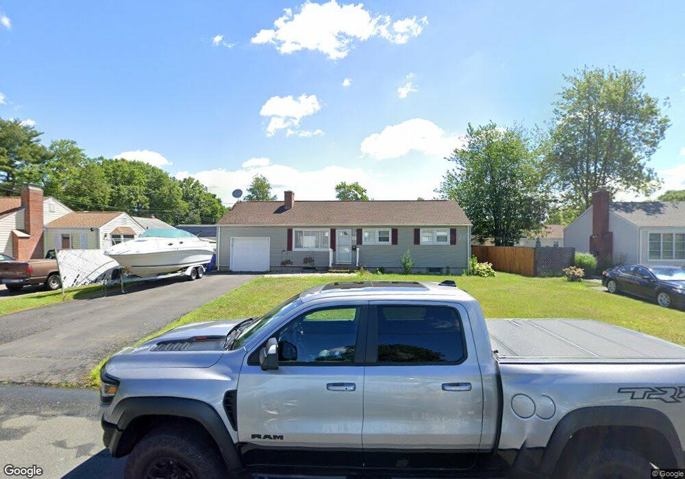
154 Brookside Cir Wethersfield, CT 06109
Estimated Value: $258,000 - $298,000
3
Beds
1
Bath
888
Sq Ft
$319/Sq Ft
Est. Value
About This Home
This home is located at 154 Brookside Cir, Wethersfield, CT 06109 and is currently estimated at $283,362, approximately $319 per square foot. 154 Brookside Cir is a home located in Hartford County with nearby schools including Emerson-Williams School, Silas Deane Middle School, and Wethersfield High School.
Ownership History
Date
Name
Owned For
Owner Type
Purchase Details
Closed on
Mar 7, 2023
Sold by
Swierszcz Adam and Swierszcz Ewa
Bought by
Swierszcz Mateusz
Current Estimated Value
Purchase Details
Closed on
Apr 3, 2007
Sold by
Smith Gary and Smith Heather Ann
Bought by
Swierszcz Adam and Swierszcz Ewa
Home Financials for this Owner
Home Financials are based on the most recent Mortgage that was taken out on this home.
Original Mortgage
$179,188
Interest Rate
6.33%
Purchase Details
Closed on
Mar 28, 2002
Sold by
Zerio Paul D and Zerio Carla D
Bought by
Smith Gary A and Smith Heatheranne H
Home Financials for this Owner
Home Financials are based on the most recent Mortgage that was taken out on this home.
Original Mortgage
$125,900
Interest Rate
9%
Purchase Details
Closed on
May 3, 1999
Sold by
Lopa Richard J
Bought by
Zerico Paul D and Zerico Carla D
Purchase Details
Closed on
Nov 10, 1994
Sold by
Blake Sheila M
Bought by
Lopa Richard S
Create a Home Valuation Report for This Property
The Home Valuation Report is an in-depth analysis detailing your home's value as well as a comparison with similar homes in the area
Home Values in the Area
Average Home Value in this Area
Purchase History
| Date | Buyer | Sale Price | Title Company |
|---|---|---|---|
| Swierszcz Mateusz | -- | None Available | |
| Swierszcz Adam | $182,000 | -- | |
| Smith Gary A | $139,900 | -- | |
| Zerico Paul D | $99,900 | -- | |
| Lopa Richard S | $95,000 | -- |
Source: Public Records
Mortgage History
| Date | Status | Borrower | Loan Amount |
|---|---|---|---|
| Previous Owner | Lopa Richard S | $150,000 | |
| Previous Owner | Lopa Richard S | $179,188 | |
| Previous Owner | Lopa Richard S | $145,800 | |
| Previous Owner | Lopa Richard S | $125,900 |
Source: Public Records
Tax History
| Year | Tax Paid | Tax Assessment Tax Assessment Total Assessment is a certain percentage of the fair market value that is determined by local assessors to be the total taxable value of land and additions on the property. | Land | Improvement |
|---|---|---|---|---|
| 2025 | $6,792 | $164,780 | $63,170 | $101,610 |
| 2024 | $4,752 | $109,950 | $57,520 | $52,430 |
| 2023 | $4,594 | $109,950 | $57,520 | $52,430 |
| 2022 | $4,517 | $109,950 | $57,520 | $52,430 |
| 2021 | $4,472 | $109,950 | $57,520 | $52,430 |
| 2020 | $4,475 | $109,980 | $57,520 | $52,460 |
| 2019 | $4,479 | $109,950 | $57,520 | $52,430 |
| 2018 | $4,486 | $110,000 | $54,200 | $55,800 |
| 2017 | $4,375 | $110,000 | $54,200 | $55,800 |
| 2016 | $4,239 | $110,000 | $54,200 | $55,800 |
| 2015 | $4,201 | $110,000 | $54,200 | $55,800 |
| 2014 | $4,041 | $110,000 | $54,200 | $55,800 |
Source: Public Records
Map
Nearby Homes
- 1 Brussels Ave
- 19 Albert Ave
- 1 Bristol St
- 219-221 Jordan Ln
- 192 Wolcott Hill Rd
- 295 Ridge Rd Unit 8
- 55 Rutledge Rd
- 166 George St
- 28 Bolton St
- 144 Brown St
- 107 Harmund Place
- 43 Yale St
- 51 Hanmer St
- 23 Hillcrest Ave
- 18 Avalon Place
- 208 Mountain St
- 183-185 Cheshire St
- 167 Campfield Ave
- 317-319 Garden St
- 1 Fernwood St
- 148 Brookside Cir
- 391 Jordan Ln
- 11 Brookside Cir
- 387 Jordan Ln
- 17 Brookside Cir
- 381 Jordan Ln
- 142 Brookside Cir
- 149 Brookside Cir
- 147 Brookside Cir
- 401 Jordan Ln
- 21 Brookside Cir
- 141 Brookside Cir
- 132 Brookside Cir
- 27 Brookside Cir
- 16 Brookside Cir
- 371 Jordan Ln
- 133 Brookside Cir
- 22 Brookside Cir
- 128 Brookside Cir
- 33 Brookside Cir
Your Personal Tour Guide
Ask me questions while you tour the home.