154 Brothers Ln Loganton, PA 17747
Estimated Value: $452,000
4
Beds
2
Baths
11,378
Sq Ft
$40/Sq Ft
Est. Value
About This Home
This home is located at 154 Brothers Ln, Loganton, PA 17747 and is currently priced at $452,000, approximately $39 per square foot. 154 Brothers Ln is a home located in Clinton County with nearby schools including Country Lane School, Meadow Brook Parochial School, and Sugar Hollow Parochial School.
Ownership History
Date
Name
Owned For
Owner Type
Purchase Details
Closed on
Dec 30, 2024
Sold by
Kauffman Rachel G
Bought by
Kauffman Daniel F and Kauffman Malinda G
Current Estimated Value
Home Financials for this Owner
Home Financials are based on the most recent Mortgage that was taken out on this home.
Original Mortgage
$600,000
Outstanding Balance
$595,809
Interest Rate
6.78%
Mortgage Type
New Conventional
Purchase Details
Closed on
Jan 1, 1992
Bought by
Kauffman John E and Kauffman Rachel G
Create a Home Valuation Report for This Property
The Home Valuation Report is an in-depth analysis detailing your home's value as well as a comparison with similar homes in the area
Home Values in the Area
Average Home Value in this Area
Purchase History
| Date | Buyer | Sale Price | Title Company |
|---|---|---|---|
| Kauffman Daniel F | -- | None Listed On Document | |
| Kauffman Daniel F | -- | None Listed On Document | |
| Kauffman John E | -- | -- |
Source: Public Records
Mortgage History
| Date | Status | Borrower | Loan Amount |
|---|---|---|---|
| Open | Kauffman Daniel F | $600,000 | |
| Closed | Kauffman Daniel F | $260,000 | |
| Closed | Kauffman Daniel F | $600,000 |
Source: Public Records
Tax History Compared to Growth
Tax History
| Year | Tax Paid | Tax Assessment Tax Assessment Total Assessment is a certain percentage of the fair market value that is determined by local assessors to be the total taxable value of land and additions on the property. | Land | Improvement |
|---|---|---|---|---|
| 2025 | $11,494 | $522,700 | $41,900 | $480,800 |
| 2024 | $11,228 | $522,700 | $41,900 | $480,800 |
| 2023 | $10,679 | $733,200 | $252,400 | $480,800 |
| 2022 | $9,757 | $688,100 | $252,400 | $435,700 |
| 2021 | $9,829 | $688,100 | $252,400 | $435,700 |
| 2020 | $9,810 | $477,600 | $0 | $0 |
| 2019 | $9,619 | $477,600 | $0 | $0 |
| 2018 | $9,409 | $477,600 | $0 | $0 |
| 2017 | $9,265 | $477,600 | $0 | $0 |
| 2016 | $8,457 | $285,200 | $0 | $0 |
| 2015 | $8,304 | $285,200 | $0 | $0 |
| 2014 | $5,148 | $285,200 | $0 | $0 |
Source: Public Records
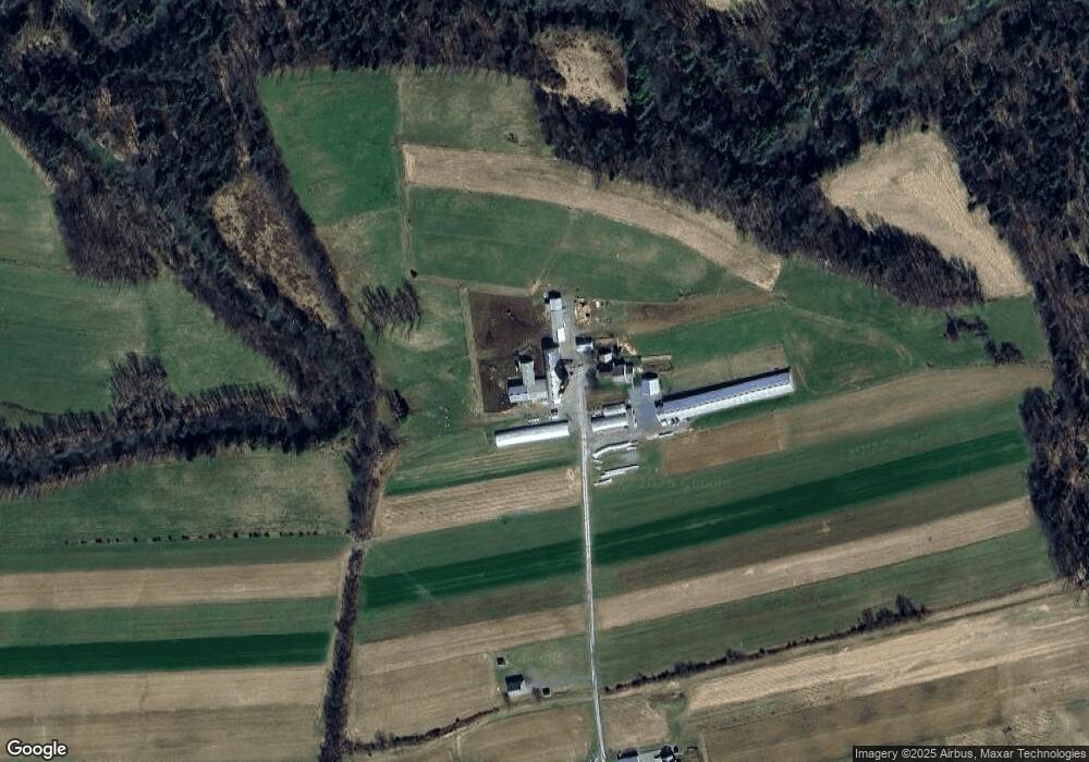
Map
Nearby Homes
- 1306 W Valley Rd
- 1329 Summer Mountain Rd
- 190 E Winter Rd
- 261 N Mill St
- 3066 E Valley Rd
- 3353 Narrows Rd
- 0 Long Run Rd
- 0 Harters Mills Trail Unit 11510009
- 0 Heckmans Gap Rd Unit WB-100728
- 168 E Main St
- 156 E Main St
- 114 W Main St
- 131 W Main St
- 126 W Main St
- 114 Smullton Rd
- 111 Smullton Rd
- 797 Long Run Rd
- PARCEL 49/50 Barner Ln
- 00 Barner Ln
- 1636 Narrows Rd
- 19 Brothers Ln
- 24 Brothers Ln
- 1480 W Winter Rd
- 1470 W Winter Rd
- 1440 W Winter Rd
- 1561 W Winter Rd
- 1412 W Winter Rd
- 1595 W Winter Rd
- 1549 W Winter Rd
- 1384 W Winter Rd
- 143 Campground Rd
- 155 Campground Rd
- 169 Campground Rd
- 137 Campground Rd
- 123 Campground Rd
- 111 Campground Rd
- 1613 W Winter Rd
- 105 Campground Rd
- 97 Campground Rd
- 136 Campground Rd