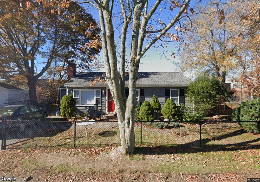
154 Central St Stoneham, MA 02180
Bear Hill NeighborhoodEstimated Value: $554,000 - $657,000
3
Beds
1
Bath
992
Sq Ft
$617/Sq Ft
Est. Value
About This Home
This home is located at 154 Central St, Stoneham, MA 02180 and is currently estimated at $612,503, approximately $617 per square foot. 154 Central St is a home located in Middlesex County with nearby schools including Stoneham High School, St. Patrick Elementary School, and St Joseph School.
Ownership History
Date
Name
Owned For
Owner Type
Purchase Details
Closed on
Aug 12, 1998
Sold by
Est Newcomb Beverly A and Breen Kathleen F
Bought by
Wigandt Maureen A and Wigandt Edward F
Current Estimated Value
Home Financials for this Owner
Home Financials are based on the most recent Mortgage that was taken out on this home.
Original Mortgage
$104,000
Outstanding Balance
$21,734
Interest Rate
6.94%
Mortgage Type
Purchase Money Mortgage
Estimated Equity
$590,769
Create a Home Valuation Report for This Property
The Home Valuation Report is an in-depth analysis detailing your home's value as well as a comparison with similar homes in the area
Home Values in the Area
Average Home Value in this Area
Purchase History
| Date | Buyer | Sale Price | Title Company |
|---|---|---|---|
| Wigandt Maureen A | $129,900 | -- |
Source: Public Records
Mortgage History
| Date | Status | Borrower | Loan Amount |
|---|---|---|---|
| Open | Wigandt Maureen A | $104,000 |
Source: Public Records
Tax History
| Year | Tax Paid | Tax Assessment Tax Assessment Total Assessment is a certain percentage of the fair market value that is determined by local assessors to be the total taxable value of land and additions on the property. | Land | Improvement |
|---|---|---|---|---|
| 2025 | $4,801 | $469,300 | $330,600 | $138,700 |
| 2024 | $4,629 | $437,100 | $304,500 | $132,600 |
| 2023 | $4,489 | $404,400 | $278,400 | $126,000 |
| 2022 | $3,855 | $370,300 | $252,300 | $118,000 |
| 2021 | $5,833 | $346,800 | $234,900 | $111,900 |
| 2020 | $3,603 | $333,900 | $219,400 | $114,500 |
| 2019 | $3,869 | $344,800 | $215,000 | $129,800 |
| 2018 | $7,156 | $303,700 | $185,700 | $118,000 |
| 2017 | $3,417 | $275,800 | $166,300 | $109,500 |
| 2016 | $3,386 | $266,600 | $166,300 | $100,300 |
| 2015 | $3,130 | $241,500 | $150,500 | $91,000 |
| 2014 | $2,857 | $211,800 | $126,700 | $85,100 |
Source: Public Records
Map
Nearby Homes
- 1 Tremont St
- 21 Tremont St Unit B
- 21 Tremont St Unit A
- 159 Main St Unit 27C
- 159 Main St Unit 39A
- 35 Tremont St
- 58 Washington St
- 8 Steele St
- 10 Pomeworth St Unit A
- 4 Garfield Ave
- 23 Sunrise Ave
- 8 Common St Unit 3
- 1 Alden Ave
- 62 High St Unit Lot 8
- 62 High St Unit 4
- 62 High St Unit Lot 5
- 62 High St Unit Lot 7
- 62 High St Unit Lot 12
- 62 High St Unit 3
- 98 Main St Unit 2
- 152 Central St
- 200 Main St
- 159 Central St
- 153 Central St
- 149 Central St
- 145 Central St
- 145 Central St Unit 10
- 170 Central St
- 170 Central St Unit 1
- 175 Central St Unit 177
- 141 Central St
- 196 Main
- 196 Main St
- 181 Central St
- 181 Central St Unit 7
- 181 Central St Unit 11
- 214 Main St
- 133 Central St
- 131 Central St
- 30 Collincote St
Your Personal Tour Guide
Ask me questions while you tour the home.