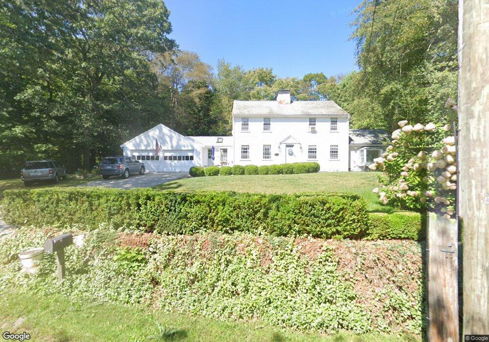
154 Gannett Rd Scituate, MA 02066
Estimated Value: $823,000 - $1,151,000
4
Beds
4
Baths
2,058
Sq Ft
$482/Sq Ft
Est. Value
About This Home
This home is located at 154 Gannett Rd, Scituate, MA 02066 and is currently estimated at $991,331, approximately $481 per square foot. 154 Gannett Rd is a home located in Plymouth County with nearby schools including Hatherly Elementary School, Lester J. Gates Middle School, and Scituate High School.
Ownership History
Date
Name
Owned For
Owner Type
Purchase Details
Closed on
Jan 12, 2009
Sold by
Burwell Helen K
Bought by
Mcneilly Jonathan D and Mcneilly Catherine Y
Current Estimated Value
Home Financials for this Owner
Home Financials are based on the most recent Mortgage that was taken out on this home.
Original Mortgage
$400,000
Outstanding Balance
$263,564
Interest Rate
5.99%
Mortgage Type
Purchase Money Mortgage
Estimated Equity
$727,767
Create a Home Valuation Report for This Property
The Home Valuation Report is an in-depth analysis detailing your home's value as well as a comparison with similar homes in the area
Home Values in the Area
Average Home Value in this Area
Purchase History
| Date | Buyer | Sale Price | Title Company |
|---|---|---|---|
| Mcneilly Jonathan D | $400,000 | -- |
Source: Public Records
Mortgage History
| Date | Status | Borrower | Loan Amount |
|---|---|---|---|
| Open | Mcneilly Jonathan D | $195,000 | |
| Open | Mcneilly Jonathan D | $400,000 | |
| Previous Owner | Mcneilly Jonathan D | $544,185 |
Source: Public Records
Tax History Compared to Growth
Tax History
| Year | Tax Paid | Tax Assessment Tax Assessment Total Assessment is a certain percentage of the fair market value that is determined by local assessors to be the total taxable value of land and additions on the property. | Land | Improvement |
|---|---|---|---|---|
| 2025 | $7,617 | $762,500 | $363,700 | $398,800 |
| 2024 | $7,477 | $721,700 | $330,600 | $391,100 |
| 2023 | $7,711 | $680,900 | $318,200 | $362,700 |
| 2022 | $7,711 | $611,000 | $307,000 | $304,000 |
| 2021 | $7,518 | $564,000 | $292,400 | $271,600 |
| 2020 | $7,289 | $539,900 | $281,100 | $258,800 |
| 2019 | $7,141 | $519,700 | $275,600 | $244,100 |
| 2018 | $6,928 | $496,600 | $274,300 | $222,300 |
| 2017 | $6,711 | $476,300 | $262,800 | $213,500 |
| 2016 | $6,412 | $453,500 | $240,000 | $213,500 |
| 2015 | $5,792 | $442,100 | $228,600 | $213,500 |
Source: Public Records
Map
Nearby Homes
- 7 Border St
- 53 Border St
- 29 Country Club Cir
- 27 Musquashicut Ave
- 16 3 Ring Rd
- 26 Mordecai Lincoln Rd
- 27 Cherry Ln
- 24 Wood Island Rd
- 112 Hollett St
- 70 Black Horse Ln
- 46 Marys Ln
- 817 Country Way
- 85 Glades Rd
- 392 S Main St
- 6 Tilden Ave
- 68 Black Horse Ln
- 151 Glades Rd
- 30 Black Horse Ln
- 245 S Main St
- 98 Black Horse Ln
- 146 Gannett Rd
- 153 Gannett Rd
- 162 Gannett Rd
- 140 Gannett Rd
- 172 Gannett Rd
- 13 Indian Trail
- 13 Indian Trail
- 137 Gannett Rd
- 9 Conihasset Rd
- 134 Gannett Rd
- 12 Conihasset Rd
- 7 Conihasset Rd
- 135 Gannett Rd
- 21 Indian Trail
- 11 Indian Trail
- 8 Border St
- 4 Wigwam Ln
- 10 Conihasset Rd
- 37 Indian Trail
- 2 Indian Trail