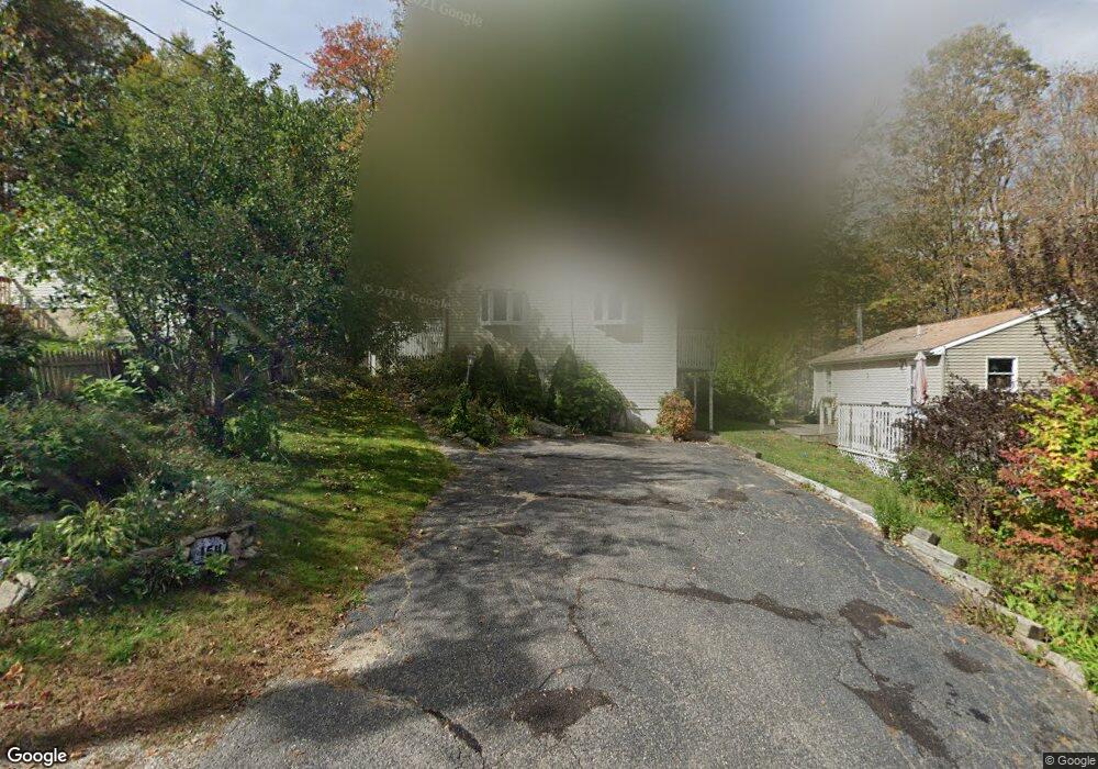
154 Mathew Rd Winsted, CT 06098
Estimated Value: $198,000 - $310,000
2
Beds
1
Bath
768
Sq Ft
$346/Sq Ft
Est. Value
About This Home
This home is located at 154 Mathew Rd, Winsted, CT 06098 and is currently estimated at $265,619, approximately $345 per square foot. 154 Mathew Rd is a home located in Litchfield County with nearby schools including Explorations Charter School, St Anthony School, and The Gilbert School.
Ownership History
Date
Name
Owned For
Owner Type
Purchase Details
Closed on
Jun 11, 2004
Sold by
Williams David S
Bought by
Cole Shirley J
Current Estimated Value
Home Financials for this Owner
Home Financials are based on the most recent Mortgage that was taken out on this home.
Original Mortgage
$94,000
Interest Rate
5.99%
Purchase Details
Closed on
Sep 30, 2002
Sold by
Seibold Kevin J and Seibold Robin M
Bought by
Williams David S
Create a Home Valuation Report for This Property
The Home Valuation Report is an in-depth analysis detailing your home's value as well as a comparison with similar homes in the area
Home Values in the Area
Average Home Value in this Area
Purchase History
| Date | Buyer | Sale Price | Title Company |
|---|---|---|---|
| Cole Shirley J | $117,500 | -- | |
| Cole Shirley J | $117,500 | -- | |
| Williams David S | $107,000 | -- | |
| Williams David S | $107,000 | -- |
Source: Public Records
Mortgage History
| Date | Status | Borrower | Loan Amount |
|---|---|---|---|
| Open | Williams David S | $88,470 | |
| Closed | Williams David S | $19,600 | |
| Closed | Williams David S | $94,000 |
Source: Public Records
Tax History Compared to Growth
Tax History
| Year | Tax Paid | Tax Assessment Tax Assessment Total Assessment is a certain percentage of the fair market value that is determined by local assessors to be the total taxable value of land and additions on the property. | Land | Improvement |
|---|---|---|---|---|
| 2025 | $3,020 | $103,530 | $37,100 | $66,430 |
| 2024 | $2,820 | $103,530 | $37,100 | $66,430 |
| 2023 | $2,732 | $103,530 | $37,100 | $66,430 |
| 2022 | $2,580 | $76,930 | $21,560 | $55,370 |
| 2021 | $2,580 | $76,930 | $21,560 | $55,370 |
| 2020 | $2,580 | $76,930 | $21,560 | $55,370 |
| 2019 | $2,580 | $76,930 | $21,560 | $55,370 |
| 2018 | $2,580 | $76,930 | $21,560 | $55,370 |
| 2017 | $2,428 | $72,380 | $17,710 | $54,670 |
| 2016 | $2,428 | $72,380 | $17,710 | $54,670 |
| 2015 | $2,367 | $72,380 | $17,710 | $54,670 |
| 2014 | $2,310 | $72,380 | $17,710 | $54,670 |
Source: Public Records
Map
Nearby Homes
- 156 Lincoln Ave
- 119 W Wakefield Blvd
- 124 Rockwell St
- 106 Rockwell St
- 48 Bridge St
- 30 Rock St
- 436 Main St
- 32 Charles St
- 720 Main St
- 9 John St
- 843-845 (lots - 10A, E Wakefield Blvd
- 605 E Wakefield Blvd
- 25 Center St
- 431 W Wakefield Blvd
- 118 Meadow St
- 77 Hubbard St
- 99 Hubbard St
- 14 Curtice St
- 38 Upland Rd
- 157 Elm St
- 156 Mathew Rd
- 152 Mathew Rd
- 135 Belvedere Ave
- 137 Belvedere Ave
- 133 Belvedere Ave
- 153 Mathew Rd
- 131 Belvedere Ave
- 151 Mathew Rd
- 203 Birch St
- 155 E Wakefield Blvd
- 147 E Wakefield Blvd
- 159 E Wakefield Blvd
- 160 Mathew Rd
- 163 E Wakefield Blvd
- 157 Mathew Rd
- 142 Belvedere Ave
- 110 Bayview Ave
- 161 Mathew Rd
- 138 Belvedere Ave
- 153 E Wakefield Blvd