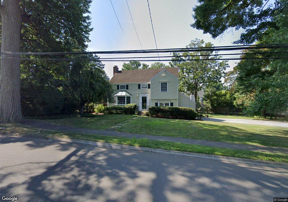
154 Middlesex Rd Darien, CT 06820
Estimated Value: $1,772,000 - $2,054,000
3
Beds
3
Baths
2,338
Sq Ft
$815/Sq Ft
Est. Value
About This Home
This home is located at 154 Middlesex Rd, Darien, CT 06820 and is currently estimated at $1,906,535, approximately $815 per square foot. 154 Middlesex Rd is a home located in Fairfield County with nearby schools including Holmes Elementary School, Middlesex Middle School, and Darien High School.
Ownership History
Date
Name
Owned For
Owner Type
Purchase Details
Closed on
May 13, 2019
Sold by
Murphy James
Bought by
James Murphy Irt
Current Estimated Value
Purchase Details
Closed on
May 13, 2014
Sold by
Evanich Alexis
Bought by
Murphy Jamey
Purchase Details
Closed on
May 4, 2004
Sold by
Mccarthy Leslie M and Mccarthy Mark L
Bought by
Evanich Alexis and Evanich Richard
Purchase Details
Closed on
Aug 4, 1994
Sold by
Brewer Hugh and Brewer Karen
Bought by
Mccarthy Mark and Mccarthy Leslie
Create a Home Valuation Report for This Property
The Home Valuation Report is an in-depth analysis detailing your home's value as well as a comparison with similar homes in the area
Home Values in the Area
Average Home Value in this Area
Purchase History
| Date | Buyer | Sale Price | Title Company |
|---|---|---|---|
| James Murphy Irt | -- | -- | |
| Murphy Jamey | $1,255,000 | -- | |
| Evanich Alexis | $1,125,000 | -- | |
| Mccarthy Mark | $415,000 | -- |
Source: Public Records
Mortgage History
| Date | Status | Borrower | Loan Amount |
|---|---|---|---|
| Previous Owner | Mccarthy Mark | $60,000 | |
| Previous Owner | Mccarthy Mark | $960,000 |
Source: Public Records
Tax History
| Year | Tax Paid | Tax Assessment Tax Assessment Total Assessment is a certain percentage of the fair market value that is determined by local assessors to be the total taxable value of land and additions on the property. | Land | Improvement |
|---|---|---|---|---|
| 2025 | $15,256 | $985,530 | $739,900 | $245,630 |
| 2024 | $14,477 | $985,530 | $739,900 | $245,630 |
| 2023 | $12,872 | $730,940 | $493,290 | $237,650 |
| 2022 | $12,594 | $730,940 | $493,290 | $237,650 |
| 2021 | $12,309 | $730,940 | $493,290 | $237,650 |
| 2020 | $11,958 | $730,940 | $493,290 | $237,650 |
| 2019 | $12,039 | $730,940 | $493,290 | $237,650 |
| 2018 | $11,960 | $743,750 | $496,160 | $247,590 |
| 2017 | $12,019 | $743,750 | $496,160 | $247,590 |
| 2016 | $11,729 | $743,750 | $496,160 | $247,590 |
| 2015 | $11,417 | $743,750 | $496,160 | $247,590 |
| 2014 | $11,164 | $743,750 | $496,160 | $247,590 |
Source: Public Records
Map
Nearby Homes
- 3 Hickory Ln
- 15 Charles St
- 3 Revere Rd
- 223 Middlesex Rd
- 167 Hollow Tree Ridge Rd
- 166 Hollow Tree Ridge Rd
- 25 Devon Rd
- 5 Shields Ln
- 17 Sunnyside Ave
- 15 Waterbury Ln
- 77 Maple St
- 26 Holly Ln
- 3 Abbey Rd
- 12 Walmsley Rd
- 22 Radio Place Unit 10
- 88 Maple Tree Ave Unit G
- 66 Stanton Rd
- 32 Relihan Rd
- 35 Maple Tree Ave Unit 1
- 43 Phillips Ln
- 4 Colony Rd
- 158 Middlesex Rd
- 4 Tyler Dr
- 150 Middlesex Rd
- 155 Middlesex Rd
- 6 Tyler Dr
- 2 Tyler Dr
- 159 Middlesex Rd
- 8 Tyler Dr
- 227 Hollow Tree Ridge Rd
- 1 Lantern Ln
- 225 Hollow Tree Ridge Rd
- 1 Colony Rd
- 223 Hollow Tree Ridge Rd
- 27 Colony Rd
- 3 Tyler Dr
- 9 Colony Rd
- 1 Tyler Dr
- 235 Hollow Tree Ridge Rd
- 221 Hollow Tree Ridge Rd
Your Personal Tour Guide
Ask me questions while you tour the home.