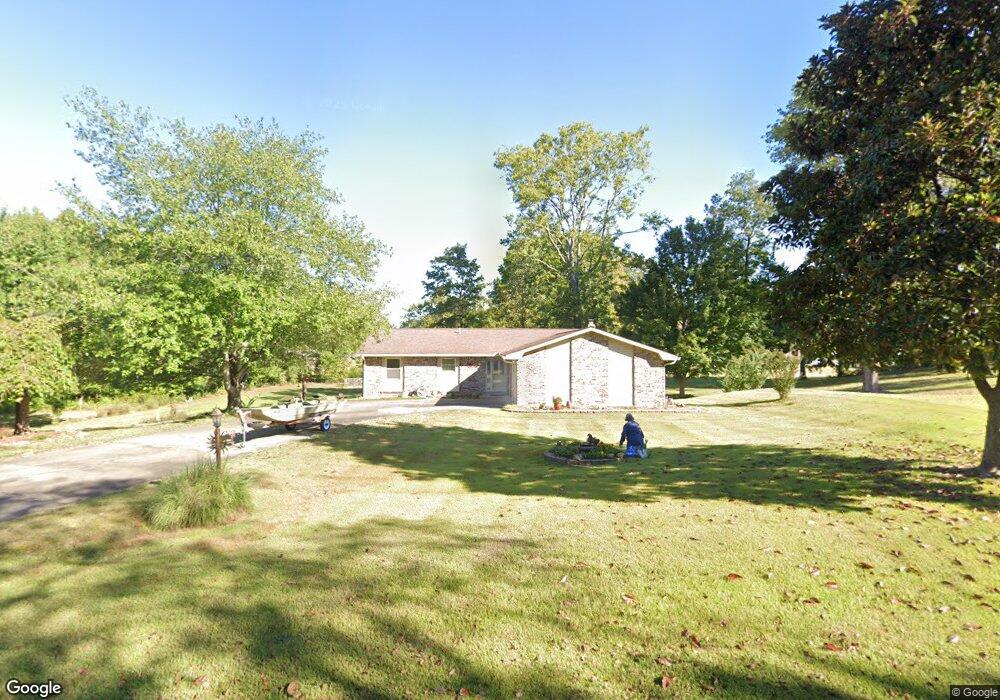
154 Rockport Dr Cape Girardeau, MO 63701
Estimated Value: $291,000 - $349,000
3
Beds
3
Baths
1,600
Sq Ft
$198/Sq Ft
Est. Value
About This Home
This home is located at 154 Rockport Dr, Cape Girardeau, MO 63701 and is currently estimated at $316,034, approximately $197 per square foot. 154 Rockport Dr is a home located in Cape Girardeau County with nearby schools including Clippard Elementary School, Central Middle School, and Central Junior High School.
Ownership History
Date
Name
Owned For
Owner Type
Purchase Details
Closed on
Aug 27, 2013
Sold by
Wehner Michael J and Wehner Carolyne
Bought by
Harper David K and Harper Sandra K
Current Estimated Value
Home Financials for this Owner
Home Financials are based on the most recent Mortgage that was taken out on this home.
Original Mortgage
$126,000
Outstanding Balance
$94,062
Interest Rate
4.41%
Mortgage Type
New Conventional
Estimated Equity
$221,972
Purchase Details
Closed on
Jul 27, 2007
Sold by
Shoff Ronald I and Shoff Barbara Dodd
Bought by
Inman Ronald D and Inman Susan Frayser
Home Financials for this Owner
Home Financials are based on the most recent Mortgage that was taken out on this home.
Original Mortgage
$198,900
Interest Rate
6.69%
Mortgage Type
New Conventional
Create a Home Valuation Report for This Property
The Home Valuation Report is an in-depth analysis detailing your home's value as well as a comparison with similar homes in the area
Home Values in the Area
Average Home Value in this Area
Purchase History
| Date | Buyer | Sale Price | Title Company |
|---|---|---|---|
| Harper David K | -- | -- | |
| Inman Ronald D | -- | None Available |
Source: Public Records
Mortgage History
| Date | Status | Borrower | Loan Amount |
|---|---|---|---|
| Open | Harper David K | $126,000 | |
| Previous Owner | Inman Ronald D | $198,900 |
Source: Public Records
Tax History Compared to Growth
Tax History
| Year | Tax Paid | Tax Assessment Tax Assessment Total Assessment is a certain percentage of the fair market value that is determined by local assessors to be the total taxable value of land and additions on the property. | Land | Improvement |
|---|---|---|---|---|
| 2025 | $1,790 | $35,960 | $5,110 | $30,850 |
| 2024 | $17 | $34,250 | $4,870 | $29,380 |
| 2023 | $1,697 | $34,250 | $4,870 | $29,380 |
| 2022 | $1,564 | $31,560 | $4,480 | $27,080 |
| 2021 | $1,564 | $31,560 | $4,480 | $27,080 |
| 2020 | $1,569 | $31,560 | $4,480 | $27,080 |
| 2019 | $1,567 | $31,560 | $0 | $0 |
| 2018 | $1,564 | $31,560 | $0 | $0 |
| 2017 | $1,568 | $31,560 | $0 | $0 |
| 2016 | $1,473 | $29,780 | $0 | $0 |
| 2015 | $1,331 | $26,880 | $0 | $0 |
| 2014 | $1,338 | $26,880 | $0 | $0 |
Source: Public Records
Map
Nearby Homes
- 495 S Lake Dr
- 393 Estate Dr
- 0 County Road 317
- 3814 Carolewood Dr
- 1304 Holly Dr
- 3657 Engram St
- 4595 Kingston Ave
- 4576 Kingston Ave
- 807 Caribou Ct
- 4568 Kingston Ave
- 725 Old Mill Dr
- 4530 Doe Run
- 4510 Doe Run
- 4516 Doe Run
- 4408 Clayton Ct
- 4559 Kingston Ave
- 4570 Kingston Ave
- 4578 Kingston Ave
- 1435 Chardonnay Ln
- 4405 Clayton Ct
- 100 S Lake Dr
- 268 Garnett Ln
- 131 Rockport Dr
- 236 Garnet Ln
- 204 Rockport Dr
- 180 Rockport Dr
- 118 Pebble Ln
- 345 Rockport Dr
- 251 Garnet Ln
- 188 Garnet Ln
- 250 Rockport Dr
- 157 Pebble Ln
- 211 S Lake Dr
- 164 Pebble Ln
- 374 N Lake Dr
- 2 Enclave Lake Estate
- 4 Enclave Lake Estate
- 20 Enclave Lake Estate
- 346 Rockport Dr
- 6 Enclave Lake Estate