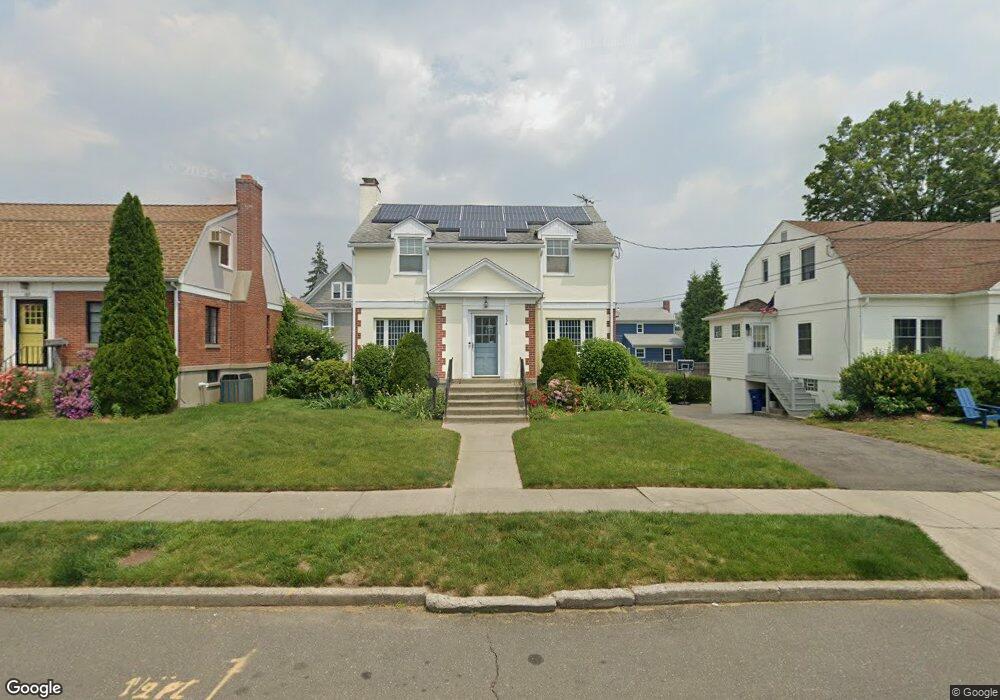
154 Seaside Ave Bridgeport, CT 06605
Black Rock NeighborhoodEstimated Value: $470,000 - $662,000
3
Beds
2
Baths
1,500
Sq Ft
$380/Sq Ft
Est. Value
About This Home
This home is located at 154 Seaside Ave, Bridgeport, CT 06605 and is currently estimated at $570,240, approximately $380 per square foot. 154 Seaside Ave is a home located in Fairfield County with nearby schools including Black Rock School, Bassick High School, and Park City Prep Charter School.
Ownership History
Date
Name
Owned For
Owner Type
Purchase Details
Closed on
Aug 3, 2004
Sold by
Nickmark Bryce
Bought by
Geotsi Georgette
Current Estimated Value
Purchase Details
Closed on
Mar 23, 2001
Sold by
Furkiotis I Est
Bought by
Vickmark Bryce
Create a Home Valuation Report for This Property
The Home Valuation Report is an in-depth analysis detailing your home's value as well as a comparison with similar homes in the area
Home Values in the Area
Average Home Value in this Area
Purchase History
| Date | Buyer | Sale Price | Title Company |
|---|---|---|---|
| Geotsi Georgette | $348,000 | -- | |
| Geotsi Georgette | $348,000 | -- | |
| Vickmark Bryce | $177,500 | -- | |
| Vickmark Bryce | $177,500 | -- |
Source: Public Records
Mortgage History
| Date | Status | Borrower | Loan Amount |
|---|---|---|---|
| Open | Vickmark Bryce | $198,500 | |
| Closed | Vickmark Bryce | $193,638 | |
| Closed | Vickmark Bryce | $210,000 |
Source: Public Records
Tax History
| Year | Tax Paid | Tax Assessment Tax Assessment Total Assessment is a certain percentage of the fair market value that is determined by local assessors to be the total taxable value of land and additions on the property. | Land | Improvement |
|---|---|---|---|---|
| 2025 | $10,067 | $231,700 | $155,820 | $75,880 |
| 2024 | $10,067 | $231,700 | $155,820 | $75,880 |
| 2023 | $10,067 | $231,700 | $155,820 | $75,880 |
| 2022 | $10,067 | $231,700 | $155,820 | $75,880 |
| 2021 | $10,067 | $231,700 | $155,820 | $75,880 |
| 2020 | $10,675 | $197,730 | $127,860 | $69,870 |
| 2019 | $10,675 | $197,730 | $127,860 | $69,870 |
| 2018 | $10,751 | $197,730 | $127,860 | $69,870 |
| 2017 | $10,751 | $197,730 | $127,860 | $69,870 |
| 2016 | $10,751 | $197,730 | $127,860 | $69,870 |
| 2015 | $9,839 | $233,150 | $135,660 | $97,490 |
| 2014 | $9,839 | $233,150 | $135,660 | $97,490 |
Source: Public Records
Map
Nearby Homes
- 97 Fayerweather Terrace
- 377 Midland St
- 315 Seaside Ave
- 8-10 Jetland Place
- 90 Clarkson St
- 318 Grovers Ave
- 554 Brewster St Unit 4
- 27 Nash Ln Unit 5
- 132 Bennett St Unit 302
- 78 Haddon St Unit 1
- 78 Rowsley St Unit 4
- 165 Bennett St
- 3250 Fairfield Ave Unit 302
- 855 Brewster St Unit 857
- 115 King St Unit 117
- 22 Monroe St Unit 24
- 188 Monroe St Unit 190
- 75 Hemlock St
- 287 Hansen Ave
- 693 S Benson Rd
- 144 Seaside Ave
- 164 Seaside Ave
- 134 Seaside Ave
- 395 Courtland Ave
- 174 Seaside Ave
- 385 Courtland Ave
- 165 Seaside Ave
- 401 Courtland Ave Unit 403
- 184 Seaside Ave
- 375 Courtland Ave
- 124 Seaside Ave
- 153 Seaside Ave
- 141 Seaside Ave
- 365 Courtland Ave
- 423 Courtland Ave Unit 425
- 425 Courtland Ave Unit 2-3
- 423 Courtland Ave Unit 1
- 423 Courtland Ave Unit 2-3
- 173 Seaside Ave
- 133 Seaside Ave
Your Personal Tour Guide
Ask me questions while you tour the home.