Estimated Value: $113,006 - $134,000
--
Bed
--
Bath
1,107
Sq Ft
$114/Sq Ft
Est. Value
About This Home
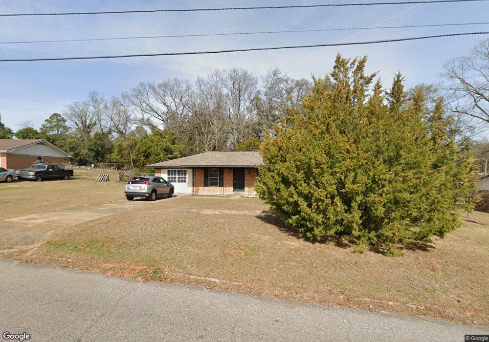
This home is located at 154 Shirley Dr, Ozark, AL 36360 and is currently estimated at $126,252, approximately $114 per square foot. 154 Shirley Dr is a home located in Dale County with nearby schools including Lisenby Primary School, Mixon Intermediate School, and D. A. Smith Middle School.
Ownership History
Date
Name
Owned For
Owner Type
Purchase Details
Closed on
May 19, 2022
Sold by
Lynn Derrick G
Bought by
Lynn6 Homes
Current Estimated Value
Home Financials for this Owner
Home Financials are based on the most recent Mortgage that was taken out on this home.
Original Mortgage
$75,600
Outstanding Balance
$71,655
Interest Rate
5%
Mortgage Type
New Conventional
Estimated Equity
$54,597
Purchase Details
Closed on
Oct 29, 2019
Sold by
Greenwich Revolving Trust
Bought by
Lynn Derrick G
Purchase Details
Closed on
Jun 7, 2019
Sold by
Red Mountain Title Llc
Bought by
Greenwich Revolving Trust
Create a Home Valuation Report for This Property
The Home Valuation Report is an in-depth analysis detailing your home's value as well as a comparison with similar homes in the area
Home Values in the Area
Average Home Value in this Area
Purchase History
| Date | Buyer | Sale Price | Title Company |
|---|---|---|---|
| Lynn6 Homes | $75,600 | None Listed On Document | |
| Lynn Derrick G | -- | None Available | |
| Greenwich Revolving Trust | $26,131 | None Available |
Source: Public Records
Mortgage History
| Date | Status | Borrower | Loan Amount |
|---|---|---|---|
| Open | Lynn6 Homes | $75,600 |
Source: Public Records
Tax History Compared to Growth
Tax History
| Year | Tax Paid | Tax Assessment Tax Assessment Total Assessment is a certain percentage of the fair market value that is determined by local assessors to be the total taxable value of land and additions on the property. | Land | Improvement |
|---|---|---|---|---|
| 2024 | $1,019 | $20,180 | $1,500 | $18,680 |
| 2023 | $1,019 | $17,200 | $1,100 | $16,100 |
| 2022 | $711 | $14,080 | $14,080 | $0 |
| 2021 | $663 | $13,120 | $1,100 | $12,020 |
| 2020 | $663 | $13,120 | $1,100 | $12,020 |
| 2019 | $332 | $6,580 | $560 | $6,020 |
| 2018 | $310 | $6,140 | $560 | $5,580 |
| 2017 | $310 | $6,140 | $560 | $5,580 |
| 2016 | $310 | $6,140 | $560 | $5,580 |
| 2015 | $310 | $6,140 | $560 | $5,580 |
| 2014 | $305 | $6,040 | $560 | $5,480 |
| 2013 | $236 | $6,040 | $560 | $5,480 |
Source: Public Records
Map
Nearby Homes
- 572 Sharon Ln
- Lot 11 Blk C Garland Ave
- Lot 4 Block D Garland Ave
- Lot 7 Blk G Amber Dr
- 248 Alberta Dr
- Lot 6 Blk G Ashley Dr
- 1.18 Acre Alley
- 1 Acre Alley
- 220 Evergreen Ave
- 2.33 acres Parker Rd
- Lot 8 Sunny Acres Dr
- 238 Juniper Dr
- 183 Alec Cir
- 284 Alec Cir
- 212 Johanna Dr
- TBD Whittle Hudson Rd
- 2.75 acres Whittle Hudson Rd
- 233 Johanna Dr
- 363 Alec Cir
- 137 Keisha Cir
- 152 Shirley Dr
- 132 Shirley Dr
- 172 Shirley Dr
- 172 Shirley Dr
- 153 Shirley Dr
- 114 Shirley Dr
- 100 Shirley Dr
- 133 Shirley Dr
- 506 Sharon Ln
- 1605 Will Logan Rd
- 1565 Will Logan Rd
- 813 Will Logan Rd
- 1625 Will Logan Rd
- 484 Sharon Ln
- 594 Sharon Ln
- 1643 Will Logan Rd
- 535 Sharon Ln
- 535 Sharon Ln
- 559 Sharon Ln
- 517 Sharon Ln