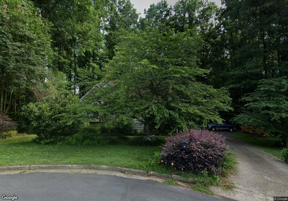
154 Thorn Brook Rd Bethlehem, GA 30620
Estimated Value: $309,000 - $323,000
--
Bed
2
Baths
1,523
Sq Ft
$206/Sq Ft
Est. Value
About This Home
This home is located at 154 Thorn Brook Rd, Bethlehem, GA 30620 and is currently estimated at $313,675, approximately $205 per square foot. 154 Thorn Brook Rd is a home located in Barrow County with nearby schools including Bethlehem Elementary School, Haymon-Morris Middle School, and Apalachee High School.
Ownership History
Date
Name
Owned For
Owner Type
Purchase Details
Closed on
Sep 13, 2004
Sold by
Courson Timothy W and Courson Teresa
Bought by
Robbins Donald G and Robbins Sandra
Current Estimated Value
Home Financials for this Owner
Home Financials are based on the most recent Mortgage that was taken out on this home.
Original Mortgage
$50,001
Interest Rate
5.92%
Mortgage Type
New Conventional
Purchase Details
Closed on
Dec 18, 1996
Sold by
Bji
Bought by
Courson Timothy W Teresa J
Purchase Details
Closed on
Aug 14, 1996
Sold by
Hu Ka Bldrs
Bought by
Bji Inc
Purchase Details
Closed on
May 18, 1995
Bought by
Hu Ka Builders Inc
Create a Home Valuation Report for This Property
The Home Valuation Report is an in-depth analysis detailing your home's value as well as a comparison with similar homes in the area
Home Values in the Area
Average Home Value in this Area
Purchase History
| Date | Buyer | Sale Price | Title Company |
|---|---|---|---|
| Robbins Donald G | $136,000 | -- | |
| Courson Timothy W Teresa J | $96,000 | -- | |
| Bji Inc | $16,500 | -- | |
| B J I Inc | $16,500 | -- | |
| Hu Ka Builders Inc | -- | -- |
Source: Public Records
Mortgage History
| Date | Status | Borrower | Loan Amount |
|---|---|---|---|
| Closed | Robbins Donald G | $50,001 | |
| Closed | B J I Inc | $0 |
Source: Public Records
Tax History Compared to Growth
Tax History
| Year | Tax Paid | Tax Assessment Tax Assessment Total Assessment is a certain percentage of the fair market value that is determined by local assessors to be the total taxable value of land and additions on the property. | Land | Improvement |
|---|---|---|---|---|
| 2024 | $684 | $80,174 | $17,200 | $62,974 |
| 2023 | $525 | $80,174 | $17,200 | $62,974 |
| 2022 | $751 | $78,818 | $17,200 | $61,618 |
| 2021 | $813 | $76,818 | $15,200 | $61,618 |
| 2020 | $690 | $67,694 | $12,000 | $55,694 |
| 2019 | $635 | $61,770 | $12,000 | $49,770 |
| 2018 | $574 | $58,395 | $10,600 | $47,795 |
| 2017 | $1,415 | $48,591 | $9,000 | $39,591 |
| 2016 | $388 | $44,809 | $13,000 | $31,809 |
| 2015 | $394 | $45,192 | $13,000 | $32,192 |
| 2014 | $735 | $39,328 | $6,370 | $32,958 |
| 2013 | -- | $37,288 | $6,370 | $30,918 |
Source: Public Records
Map
Nearby Homes
- 724 Manger Ave
- 966 David Ave
- 898 Harrison Mill Rd
- 0 Manger Ave E Unit 20154677
- 0 Manger Ave E Unit 20127001
- 0 Monroe Hwy Unit 10466108
- 0 Monroe Hwy Unit 7530054
- 784 Manger Ave
- 328 Advent Dr
- 182 Nativity Cove
- 528 Harris Dr
- 1050 Bethlehem Church Rd
- 164 Manning Gin Rd
- 0 Harrison Mill Rd Unit 10522698
- 449 & 455 Carl-Bethlehem Rd
- 213 Harvey Lokey Rd
- 0 Carson Wages Rd Unit 7617509
- 0 Carson Wages Rd Unit 10348307
- 0 McElhannon Rd SW Unit 10581793
- 303 Carly Ct
- 159 Thorn Brook Rd
- 150 Thorn Brook Rd Unit 61
- 150 Thorn Brook Rd
- 149 Thorn Brook Rd
- 264 Thorn Brook Cir
- 262 Thorn Brook Cir
- 148 Thorn Brook Rd
- 258 Thorn Brook Cir
- 256 Thorn Brook Cir
- 147 Thorn Brook Rd
- 144 Thorn Brook Rd
- 61 Gifton Thomas Rd
- 254 Thorn Brook Cir
- 266 Thorn Brook Cir
- 0 Thorn Brook Cir Unit 8853348
- 0 Thorn Brook Cir Unit 8605533
- 0 Thorn Brook Cir Unit 9001055
- 0 Thorn Brook Cir Unit 8827227
- 0 Thorn Brook Cir Unit 8852567
- 0 Thorn Brook Cir Unit 8852376
