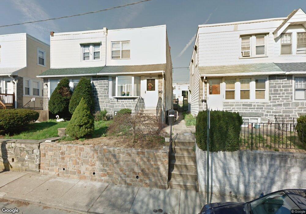
154 Westdale Rd Upper Darby, PA 19082
Estimated Value: $195,712 - $213,000
3
Beds
1
Bath
1,200
Sq Ft
$171/Sq Ft
Est. Value
About This Home
This home is located at 154 Westdale Rd, Upper Darby, PA 19082 and is currently estimated at $205,428, approximately $171 per square foot. 154 Westdale Rd is a home located in Delaware County with nearby schools including Drexel Hill Middle School, Upper Darby High School, and Harambee Institute of Science and Techno.
Ownership History
Date
Name
Owned For
Owner Type
Purchase Details
Closed on
May 23, 2005
Sold by
Broadbent George
Bought by
Fitchett Robert A and Howell Ashanti Y
Current Estimated Value
Home Financials for this Owner
Home Financials are based on the most recent Mortgage that was taken out on this home.
Original Mortgage
$91,200
Outstanding Balance
$53,224
Interest Rate
7.75%
Mortgage Type
Purchase Money Mortgage
Estimated Equity
$152,204
Purchase Details
Closed on
Dec 15, 2003
Sold by
Walsh John
Bought by
Broadbent George
Home Financials for this Owner
Home Financials are based on the most recent Mortgage that was taken out on this home.
Original Mortgage
$82,800
Interest Rate
5.89%
Mortgage Type
Purchase Money Mortgage
Purchase Details
Closed on
Apr 30, 1998
Sold by
Kluzynski Joann and Anastasi Joann
Bought by
Walsh John
Home Financials for this Owner
Home Financials are based on the most recent Mortgage that was taken out on this home.
Original Mortgage
$49,000
Interest Rate
7.05%
Mortgage Type
Purchase Money Mortgage
Create a Home Valuation Report for This Property
The Home Valuation Report is an in-depth analysis detailing your home's value as well as a comparison with similar homes in the area
Home Values in the Area
Average Home Value in this Area
Purchase History
| Date | Buyer | Sale Price | Title Company |
|---|---|---|---|
| Fitchett Robert A | $114,000 | -- | |
| Broadbent George | $92,000 | -- | |
| Walsh John | $70,000 | Commonwealth Land Title Ins |
Source: Public Records
Mortgage History
| Date | Status | Borrower | Loan Amount |
|---|---|---|---|
| Open | Fitchett Robert A | $91,200 | |
| Previous Owner | Broadbent George | $82,800 | |
| Previous Owner | Walsh John | $49,000 |
Source: Public Records
Tax History Compared to Growth
Tax History
| Year | Tax Paid | Tax Assessment Tax Assessment Total Assessment is a certain percentage of the fair market value that is determined by local assessors to be the total taxable value of land and additions on the property. | Land | Improvement |
|---|---|---|---|---|
| 2025 | $3,824 | $90,430 | $23,370 | $67,060 |
| 2024 | $3,824 | $90,430 | $23,370 | $67,060 |
| 2023 | $3,788 | $90,430 | $23,370 | $67,060 |
| 2022 | $3,687 | $90,430 | $23,370 | $67,060 |
| 2021 | $4,971 | $90,430 | $23,370 | $67,060 |
| 2020 | $4,144 | $64,060 | $23,370 | $40,690 |
| 2019 | $4,071 | $64,060 | $23,370 | $40,690 |
| 2018 | $4,024 | $64,060 | $0 | $0 |
| 2017 | $3,920 | $64,060 | $0 | $0 |
| 2016 | $352 | $64,060 | $0 | $0 |
| 2015 | $352 | $64,060 | $0 | $0 |
| 2014 | $352 | $64,060 | $0 | $0 |
Source: Public Records
Map
Nearby Homes
- 171 N Carol Blvd
- 105 N Fairview Ave
- 201 Saint Laurence Rd
- 25 N Pennock Ave
- 105 Academy Ln
- 8125 W Chester Pike Unit A4
- 7920 W Chester Pike
- 11 S Cedar Ln
- 7502 Parkview Rd
- 46 S State Rd
- 24 Sunshine Rd
- 9 Berbro Ave
- 241 S Cedar Ln
- 7409 Miller Ave
- 7226 Penarth Ave
- 7649 Malvern Ave
- 18 Elm Ave
- 207 Berbro Ave
- 1314 Farrington Rd
- 1818 N 77th St
- 156 Westdale Rd
- 158 Westdale Rd
- 152 Westdale Rd
- 160 Westdale Rd
- 150 Westdale Rd
- 162 Westdale Rd
- 164 Westdale Rd
- 148 Westdale Rd
- 146 Westdale Rd
- 161 N Carol Blvd
- 166 Westdale Rd
- 163 N Carol Blvd
- 159 N Carol Blvd
- 157 N Carol Blvd
- 165 N Carol Blvd
- 167 N Carol Blvd
- 155 N Carol Blvd
- 144 Westdale Rd
- 169 N Carol Blvd
- 153 N Carol Blvd