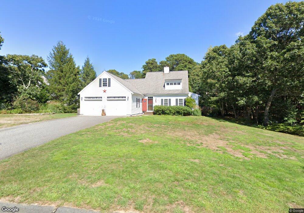
154 Wianno Rd Yarmouth Port, MA 02675
Yarmouth Port NeighborhoodEstimated Value: $792,000 - $919,000
3
Beds
3
Baths
1,830
Sq Ft
$474/Sq Ft
Est. Value
About This Home
This home is located at 154 Wianno Rd, Yarmouth Port, MA 02675 and is currently estimated at $866,887, approximately $473 per square foot. 154 Wianno Rd is a home located in Barnstable County with nearby schools including Dennis-Yarmouth Regional High School.
Ownership History
Date
Name
Owned For
Owner Type
Purchase Details
Closed on
Aug 31, 2007
Sold by
Gruttadauria Marissa E and Gruttadauria Matthew K
Bought by
Burt Jessica and Burt Philip
Current Estimated Value
Home Financials for this Owner
Home Financials are based on the most recent Mortgage that was taken out on this home.
Original Mortgage
$402,215
Interest Rate
6.71%
Mortgage Type
Purchase Money Mortgage
Purchase Details
Closed on
Jun 29, 2006
Sold by
Shandy Llc
Bought by
Gruttadauria Marissa E and Gruttadauria Matthew K
Home Financials for this Owner
Home Financials are based on the most recent Mortgage that was taken out on this home.
Original Mortgage
$400,000
Interest Rate
6.58%
Mortgage Type
Purchase Money Mortgage
Create a Home Valuation Report for This Property
The Home Valuation Report is an in-depth analysis detailing your home's value as well as a comparison with similar homes in the area
Home Values in the Area
Average Home Value in this Area
Purchase History
| Date | Buyer | Sale Price | Title Company |
|---|---|---|---|
| Burt Jessica | $502,768 | -- | |
| Burt Jessica | $502,768 | -- | |
| Gruttadauria Marissa E | $536,000 | -- | |
| Gruttadauria Marissa E | $536,000 | -- |
Source: Public Records
Mortgage History
| Date | Status | Borrower | Loan Amount |
|---|---|---|---|
| Open | Gruttadauria Marissa E | $397,750 | |
| Closed | Burt Jessica | $402,215 | |
| Previous Owner | Gruttadauria Marissa E | $400,000 |
Source: Public Records
Tax History Compared to Growth
Tax History
| Year | Tax Paid | Tax Assessment Tax Assessment Total Assessment is a certain percentage of the fair market value that is determined by local assessors to be the total taxable value of land and additions on the property. | Land | Improvement |
|---|---|---|---|---|
| 2025 | $6,207 | $876,700 | $181,900 | $694,800 |
| 2024 | $5,765 | $781,200 | $158,200 | $623,000 |
| 2023 | $5,739 | $707,700 | $143,700 | $564,000 |
| 2022 | $5,160 | $562,100 | $137,200 | $424,900 |
| 2021 | $5,029 | $526,000 | $137,200 | $388,800 |
| 2020 | $4,868 | $486,800 | $145,300 | $341,500 |
| 2019 | $4,496 | $445,100 | $145,300 | $299,800 |
| 2018 | $4,331 | $420,900 | $121,100 | $299,800 |
| 2017 | $4,217 | $420,900 | $121,100 | $299,800 |
| 2016 | $4,104 | $411,200 | $111,400 | $299,800 |
| 2015 | $3,897 | $388,100 | $106,500 | $281,600 |
Source: Public Records
Map
Nearby Homes
- 800 Route 6a
- 800 Route 6a
- 20 Trophy Ln
- 14 Many Oaks Cir
- 6 Nimble Hill Dr
- 21 Boxwood Cir
- 4208 Heatherwood
- 64 Kates Path
- 17 Kates Path Unit A
- 8 Rowley Ln
- 28 Oak Glen
- 25 Oak Glen
- 25 Oak Glen Village Unit 25
- 13 Covey Dr
- 228 Kates Path
- 15 Follins Pond Rd
- 158 Kates Path
- 2 Pine Grove
- 19 John Halls Cartpath Village Unit E
- 4 Old Colony Way