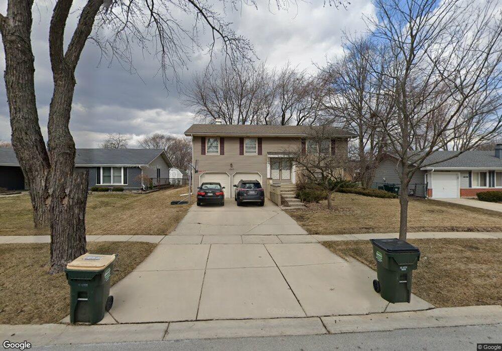
1540 Newcastle Ln Hoffman Estates, IL 60169
South Hoffman Estates NeighborhoodEstimated Value: $314,000 - $382,646
3
Beds
2
Baths
1,176
Sq Ft
$306/Sq Ft
Est. Value
About This Home
This home is located at 1540 Newcastle Ln, Hoffman Estates, IL 60169 and is currently estimated at $360,162, approximately $306 per square foot. 1540 Newcastle Ln is a home located in Cook County with nearby schools including Neil Armstrong Elementary School, Dwight D Eisenhower Junior High School, and Hoffman Estates High School.
Ownership History
Date
Name
Owned For
Owner Type
Purchase Details
Closed on
Sep 1, 2004
Sold by
Duffy Steve R and Duffy Cynthia J
Bought by
Johnson Patrick
Current Estimated Value
Home Financials for this Owner
Home Financials are based on the most recent Mortgage that was taken out on this home.
Original Mortgage
$165,000
Outstanding Balance
$81,091
Interest Rate
6.08%
Mortgage Type
Fannie Mae Freddie Mac
Estimated Equity
$279,071
Create a Home Valuation Report for This Property
The Home Valuation Report is an in-depth analysis detailing your home's value as well as a comparison with similar homes in the area
Home Values in the Area
Average Home Value in this Area
Purchase History
| Date | Buyer | Sale Price | Title Company |
|---|---|---|---|
| Johnson Patrick | $270,000 | Premier Title |
Source: Public Records
Mortgage History
| Date | Status | Borrower | Loan Amount |
|---|---|---|---|
| Open | Johnson Patrick | $165,000 |
Source: Public Records
Tax History
| Year | Tax Paid | Tax Assessment Tax Assessment Total Assessment is a certain percentage of the fair market value that is determined by local assessors to be the total taxable value of land and additions on the property. | Land | Improvement |
|---|---|---|---|---|
| 2025 | $8,027 | $37,000 | $8,190 | $28,810 |
| 2024 | $8,027 | $27,017 | $6,825 | $20,192 |
| 2023 | $7,738 | $29,475 | $6,825 | $22,650 |
| 2022 | $7,738 | $29,475 | $6,825 | $22,650 |
| 2021 | $6,022 | $21,304 | $4,550 | $16,754 |
| 2020 | $5,956 | $21,304 | $4,550 | $16,754 |
| 2019 | $5,926 | $23,672 | $4,550 | $19,122 |
| 2018 | $5,153 | $19,237 | $3,867 | $15,370 |
| 2017 | $5,080 | $19,237 | $3,867 | $15,370 |
| 2016 | $5,936 | $22,423 | $3,867 | $18,556 |
| 2015 | $5,613 | $20,099 | $3,412 | $16,687 |
| 2014 | $5,531 | $20,099 | $3,412 | $16,687 |
| 2013 | $5,371 | $20,099 | $3,412 | $16,687 |
Source: Public Records
Map
Nearby Homes
- 1365 Newcastle Ln
- 1335 Blair Ln
- 1975 Leiter Way Unit 12002
- 1982 Leiter Way Unit 13004
- 1985 Leiter Way Unit 1102
- 1988 Leiter Way Unit 13001
- 1979 Leiter Way Unit 12004
- 1981 Leiter Way Unit 12005
- 1994 Leiter Way Unit 14003
- 1977 Leiter Way Unit 12003
- 1986 Leiter Way Unit 13002
- 1989 Leiter Way Unit 11004
- 1360 Devonshire Ln
- 1103 Southbridge Ln
- 1708 Southbridge Ct
- 1500 Robin Cir Unit 314
- 845 Harmon Blvd
- 1880 Bonnie Ln Unit 112
- 1769 Sessions Walk Unit C
- 1712 Fayette Walk Unit D
- 1530 Newcastle Ln
- 1550 Newcastle Ln
- 1520 Newcastle Ln
- 1560 Newcastle Ln
- 1305 Meyer Rd
- 1535 Newcastle Ln
- 1315 Meyer Rd
- 1525 Newcastle Ln
- 1300 Kingsdale Rd
- 1545 Newcastle Ln
- 1515 Newcastle Ln
- 1310 Kingsdale Rd
- 1325 Meyer Rd
- 1555 Newcastle Ln
- 1290 Kingsdale Rd
- 1335 Meyer Rd
- 1570 Newcastle Ln
- 1532 W Oakmont Rd
- 1565 Newcastle Ln
- 1522 W Oakmont Rd
Your Personal Tour Guide
Ask me questions while you tour the home.