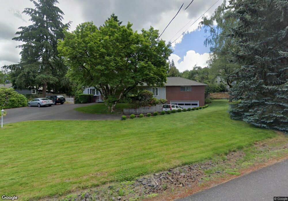
1540 SW Maplecrest Dr Portland, OR 97219
Marshall Park NeighborhoodEstimated Value: $638,000 - $803,000
2
Beds
2
Baths
1,914
Sq Ft
$388/Sq Ft
Est. Value
About This Home
This home is located at 1540 SW Maplecrest Dr, Portland, OR 97219 and is currently estimated at $743,278, approximately $388 per square foot. 1540 SW Maplecrest Dr is a home located in Multnomah County with nearby schools including Stephenson Elementary School, Jackson Middle School, and Ida B. Wells-Barnett High School.
Ownership History
Date
Name
Owned For
Owner Type
Purchase Details
Closed on
Jul 26, 2024
Sold by
Novash Ruth E
Bought by
Ruth Elaine Novash Living Trust and Novash
Current Estimated Value
Purchase Details
Closed on
Oct 30, 1998
Sold by
Novash Joseph M
Bought by
Novash Ruth E
Home Financials for this Owner
Home Financials are based on the most recent Mortgage that was taken out on this home.
Original Mortgage
$90,000
Interest Rate
6.61%
Mortgage Type
Purchase Money Mortgage
Create a Home Valuation Report for This Property
The Home Valuation Report is an in-depth analysis detailing your home's value as well as a comparison with similar homes in the area
Home Values in the Area
Average Home Value in this Area
Purchase History
| Date | Buyer | Sale Price | Title Company |
|---|---|---|---|
| Ruth Elaine Novash Living Trust | -- | None Listed On Document | |
| Novash Ruth E | $14,619 | Oregon Title Insurance Co |
Source: Public Records
Mortgage History
| Date | Status | Borrower | Loan Amount |
|---|---|---|---|
| Previous Owner | Novash Ruth E | $90,000 |
Source: Public Records
Tax History Compared to Growth
Tax History
| Year | Tax Paid | Tax Assessment Tax Assessment Total Assessment is a certain percentage of the fair market value that is determined by local assessors to be the total taxable value of land and additions on the property. | Land | Improvement |
|---|---|---|---|---|
| 2025 | $9,916 | $368,360 | -- | -- |
| 2024 | $9,560 | $357,640 | -- | -- |
| 2023 | $9,192 | $347,230 | $0 | $0 |
| 2022 | $8,993 | $337,120 | $0 | $0 |
| 2021 | $8,841 | $327,310 | $0 | $0 |
| 2020 | $8,110 | $317,780 | $0 | $0 |
| 2019 | $7,812 | $308,530 | $0 | $0 |
| 2018 | $7,583 | $299,550 | $0 | $0 |
| 2017 | $7,267 | $290,830 | $0 | $0 |
| 2016 | $6,650 | $282,360 | $0 | $0 |
| 2015 | $6,476 | $274,140 | $0 | $0 |
| 2014 | $6,378 | $266,160 | $0 | $0 |
Source: Public Records
Map
Nearby Homes
- 1620 SW Maplecrest Dr
- 10005 SW Balmer Cir
- 10151 SW Lancaster Rd
- 10624 SW 14th Dr
- 9930 SW 25th Ave
- 9841 SW 25th Ave
- 9855 SW 25th Ave
- 9939 SW 25th Ave
- 1845 SW Taylors Ferry Rd
- 9377 SW 8th Ave
- 9375 SW 8th Ave
- 2007 SW Arnold St
- 9341 SW 8th Ave
- 9723 SW Quail Post Rd
- 1389 SW Taylors Ferry Ct
- 2249 SW Taylors Ferry Rd
- 2118 SW Primrose St
- 1345 SW Taylors Ferry Ct
- 2641 SW Ridge Dr
- 9224 SW 26th Ave
- 1528 SW Maplecrest Dr
- 1600 SW Maplecrest Dr
- 1610 SW Maplecrest Dr
- 1541 SW Maplecrest Dr
- 9845 SW 18th Place
- 1551 SW Maplecrest Dr
- 9840 SW 18th Place
- 1616 SW Maplecrest Dr
- 1492 SW Maplecrest Dr
- 1603 SW Maplecrest Dr
- 1804 SW Broadleaf D Relisted
- 1804 SW Broadleaf Dr
- 1525 SW Maplecrest Dr
- 1611 SW Maplecrest Dr
- 1470 SW Maplecrest Dr
- 9820 SW 18th Place
- 1444 SW Maplecrest Dr
- 1607 SW Maplecrest Dr
- 1495 SW Maplecrest Dr
- 1640 SW Maplecrest Dr